Submarine landslides and associated turbidity currents can be orders of magnitude larger than their terrestrial equivalents. Their prevalence globally is hugely underrepresented by in situ observations. In addition to their importance in mass transport and morphologic change they can pose significant threat to coastal communities and subsea infrastructure. This presentation focusses on noise measurements from turbidity currents flowing down the face of a fjord delta and how they can inform the use of passive acoustics as a tool for future observations of these under sampled phenomena. Noise was measured underwater at frequencies from 1 to 1200 kHz. The noise spectra are consistent with sound generation by collisions among sand-sized particles within the turbidity current, also known as acoustic sediment-generated noise or SGN. The spectra from the leading head of the current extend to higher frequencies than those from the trailing body, indicating that collisions were between finer-grained particles in the head and coarser-grained particles in the body. Noise intensity increased 100-fold for a two-fold increase in current head speed, consistent with the expected collision rate for granular materials in the high-flow gas-like phase and highly turbulent particle-laden flows.
Seafloor sediment flows, called turbidity currents, form the largest sediment accumulations, deepest canyons and longest channels on Earth. It was once thought that turbidity currents were impractical to measure in action, especially given their ability to damage sensors in their path, but direct monitoring since the mid-2010s has measured them in detail. In this Review, we summarize knowledge of turbidity currents gleaned from this direct monitoring. Monitoring identifies triggering mechanisms from dilute river plumes, and shows how rapid sediment accumulation can precondition slope failure, but the final triggers can be delayed and subtle. Turbidity currents are consistently more frequent than predicted by past sequence-stratigraphic models, including at sites >300 km from any coast. Faster flows (more than ~1.5 m s–1) are driven by a dense near-bed layer at their front, whereas slower flows are entirely dilute. This frontal layer sometimes erodes large (>2.5 km3) volumes of sediment, yet maintains a near-uniform speed, leading to a travelling-wave model. Monitoring shows that flows sculpt canyons and channels through fast-moving knickpoints, and shows how deposits originate. Emerging technologies with reduced cost and risk can lead to widespread monitoring of turbidity currents, so their sediment and carbon fluxes can be compared with other major global transport processes. Seafloor turbidity currents form Earth’s largest sediment accumulations, deepest canyons and longest channels, but their destructive nature makes them notoriously difficult to measure in action. This Review explores how insights from detailed direct measurements have advanced understanding of turbidity currents.
Submarine channels are the primary conduits for land-derived material, including organic carbon, pollutants, and nutrients, into the deep-sea. The flows (turbidity currents) that traverse these systems can pose hazards to seafloor infrastructure such as cables and pipelines. Here we use a novel combination of repeat seafloor surveys and turbidity current monitoring along a 50 km-long submarine channel in Bute Inlet, British Columbia, and discharge measurements from the main feeding river. These source-to-sink observations provide the most detailed information yet on magnitude-frequency-distance relationships for turbidity currents, and the spatial-temporal patterns of sediment transport within a submarine channel-lobe system. This analysis provides new insights into mass redistribution, and particle residence times in submarine channels, as well as where particles are eventually buried and how that is recorded in the deposits. We observe stepwise sediment transport down the channel, with turbidity currents becoming progressively less frequent with distance. Most flows dissipate and deposit within the proximal (< 11 km) part of the system, whilst longer run-out flows then pick up this sediment, 'shuffling' it further downstream along the channel. This shuffling occurs mainly through upstream migration of knickpoints, which can generate sediment bypass along the channel over timescales of 10-100 yrs. Infrequent large events flush the channel and ultimately transport sediment onto the lobe. These flushing events can occur without obvious triggers, and thus might be internally generated. We then present the first ever sediment budget analysis of an entire submarine channel system, which shows that the river input and lobe aggradation can approximately balance over decadal timescales. We conclude by discussing the implication of this sediment shuffling for seafloor geohazards and particle burial. (c) 2022 The Author(s). Published by Elsevier B.V.& nbsp;
The study of palaeo‐glacial landforms and sediments can give insights into the nature and dynamics of ice sheets. This is particularly the case with regards to the subglacial record, which is challenging to observe in contemporary glaciated settings and hence remains only partially understood. The subglacial hydrological system is an essential component of ice dynamics, where increased water pressure enhances ice motion and sediment deformation, thus reducing ice‐bed contact. Tunnel valleys are large, sinuous, steep‐sided incisions that, together with smaller scale meltwater channels, indicate subglacial meltwater discharge beneath large ice sheets. Through the use of high‐resolution marine geophysical data, a system of buried and exposed tunnel valleys, possible subglacial or proglacial meltwater channels and palaeo‐fluvial valleys have been identified across the shelf of the Celtic Sea between Ireland and Britain. The presence of steep‐sided and overdeepened tunnel valleys is indicative of a large channelized meltwater drainage system beneath the former Irish Sea Ice Stream, the most extensive ice stream to drain the last British–Irish Ice Sheet. After the rapid ice expansion across the Celtic Sea shelf around 28–26 ka, the tunnel valleys were carved into both bedrock and glacigenic sediments and are associated with rapid ice stream retreat northwards into the Irish Sea Basin between 25.6 and 24.3 ka. The presence of a major subglacial meltwater system on the relatively shallow shelf suggests that significant erosive meltwater discharge occurred during the last deglaciation and highlights the important contribution of meltwater to the retreat of the British–Irish Ice Sheet on the continental shelf.
SignificanceTemperature increases in Arctic regions have focused attention on permafrost degradation on land, whereas little is known about the dynamics of extensive glacial-age permafrost bodies now submerged under the vast Arctic Continental shelves. Repeated high-resolution bathymetric surveys show that extraordinarily rapid morphologic changes are occurring at the edge of the continental slope of the Canadian Beaufort Sea along what was once the seaward limit of relict Pleistocene permafrost. How widespread similar changes are on the Arctic shelves is unknown, as this is one of the first areas in the Arctic subjected to multiple multibeam bathymetric surveys. Rapid morphologic changes associated with active submarine permafrost thawing may be an important process in sculpturing the seafloor in other submarine permafrost settings.
Iceberg discharge influences ocean circulation, affects climate and increases global sea level. Icebergs are also known to gouge the seafloor in water depths limited by their keel depth, thus representing a hazard to subsea infrastructure. Here, we provide evidence that icebergs can affect the seafloor at depths greater than their keel depth by triggering submarine landslides. Using repeat bathymetric surveys from multibeam echo sounders, we investigate the cause of a submarine landslide that occurred in Southwind Fjord, Baffin Island, between September 2018 and September 2019. This landslide is shown to be closely associated with recently formed iceberg pits at its headscarp carved by an iceberg that grounded and that capsized in the fjord in early September 2018. Geotechnical data from a nearby sediment core indicate that the vertical loading induced by the iceberg grounding and capsizing is sufficient to trigger the observed landslide. These results imply that icebergs originating from the Arctic, Greenland and Antarctica are hazards thousands of kilometres away from their original source and can affect continental slopes by triggering submarine landslides. This process represents an additional source of marine geohazards, especially if climate change leads to increased iceberg discharge. Iceberg gouging of continental slopes can initiate submarine landslides, potentially far from the iceberg source region, according to observations and geotechnical analysis of an event in a Baffin Island fjord.
Deep‐water deposits are important archives of Earth’s history including the occurrence of powerful flow events and the transfer of large volumes of terrestrial detritus into the world’s oceans. However the interpretation of depositional processes and palaeoflow conditions from the deep‐water sedimentary record has been limited due to a lack of direct observations from modern depositional systems. Recent seafloor studies have resulted in novel findings, including the presence of upslope‐migrating bedforms such as cyclic steps formed by supercritical turbidity currents that produce distinct depositional signatures. This study builds on process to product relationships for cyclic steps using modern and ancient datasets by providing sedimentological and quantitative, three‐dimensional architectural analyses of their deposits, which are required for recognition and palaeoflow interpretations of sedimentary structures in the rock record. Repeat‐bathymetric surveys from two modern environments (Squamish prodelta, Canada, and Monterey Canyon, USA) were used to examine the stratigraphic evolution connected with relatively small‐scale (average 40 to 55 m wavelengths and 1.5 to 3.0 m wave heights) upslope‐migrating bedforms interpreted to be cyclic steps within submarine channels and lobes. These results are integrated to interpret a succession of Late Cretaceous Nanaimo Group deep‐water slope deposits exposed on Gabriola Island, Canada. Similar deposit dimensions, facies and architecture are observed in all datasets, which span different turbidite‐dominated settings (prodelta, upper submarine canyon and deep‐water slope) and timescales (days, years or thousands of years). Bedform deposits are typically tens of metres long/wide, <1 m thick and make up successions of low‐angle, backstepping trough‐shaped lenses composed of massive sands/sandstones. These results support process‐based relationships for these deposits, associated with similar cyclic step bedforms formed by turbidity currents with dense basal layers under low‐aggradation conditions. Modern to ancient comparisons reveal the stratigraphic expression of globally prevalent, small‐scale, sandy upslope‐migrating bedforms on the seafloor, which can be applied to enhance palaeoenvironmental interpretations and understand long‐term preservation from ancient deep‐water deposits.
Submarine channels deliver globally important volumes of sediments, nutrients, contaminants and organic carbon into the deep sea. Knickpoints are significant topographic features found within numerous submarine channels, which most likely play an important role in channel evolution and the behaviour of the submarine sediment‐laden flows (turbidity currents) that traverse them. Although prior research has linked supercritical turbidity currents to the formation of both knickpoints and smaller crescentic bedforms, the relationship between flows and the dynamics of these seafloor features remains poorly constrained at field‐scale. This study investigates the distribution, variation and interaction of knickpoints and crescentic bedforms along the 44 km long submarine channel system in Bute Inlet, British Columbia. Wavelet analyses on a series of repeated bathymetric surveys reveal that the floor of the submarine channel is composed of a series of knickpoints that have superimposed, higher‐frequency, crescentic bedforms. Individual knickpoints are separated by hundreds to thousands of metres, with the smaller superimposed crescentic bedforms varying in wavelengths from ca 16 m to ca 128 m through the channel system. Knickpoint migration is driven by the passage of frequent turbidity currents, and acts to redistribute and reorganize the crescentic bedforms. Direct measurements of turbidity currents indicate the seafloor reorganization caused by knickpoint migration can modify the flow field and, in turn, control the location and morphometry of crescentic bedforms. A transect of sediment cores obtained across one of the knickpoints show sand–mud laminations of deposits with higher aggradation rates in regions just downstream of the knickpoint. The interactions between flows, knickpoints and bedforms that are documented here are important because they likely dominate the character of preserved submarine channel‐bed deposits.
The scale of submarine channels can rival or exceed those formed on land and they form many of the largest sedimentary deposits on Earth. Turbidity currents that carve submarine channels pose a major hazard to offshore cables and pipelines, and transport globally significant amounts of organic carbon. Alongside the primary channels, many systems also exhibit a range of headless channels, which often abruptly terminate at steep headscarps. These enigmatic features are widespread in lakes and ocean floors, either as branches off the main submarine channel thalweg or as isolated secondary channels. Prior research has proposed that headless channels may be associated with early and incipient stages of channel development, but their formation and evolution remain poorly understood. Here, we investigate the morphology, origin and development of headless channels by examining repeat bathymetric surveys spanning a period from 1986 to 2018, in Bute Inlet, Canada. We show how channel switching processes, the extension of turbidity currents across distal fans, along with overbanking turbidity currents, are able to initiate headless channels in submarine settings. We discuss how the evolution of headless channels plays an important role in shaping submarine channels, promoting channel extension and modifying the overall longitudinal profile, as well as impacting the character of sedimentary records in channel-lobe transition zones.
Noise from turbidity currents flowing down the face of a fjord delta was measured underwater at frequencies from 1 to 1200 kHz. The noise spectra are consistent with sound generation by collisions among sand-sized particles. The spectra from the leading head extend to higher frequencies than those from the trailing body, indicating that collisions were between finer-grained particles in the head and coarser-grained particles in the body. Noise intensity increased 100-fold for a two-fold increase in head speed, consistent with the expected collision rate for granular materials in the high-flow gas-like phase and highly turbulent particle-laden flows.
An amendment to this paper has been published and can be accessed via a link at the top of the paper.
Turbidity currents transport globally significant volumes of sediment and organic carbon into the deep-sea and pose a hazard to critical infrastructure. Despite advances in technology, their powerful nature often damages expensive instruments placed in their path. These challenges mean that turbidity currents have only been measured in a few locations worldwide, in relatively shallow water depths (<<2 km). Here, we share lessons from recent field deployments about how to design the platforms on which instruments are deployed. First, we show how monitoring platforms have been affected by turbidity currents including instability, displacement, tumbling and damage. Second, we relate these issues to specifics of the platform design, such as exposure of large surface area instruments within a flow and inadequate anchoring or seafloor support. Third, we provide recommended modifications to improve design by simplifying mooring configurations, minimizing surface area and enhancing seafloor stability. Finally, we highlight novel multi-point moorings that avoid interaction between the instruments and the flow, and flow-resilient seafloor platforms with innovative engineering design features, such as feet and ballast that can be ejected. Our experience will provide guidance for future deployments, so that more detailed insights can be provided into turbidity current behaviour, in a wider range of settings.
Rivers (on land) and turbidity currents (in the ocean) are the most important sediment transport processes on Earth. Yet how rivers generate turbidity currents as they enter the coastal ocean remains poorly understood. The current paradigm, based on laboratory experiments, is that turbidity currents are triggered when river plumes exceed a threshold sediment concentration of ~1 kg/m3. Here we present direct observations of an exceptionally dilute river plume, with sediment concentrations 1 order of magnitude below this threshold (0.07 kg/m3), which generated a fast (1.5 m/s), erosive, short-lived (6 min) turbidity current. However, no turbidity current occurred during subsequent river plumes. We infer that turbidity currents are generated when fine sediment, accumulating in a tidal turbidity maximum, is released during spring tide. This means that very dilute river plumes can generate turbidity currents more frequently and in a wider range of locations than previously thought.
River deltas and associated turbidity current systems produce some of the largest and most rapid sediment accumulations on our planet. These systems bury globally significant volumes of organic carbon and determine the runout distance of potentially hazardous sediment flows and the shape of their deposits. Here we seek to understand the main factors that determine the morphology of turbidity current systems linked to deltas in fjords, and why some locations have well developed submarine channels while others do not. Deltas and associated turbidity current systems are analysed initially in five fjord systems from British Columbia in Canada, and then more widely. This provides the basis for a general classification of delta and turbidity current system types, where rivers enter relatively deep (>200 m) water. Fjord‐delta area is found to be strongly bimodal. Avalanching of coarse‐grained bedload delivered by steep mountainous rivers produces small Gilbert‐type fan deltas, whose steep gradient (11°–25°) approaches the sediment's angle of repose. Bigger fjord‐head deltas are associated with much larger and finer‐grained rivers. These deltas have much lower gradients (1.5°–10°) that decrease offshore in a near exponential fashion. The lengths of turbidity current channels are highly variable, even in settings fed by rivers with similar discharges. This may be due to resetting of channel systems by delta‐top channel avulsions or major offshore landslides, as well as the amount and rate of sediment supplied to the delta front by rivers. © 2018 John Wiley & Sons, Ltd.
Advances in multibeam sonar mapping and data visualization have increasingly brought to light the subtle integration errors remaining in bathymetric datasets. Traditional field calibration procedures, such as the patch test, just account for static orientation bias and sonar to position latency. This, however, ignores the generally more subtle integration problems that generate time-varying depth errors. Such dynamic integration errors are the result of an unknown offset in one or more of orientation, space, sound speed or time between the sonar and ancillary sensors. Such errors are systematic, and thus should be predictable, based on their relationship between the input data and integrated output. A first attempt at addressing this problem utilized correlations between motion and ping-averaged residuals [1]. The known limitations of that approach, however, included only being able to estimate the dominant integration error, imperfectly accounting for irregular sounding distribution and it only working in shallow water. This paper presents a new and improved means of utilizing the dynamics of the integration error signatures which can address multiple issues simultaneously, better account for along-track sounding distribution, and is not restricted to the shallow water geometry. The motion-driven signatures of multiple integration errors may be simultaneously identified through individually considering each sounding’s input-error relationship along extended sections of a single swath corridor. Such an approach provides a means of underway system optimization using nothing more than the bathymetry of typical seafloors acquired during transit. Successful estimation, however, imposes conditions of significant vessel motion, and smooth, gently rolling bathymetry. Initial results of the new algorithm are presented using data generated from a simulator, with known inputs and integration errors, to test the efficacy of the method.
Turbidity currents are powerful flows of sediment that pose a hazard to critical seafloor infrastructure and transport globally important amounts of sediment to the deep sea. Due to challenges of direct monitoring, we typically rely on their deposits to reconstruct past turbidity currents. Understanding these flows is complicated because successive flows can rework or erase previous deposits. Hence, depositional environments dominated by turbidity currents, such as submarine channels, only partially record their deposits. But precisely how incomplete these deposits are, is unclear. Here we use the most extensive repeat bathymetric mapping yet of any turbidity current system, to reveal the stratigraphic evolution of three submarine channels. We re-analyze 93 daily repeat surveys performed over four months at the Squamish submarine delta, British Columbia in 2011, during which time >100 turbidity currents were monitored. Turbidity currents deposit and rework sediments into upstream-migrating bedforms, ensuring low rates of preservation (median 11%), even on the terminal lobes. Large delta-lip collapses (up to 150,000 m3) are relatively well preserved, however, due to their rapidly emplaced volumes, which shield underlying channel deposits from erosion over the surveyed timescale. The biggest gaps in the depositional record relate to infrequent powerful flows that cause significant erosion, particularly at the channel-lobe transition zone where no deposits during our monitoring period are preserved. Our analysis of repeat surveys demonstrates how incomplete the stratigraphy of submarine channels can be, even over just 4 months, and provides a new approach to better understand how the stratigraphic record is built and preserved in a wider range of marine settings.
Submarine turbidity currents are one of the most important processes for moving sediment across our planet; they are hazardous to offshore infrastructure, deposit petroleum reservoirs worldwide, and may record tsunamigenic landslides. However, there are few studies that have monitored these submarine flows in action, and even fewer studies that have combined direct monitoring with longer‐term records from core and seismic data of deposits. This article provides one of the most complete studies yet of a turbidity current system. The aim here is to understand what controls changes in flow frequency and character along the turbidite system. The study area is a 12 km long delta‐fed fjord (Howe Sound) in British Columbia, Canada. Over 100 often powerful (up to 2 to 3 m sec −1 ) events occur each year in the highly‐active proximal channels, which extend for 1 to 2 km from the delta lip. About half of these events reach the lobes at the channel mouths. However, flow frequency decreases rapidly once these initially sand‐rich flows become unconfined, and only one to five flows run out across the mid‐slope each year. Many of these sand‐rich, channelized, delta‐sourced flows therefore dissipated over a few hundred metres, once unconfined, rather than eroding and igniting. Upflow migrating bedforms indicate that supercritical flow dominated in the proximal channels and lobes, and also across the unconfined mid‐slope. These supercritical flows deposited thick sand beds in proximal channels and lobes, but thinner and finer beds on the unconfined mid‐slope. The distal flat basin records far larger volume and more hazardous events that have a recurrence interval of ca 100 years. This study shows how sand‐rich delta‐fed flows dissipate rapidly once they become unconfined, that supercritical flows dominate in both confined and unconfined settings, and how a second type of more hazardous, and much less frequent event is linked to a different scale of margin failure.
 Matthieu Cartigny合作论文数Department of Geography, Durham University;Department of Earth Sciences, Durham University35
 Peter Talling合作论文数Department of Earth Sciences, Durham University;Department of Geography, Durham University33
 Michael Clare合作论文数28
 Cooper Stacey合作论文数Geological Survey of Canada, Natural Resources Canada22
 Sophie Hage合作论文数National Oceanography Centre, University of Southampton Waterfront Campus, Southampton SO14 3ZH, UK21
 Esther Sumner合作论文数Southampton Marine and Maritime Institute, Faculty of Engineering and Physical Sciences, University of Southampton20
 D. Gwyn Lintern合作论文数20
 Larry A. Mayer (Larry Mayer)合作论文数Center for Coastal and Ocean Mapping, University of New Hampshire;School of Marine Science and Ocean Engineering, University of New Hampshire20
 Jamie Hizzett合作论文数Sch Ocean & Earth Sci, Univ Southampton18
 Daniel Parsons合作论文数Vice-Chancellor's Office, Loughborough University;Energy and Environment Institute, University of Hull17Age Vellinga合作论文数Sch Ocean & Earth Sci, Univ Southampton14
 Stephen M. Simmons合作论文数12
 Daniela Vendettuoli合作论文数National Oceanography Centre Southampton11S. Blasco合作论文数11D. Russell Parrott合作论文数11
 James E. Gardner合作论文数11Ed L. Pope合作论文数10
 James E. Hunt合作论文数Natl Oceanog Ctr, European Way, Southampton SO14 3ZH, Hants, England10
 I. Church合作论文数Ocean Mapping Group, University of New Brunswick10
 Maarten S. Heijnen合作论文数National Oceanography Centre Southampton9
 Stephen Hubbard合作论文数Department of Earth, Energy, and Environment, Faculty of Science, University of Calgary9
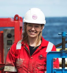 jenny a gales合作论文数Univ Southampton, Natl Oceanog Ctr, Waterfront Campus,European Way, Southampton SO14 3ZH, Hants, England8
 John Shaw合作论文数Natural Resources Canada, Geological Survey of Canada8
 Robbie Bennett合作论文数8
 Miquel Canals Artigas合作论文数Departament de Dinàmica de la Terra i de l'Oceà, Universitat de Barcelona8
 Galderic Lastras合作论文数Dept. d’Estratigrafia, Paleontologia i Geociències Marines, Universitat de Barcelona8Peter Dartnell合作论文数8
 Mark E. Vardy合作论文数School of Ocean and Earth Science, University of Southampton7
 Marc De Batist合作论文数7B. Maclean合作论文数7
 David J. W. Piper合作论文数Bedford Institute of Oceanography, Geological Survey of Canada7
 Joris T. Eggenhuisen合作论文数Department of Earth Sciences, Utrecht University7
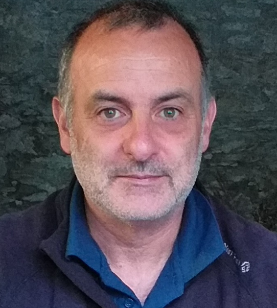 Roger Urgeles Esclasans合作论文数Laboratory of Seafloor and SubSeafloor Geological Processes, Departament de Geociències Marines, Institut de Ciències del Mar;Department of Geosciences, Institut de Ciències del Mar7M. Azpiroz合作论文数6Maria Azpiroz合作论文数6
 Eric R. Patton合作论文数6
 Jonathan Beaudoin合作论文数6
 Charles K. Paull合作论文数Monterey Bay Aquarium Research Institue6
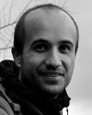 David Amblas合作论文数GRC Geociències Marines, Universitat de Barcelona6D R Parrott合作论文数5
 Kurt J. Rosenberger合作论文数US Geol Survey, Pacific Coastal & Marine Sci Ctr, 2885 Mission St, Santa Cruz, CA 95060 USA5
 Jingping Xu (徐景平)合作论文数Southern University of Science & Technology5
 Garret P. Duffy合作论文数Ocean Mapping Group;Department of Geodesy and Geomatic Engineering;University of New Brunswick;Ocean Mapping Group, University of New Brunswick5R. Gwiazda合作论文数4jason bartlett合作论文数4roberto gwiazda合作论文数Monterey Bay Aquarium Res Inst, Moss Landing, CA 95039 USA4
 M. Clare合作论文数Engineering Geology and Geohazards Team, Fugro GeoConsulting Limited4Ben De Mol合作论文数4
 Jianhu Zhao (赵建虎)合作论文数School of Geodesy and Geomatics, Wuhan University4




