Most of the existing researches only consider vehicles and signals as control objects, and there are also problems of loss of space and time resources caused by unreasonable distribution of spatiotemporal-right. In this paper, an overall collaborative control model for intersections considering the distribution of spatiotemporal right, vehicle trajectory and signal timing was established. A solution algorithm for the assignment of spatiotemporal-rights based on decision tree C4.5 is proposed. A high-dimensional solution based on genetic algorithm and an enumerated low-dimensional solution for signal timing and vehicle trajectory optimization are proposed respectively. Finally, an overall control model including the phase and lane, signal timing and vehicle trajectory was established. The simulation program was developed with python3.7, and the effectiveness of algorithm proposed in this paper was verified by experiments. When flow intensity is 0.23, the algorithm has the best improvement effect, the high-dimensional and low-dimensional algorithms can reduce the delay by 57.6% and 44.8% respectively. It also verified that the algorithm has better adaptability to the change of traffic demand than the algorithm that only considers the vehicle trajectory or signal timing.
There are problems such as complex control objects, multiple optimization objectives and control variables in traffic control under intelligent Vehicle-Infrastructure Cooperative System(i-VICS). In order to overcome the above problems, a control algorithm considering the penetration rate of connected automated vehicle (CAV) was established in this paper. To be able to control spatiotemporal-right and signal timing as a whole, a spatiotemporal-right solving method based on decision tree, a high-dimensional based genetic (MV-A1) and a low-dimensional based enumerated (MV-A2) signal-solving method were proposed; In order to achieve coordinated optimization of traffic efficiency and safety at intersections, a solution method based on Pareto optimality was proposed; Considering the influence of human-driven vehicle(HV), a CAV lane change and speed control method under mixed traffic conditions is proposed. A simulation experiment platform was developed by python3.7 to simulate and analyze the algorithm proposed in the paper. The results show that when the flow intensity is 0.23-0.45, the control effect is the best; 50% CAV penetration rate is the best benefit point of the control effect; the control algorithm has better adaptability to the time-varying of traffic demand.
Using the floating car data obtained by simulation to carry out theoretical research on link travel time evaluation and prediction, it has the advantage of conveniently setting different situations and providing reference for practical applications. In this paper, we have acquired the floating car data based on microscopic simulation, and then the complex trapezoidal quadrature formula is used to obtain link travel time of a single vehicle. When setting different ratios of floating cars, the average link travel time is obtained by the mean-median method. The results show that the effect is better than the arithmetic average method, and the higher the ratio of floating cars, the higher the accuracy of evaluation. The markov model has been used to correct the gray prediction model, with that we establish travel time prediction model based on the grey markov chain. The experimental results show that the prediction accuracy is high.
It is assumed that the vehicles entering the intersection can establish real-time and effective interaction with the intersection control center under the V2X technology. The vehicle optimal control (VOC) algorithm was proposed in this paper. The algorithm comprehensively considers factors such as controllable area, prohibited lane change area, safe following distance, and safe lane change conditions. And based on the COM interface of vissim software, the control algorithm is implemented by C++ programming. Under the conditions of different intersection saturation and control area distance, the traditional method and V2X method control experiment are carried out respectively. The results show that when the saturation does not exceed 0.45, the VOC algorithm has the best effect on the effect of the intersection, and the highest speed increase is 27%, the delay is reduced by 67%, and the number of stops is reduced by 65%. When oversaturated, the algorithm does not have a significant effect on the improvement of the running effect. When the saturation is 0.45-0.6, 0.75-0.9, the optimal control distance is 200m, 300m, and the remaining saturation range is not sensitive to the control distance.
With the continuous development and application of V2X and autonomous driving technology, the traditional optimal control technology of intersections is unable to meet intelligent transportation demand. In this paper, the optimal operation efficiency of critical intersections is the control target. Based on intersection control logic, a systematic control algorithm is proposed by using fuzzy mathematic method from the three levels of lane division, phase division, and timing optimization. Simulation experiment was carried out with Matlab and Vissim software. The experimental results show that for large variations in road network traffic intersections, the dynamic control method proposed in this paper is better than a fixed plan control effect. During the experimental period, the overall delay of intersections decreased by 65.1 percent.
The fast, scientific and accurate deployment of emergency resource is the key restraint of emergency disposal. Based on the degree of demand for medicine, firefighting, police, hazardous chemicals rescue and other special categories of resources in road emergency handling, an emergency resource optimization model was proposed in this paper. Artificial intelligence rule-based-reasoning and fuzzy mathematics were aggregated to build an optimal allocation model. This research is funded by project in the National Science and Technology Program during the Twelfth Five-year Plan Period (Project Number: 2014BAG01B0501). In the process of project implementation, different cases were analyzed based on historical data and the validity of the model was confirmed to support related research and applications.
一、研究背景及意义 综合交通枢纽是公共交通整体化的重点.近年来,随着交通建设的大发展大繁荣,各类大型综合交通枢纽应运而生,其安全问题也日益受到人们的重点关注.综合交通枢纽环境密闭、行人密度大、流动性大,紧急安全事故一旦发生就会造成重大人身伤亡.因此,有效疏散行人成为综合交通枢纽安全运行的基本保障,而行人安全疏散的诱导方法是解决安全疏散问题的重要前提和基础.
城市交通微循环和支路网在城市交通系统中具有重要地位。首先对交通微循环的概念与功能特性进行总结,在此基础上提出交叉口中、学校及区域的三种微循环模式,重点对学校周边交通问题并结合微循环模式提出一种优化方案,定量分析微循环交通在主动预防城市交通拥堵中的重要作用,以期对其他类似区域交通路网缓堵措施决策研究提供参考建议。最后指出,微循环交通的分流作用还需指路标志的辅助才能起到事半功倍的效果。
基于公安交通管理部门亟需完成对交通管理与出行服务的技术方法革新的考虑,构建了基于微信平台的三层级公安交通管理与服务体系框架,描述了不同层级的具体应用范畴,并详细介绍了高层级的系统结构与应用设计,以此丰富新技术条件下公安交通管手段,提高公安交管部门的行政管理、执法与便民服务水平,为今后的研究与发展提供新思路.
以城市路内停车问题为研究对象,梳理城市路内停车管理原则,并分析国内外相关技术研究及应用情况.在浙江省湖州市开展实地调研的基础上,对湖州市目前以“咪表”为主的路内停车管理现状问题进行总结分析,以解决城市路内停车问题为目标,从政策法规调整、管理模式改善、技术应用创新三个角度提出解决方案,为实现路内停车智能化管控,提出了系统架构与功能设计,以期为城市路内停车管理项目实施提供借鉴.
从出行链的角度出发研究多方式诱导信息对通勤出行方式选择的影响.通过RP&SP调查获取通勤者的实际和意向出行链数据,建立了综合考虑尺度系数差异、非显化异质性效应和参照依赖效应的mixed logit模型,并设计仿真方法求解.结果表明,尺度系数差异解释了RP数据与SP数据融合时隐含的方差差异;异质性和参照依赖效应的引入可以度量偏好差异较大的随机变量的影响程度,反映随机变量的偏好分布;综合考虑3种因素的mixedlogit模型比多项logit模型和普通mixed logit模型的精度高,解释能力更强.参数标定结果表明:多方式诱导信息服务对引导小汽车通勤出行链转向其他交通方式有积极作用,有利于从源头上缓解道路交通拥堵.
近年来,我国高速公路路网建设日趋完善,然而工程建设的快速发展与应急救援系统相对滞后之间的矛盾亦日渐凸显.高速公路在经济社会发展中承担着不容小觑的运输重责,随之而来的风险亦空前巨大.风险相生相伴,可降低发生几率却不可完全避免.
城市交通微循环和支路网在城市交通系统中具有重要地位。首先对交通微循环的概念与功能特性进行总结,在此基础上提出交叉口中、学校及区域的三种微循环模式,重点对学校周边交通问题并结合微循环模式提出一种优化方案,定量分析微循环交通在主动预防城市交通拥堵中的重要作用,以期对其他类似区域交通路网缓堵措施决策研究提供参考建议。最后指出,微循环交通的分流作用还需指路标志的辅助才能起到事半功倍的效果。
快速路作为连接现代大型城市内部交通的重要骨架网络,是市民通勤出行的重要通道。文中以北京西三环快速路(玉泉营桥—四通桥)为研究对象,通过采用浮动车技术得到西三环不同路段速度和利用视频卡口监控得到流量等评价指标的统计数据,结合GIS生成的交通拥堵程度时空分布图进行综合分析判断,探究北京西三环交通拥堵的真实成因。
<正>高速公路与城市快速路是连接城市之间、城市中心区与远郊区之间的重要交通骨干,与城市道路和低等级公路不同,高速公路与城市快速路具有更为严格的设计标准,全封闭或半封闭的道路环境为车辆的快速行驶提供了更为可靠的空间保障,立体交叉的设计形式消除了不同方向车流间的行车冲突从而确保了行驶的持续顺畅,没有了混合交通的干扰和信号控制带来的延误,高速公路与快速路给驾驶人带来的应该是前所未有的行驶体验。然而,近年来,时逢节假日或重大活动期间,全国各地高速公
随着城市的飞速发展,停车难已经成为困扰世界各大城市的难题。以提高停车泊位使用率和减少寻找停车泊位带来的无效交通为目的,在分析国内外对停车诱导系统的研究与应用情况基础上,论述了停车诱导系统的目标、功能及框架结构,结合我国实际情况,提出了基于车位预定和多级诱导方式的停车诱导手段,并对必要的政策支持进行了探讨。
交通拥挤问题直接关系到城市的经济发展以及城市居民的生活质量,是目前我国城市交通管理面临的核心问题。结合目前椒江城区的交通现状,从静态交通和动态交通两方面对导致椒江城区交通拥挤的原因进行分析。根据引起交通拥挤的具体问题,从交通组织管理、规划以及交通控制等方面提出了椒江城区交通拥挤的改善措施,能够为有效地缓解椒江交通拥挤提供一定的理论支持。
公交优先策略是解决城市交通问题的良好策略,信号交叉口公共交通优先通行能够减少公交车在交叉口的延误,从而保证公交车的准时性,提高公交的服务水平,促进公共交通的发展,对缓解城市交通压力具有重大的意义。以智能交通的研究为背景探讨信号交叉口公交优先控制策略,提出信号交叉口多种公交优先的策略,如延长绿灯或缩短红灯等措施。在兼顾其他车辆运行情况的同时,给公交车优先通行的信号。
通过对快速公交信号优先控制策略及其交通影响分析,借鉴北京BRT1成功经验,提出了基于降低社会车辆延误的快速公交信号优先控制策略。对北京设置的公交信号优先的快速公交1号线(BRT1)和没有设置公交信号优先的快速公交2号线(BRT2)运行时耗、运行速度的对比分析,论证了在交叉口设置快速公交信号优先的必要性,并从其他方面对改善快速公交运营情况提出了建议。
智能车载导航系统是智能交通系统的重要组成部分,并逐渐成为交通导航的重要工具.智能车载导航系统包括车载设备系统、车载导航系统以及二者的各个组成部分.智能车载导航系统在道路交通管理中的应用,使先进的智能导航系统应用于交通出行信息服务、交通预测控制、交通诱导控制、交通安全保障等方面,不但有利于实现道路交通管理的科学性,而且能够满足道路使用者出行的便利.
 Yin Zhu (朱茵)合作论文数9Zhu Yin合作论文数4
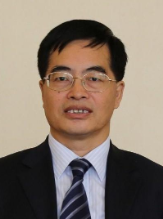 Huapu Lu (陆化普)合作论文数Institute of Transportation Engineering and Geomatics, Department of Civil Engineering, School of Civil Engineering, Tsinghua University4Jingsheng Wang合作论文数4Song YAN (晏松)合作论文数3HaiSong Zhou (周海淞)合作论文数3Peng-sen GE (葛鹏森)合作论文数2Xin Pei (裴欣)合作论文数2Ruibin Wang (王瑞斌)合作论文数2Lei Li (李磊)合作论文数2Wei Zhang (张伟)合作论文数2
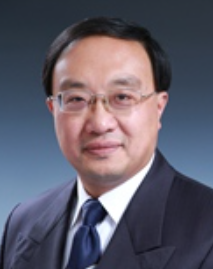 Yi Zhang (张毅)合作论文数Department of Automation, Tsinghua University2Pei FENG (冯培)合作论文数1Yuanyuan WANG (王媛媛)合作论文数1yuxiang zhang (张宇翔)合作论文数1CHENG Gang (程刚)合作论文数1Hong-liang WANG (王洪亮)合作论文数1Jia-liang MA (马嘉良)合作论文数1Yan Song合作论文数1shaolong gu (谷少龙)合作论文数1Jingya YUAN (苑敬雅)合作论文数1Yuan-hai WANG (王元海)合作论文数1RuiHua Yu (于瑞华)合作论文数1TingJie Han (韩廷解)合作论文数1Jing Ren (任静)合作论文数1
 Juan Li (李娟)合作论文数School of Traffic and Transportation, Beijing Jiaotong University1Xuejun Niu (牛学军)合作论文数Peoples Public Security University of China1
 Bobin Wang合作论文数Beijing Jiaotong University, Northern Jiaotong University1Wenjie Chen (陈文杰)合作论文数1Jianyue Zhang (张建跃)合作论文数1Hongjie Chen (陈鸿杰)合作论文数1Bo Deng (邓博)合作论文数1Xiaofeng Zhang (张晓峰)合作论文数1Yuxiang Zhang (张宇翔)合作论文数1
 Jun Ma (马骏)合作论文数People's Public Security University of China1
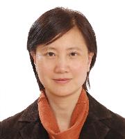 Dalin Qian (钱大琳)合作论文数School of Traffic and Transportation, Beijing Jiaotong University1
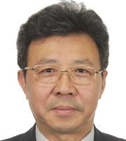 Chunfu Shao (邵春福)合作论文数School of Traffic and Transportation, Beijing Jiaotong University1




