Hydropower dams regulate water flows for millions of downstream inhabitants worldwide, altering water availability. Under a changing climate, flow control is often framed technically and politically as being essential for reducing drought and flood risks. However, it can also disrupt ecological flows, impact livelihoods and erode environmental knowledge. We contribute to this debate by examining how ribere & ntilde;os-rural communities in Colombia characterized by their interdependence with rivers-experience fluctuating water levels. We focus on 'dry events', situations where decreases in the river's water levels hinder ribere & ntilde;os' livelihoods. Our case study, the Lower Sogamoso River (dammed in 2014 by Hidrosogamoso Dam), no longer follows a clear pattern of rising and falling waters, which previously allowed ribere & ntilde;os to prepare socially and economically for seasonal activities. Drawing on a relational perspective on rivers and infrastructures, we mobilize the notion of rhythms to account for the temporal dimensions of hydrosocial relations and sociotechnical infrastructures. Using an interdisciplinary combination of ethnographic research and statistical analysis of hydrological and electricity data, three distinct situations come into view: the regular dry season, hourly low water levels and the 2015-2016 El Ni & ntilde;o. Our findings demonstrate how temporal operations of hydropower and associated pricing mechanisms transform the hydrosocial relations of riverine communities. Daily operations disrupt gradual seasonal streamflow patterns, hindering seasonal livelihoods, while pricing decisions generate disruptive events on an hourly scale. During the 2015-2016 drought, the energy company's water storage and price bidding strategy led to unprecedented water level variations. Synthesis and applications. Our interdisciplinary approach made it possible to connect the temporal experiences of communities with large electricity market fluctuations. We emphasize that dry events must be assessed not only based on climatic conditions or dam presence but also taking into account the intersection of temporal logics at multiple scales. We underscore the need to evaluate streamflow variations at both daily and hourly scales, which are often overlooked in research and policy yet are essential for riverine cultures across the globe.Read the free for this article on the Journal blog.Spanish translation: Read the free for this article on the Journal blog. Las represas hidroel & eacute;ctricas regulan los caudales de agua para cientos de comunidades ribere & ntilde;as ubicadas aguas abajo, alterando la disponibilidad de agua. A la luz de variaciones en el clima, el control de caudales a menudo se enmarca t & eacute;cnica y pol & iacute;ticamente como esencial para reducir los riesgos de sequ & iacute;as e inundaciones. Sin embargo, tal regulaci & oacute;n tambi & eacute;n puede interrumpir los flujos ecol & oacute;gicos, impactar los medios de vida y erosionar el conocimiento ambiental local. Contribuimos a este debate examinando c & oacute;mo los ribere & ntilde;os -comunidades rurales en Colombia caracterizadas por su interdependencia con los r & iacute;os- experimentan las fluctuaciones en los niveles de agua. Enfocamos nuestro an & aacute;lisis en situaciones donde la disminuci & oacute;n en los niveles de agua del r & iacute;o transforma y dificulta los medios de vida de estas comunidades. Nuestro estudio de caso, el bajo r & iacute;o Sogamoso (represado en 2014 por la represa Hidrosogamoso), ya no sigue un patr & oacute;n claro de crecidas y descensos de agua, que previamente permit & iacute;a a los ribere & ntilde;os prepararse social y econ & oacute;micamente para trabajos estacionales. Bas & aacute;ndonos en una perspectiva relacional sobre r & iacute;os e infraestructuras, movilizamos la noci & oacute;n de ritmos para dar cuenta de las dimensiones temporales de las relaciones hidrosociales y las infraestructuras sociot & eacute;cnicas. Mediante una metodolog & iacute;a interdisciplinaria que integra la investigaci & oacute;n etnogr & aacute;fica y el an & aacute;lisis estad & iacute;stico de datos hidrol & oacute;gicos y el & eacute;ctricos, detallamos tres situaciones espec & iacute;ficas: la temporada regular de menor precipitaci & oacute;n, eventos horarios de bajos niveles de agua y el fen & oacute;meno de El Ni & ntilde;o 2015-2016. Nuestros hallazgos demuestran c & oacute;mo las operaciones temporales de la hidroelectricidad y los mecanismos del mercado de precios transforman las relaciones hidrosociales de las comunidades ribere & ntilde;as. Las operaciones diarias interrumpen los patrones graduales de caudal estacional, impactando los medios de vida estacionales, mientras que las decisiones de precios generan eventos disruptivos a escala horaria. Durante la sequ & iacute;a de 2015-2016, la estrategia de almacenamiento de agua y de puja de precios de la empresa energ & eacute;tica condujo a variaciones sin precedentes en los niveles de agua. S & iacute;ntesis y aplicaciones: Nuestro enfoque interdisciplinario permiti & oacute; conectar las experiencias temporales de las comunidades con las grandes fluctuaciones del mercado el & eacute;ctrico. Enfatizamos que los eventos secos deben evaluarse no solo bas & aacute;ndose en las condiciones clim & aacute;ticas o la presencia de la represa, sino tambi & eacute;n teniendo en cuenta la intersecci & oacute;n de l & oacute;gicas temporales a m & uacute;ltiples escalas. Adem & aacute;s, destacamos la necesidad de evaluar las variaciones del caudal tanto a escalas diarias como horarias, las cuales a menudo se pasan por alto en la investigaci & oacute;n y las pol & iacute;ticas p & uacute;blicas, pero que resultan esenciales para las culturas ribere & ntilde;as.
Bayesian calibration of environmental models is computationally constrained. Traditional Gibbs sampling is inefficient for large datasets, while Hamiltonian Monte Carlo (HMC) algorithms struggle with the discrete, step-like functions common in such systems. Using crop phenology as a representative case study, we present a scalable framework to overcome these bottlenecks. By smoothing temperature thresholds and phase transitions with continuous sigmoid functions, we established fully differentiable, HMC-compatible models in Stan. This drastically reduced calibration times, enabling model calibration against a large dataset of 1,000 site-years. We assessed the effects of varying calibration data sizes, model complexities, and inference engines on posterior distributions and out-of-sample performance, alongside power-scaling sensitivity analysis. Comparisons to Gibbs counterparts demonstrated that HMC maintains model integrity while larger datasets significantly narrow parameter uncertainties and improve out-of-sample performance, though adding cultivar-specific complexity introduces overfitting constraints. This methodology provides a generalizable blueprint for scaling Bayesian inference across environmental models.
Many agree that addressing complex water problems requires interdisciplinary approaches. Yet, entrenched epistemic, methodological and institutional hierarchies often privilege technocratic and positivist framings over critical, reflexive and situated ways of knowing. As a result, interdisciplinary knowledge-making is often hesitant to explicitly engage with political questions and fails to expose or challenge the political, cultural and economic systems driving complex water problems. We argue that making interdisciplinary water knowledge more socially and environmentally transformative hinges on embracing critical social sciences and learning from non-Western epistemologies. This becomes possible when interdisciplinary knowledge-making is treated not as integration but as a weaving together and mediation of epistemic and methodological differences, where no discipline must conform to the definitions, frameworks or methods of others. Through collaborative learning processes that are grounded in care and reciprocity, difference can be harnessed as a transformative force for knowledge-making that supports action towards alternative development pathways and more just water futures. Transformative interdisciplinary water research carefully embraces difference and diverse knowledges, rather than enforcing conformity with conventional scientific methods.
This study evaluates three machine learning methods: Random Forest (RF), Long Short-Term Memory networks (LSTM), and Multilayer Perceptron Artificial Neural Networks, to forecast streamflow at daily and monthly scales for the Betania, Quimbo, Hidrosogamoso, and Urr & aacute; hydropower basins in Colombia. Model skill was assessed using two input configurations: (1) temperature and rainfall with multiple time delays, and (2) the same predictors including past inflow. Results indicate that no single model, configuration, or temporal resolution performs best across all basins. In some catchments, meteorological variables alone are sufficient, while in others, antecedent conditions represented by previous inflow are essential to improve accuracy. Monthly aggregation can enhance peak-flow representation but may increase overfitting, especially in basins with limited data; thus, daily data often remain more informative. During El Ni & ntilde;o -Southern Oscillation (ENSO) events, forecasting skill is satisfactory for normal and low flows, whereas performance deteriorates for high-flow conditions. Overall, model performance tends to be better during El Ni & ntilde;o than La Ni & ntilde;a conditions. These findings support improved strategic energy planning in hydropower-dependent systems, where accurate inflow forecasts are critical for reliability.
A growing scholarship suggests hydrological models have political power as they embed and reinforce specific understandings of water and society relations which, in turn, shape future visions of how and for whom water is to be managed. In this commentary, we explore how the power of models can be explicitly and constructively engaged with, thereby expanding their potential to support transformations to water justice and sustainability. To achieve this, we suggest understanding, analyzing, and doing hydrological modeling as a situated knowledge practice. We take inspiration from feminist scholarship that emphasizes that all forms of knowledge are inherently partial, situated within specific contexts, experiences, and circumstances, and shaped by power relations. Situating hydrological modeling, we argue, requires opening up modeling processes to ask where, how, for whom, and by whom models are developed and used, and how outcomes influence water distributions and conditions of access for different social groups. Situating also opens opportunities to explore what it would take for hydrological modeling to explicitly pursue justice and sustainability goals in context-specific and tangible ways. We present initial insights and invite further experimentation towards making models active agents of a more inclusive, transparent, and transformative water management.
To better understand the increasing human impact on the water cycle and the feedbacks between hydrology and society, the International Association of Hydrological Sciences (IAHS) organized the scientific decade "Panta Rhei - Everything Flows: Change in hydrology and society" (2013-2022). A key finding is the need to use integrated approaches to assess the co-evolution of human-water systems in order to avoid unintended consequences of human interventions over long periods of time. Additionally, substantial progress has been made in leveraging new data sources on human behaviour, e.g. through text mining of social media posts. Much has been learned about detecting hydrological changes and attributing them to their drivers, e.g. quantifying climate effects on floods. To achieve further progress, we recommend broadening the understanding, the discipline and training activities, while at the same time pursuing synthesis by focusing on key themes, developing innovative approaches and finding sustainable solutions to the world's water problems.
Study Region: This study explores three Colombian regions where hydroclimatic fluctuations create significant operational challenges for hydropower systems, particularly those associated with El Niño-Southern Oscillation (ENSO): the upper and middle Magdalena basins and the Sinú basin. These regions contain hydroelectric facilities that are central to Colombia’s electricity supply. Each basin is characterized by diverse climatic regimes, socioeconomic contexts, environmental legislations, and water uses. Study Focus: This study focuses on assessing the effects of ENSO events on electricity variables. It aims to identify differences at the plant level, explore the planning strategies hydropower plants use to prepare for ENSO events, and examine the adaptation strategies they employ in response to climate change. The analysis integrates quantitative hydrological and energy data with qualitative insights from stakeholders in an effort to triangulate the findings. New Hydrological Insights: This study contributes to understanding how plants plan and adapt in an electricity system highly dependent on hydropower generation. Moreover, the findings reveal contrasting effects and responses to ENSO events. The middle Magdalena region is more vulnerable to climatic variability, followed by the Upper Magdalena and Sinú basins. Hydrological variability associated with ENSO events is strategically leveraged by power companies in electricity generation management. Adaptation strategies differ significantly, focusing primarily on operational changes, with limited involvement from local communities. Climate adaptation efforts remain technical, underscoring the need for more integrated and inclusive approaches.
Abstract Conservation performance payments are becoming an increasingly popular instrument to tackle human–wildlife conflicts. In Sweden, Sámi communities practicing reindeer husbandry receive performance payments as compensation for reindeer losses caused by lynxes and wolverines. This study examines the challenges and conflicts associated with the Conservation Performance payment scheme and aims to understand its effectiveness. We carried out a thematic analysis of challenges and conflicts using semi‐structured interviews with stakeholders associated with the payment scheme as the main source of evidence, supported by literature identified in a systematic review. The results reveal a wicked conflict setting with a broad range of direct and indirect conflicts. Direct conflicts revolve around the following themes: (1) Uncertainty and mistrust regarding the annual number of lynx and wolverine family groups and the extent of reindeer losses caused by these predators; (2) Payments being too small to cover losses; (3) Large numbers of reindeer lost to predators in many communities and the related hunting regulations. Indirect conflicts are linked to cumulative effects, such as the negative effects of forestry and mining projects on reindeer husbandry, a lack of comprehensive environmental policies, and the perceived lack of respect for reindeer herding as a culturally significant livelihood. We argue that conflicts regarding uncertainties in predator and reindeer loss numbers in particular rather mask broader underlying conflicts. Policy implications: We suggest that high predator‐caused reindeer losses in combination with indirect conflicts hampers the successful implementation of the program. Nevertheless, all interviewees appreciated the basic design of the program and its potential. However, realizing this potential requires acknowledging the wickedness of human–wildlife conflicts and adequately addressing long‐standing ecological and socio‐cultural root conflicts by developing comprehensive, cross‐sectoral, and inclusive conservation policies. Read the free Plain Language Summary for this article on the Journal blog.
Ethnographic and statistical methods have very different epistemological underpinnings; ethnographic research is interpretive, while statistical research is generalizing. Our case study combines these two contrasting approaches and brings them into an eye-level conversation with each other. We conceptualized a Bayesian statistical model for Rainwater Harvesting Mode in rural South Africa, based on hypothetical relations derived from ethnographic field observations. The model pointed to spurious relations and that new hypotheses from fieldwork helped explain. Mixing the two methods means using one to critically reflect on and challenge the other, lending robustness to the research process and the results in a form of triangulation. Iterating ethnographic field work and statistical modelling is useful for learning about particular places. Importantly, we do not see statistical modelling as the end point that ethnographies may provide hypotheses for, but as a recurring step of quantification that generates valuable questions for subsequent ethnographic field work.
Interdisciplinary work can be a challenge even for experienced scientists. Integrating different work methodologies, utilizing different skillsets, and effectively communicating across different fields are all essential to successfully completing such projects. How can we then design an interdisciplinary study program that is engaging for the students and clearly presents the challenges of interdisciplinary work without becoming too problematic and disillusioning?The course Social Hydrology is organized at the Humboldt University of Berlin for students of both social and natural sciences. The goal of the program is to encourage students to engage with water-related problems in a wide interdisciplinary context while conducting an individual research project.What keeps the course together is the subject: each year the lecture is built around a selected smaller river near the city of Berlin. The course starts with an excursion along the selected river, where walking along the river we visit all the relevant locations along them. The students use this excursion to collect impressions of human-water relations through photos, sound or text. During these excursions, the students come up with research questions which are then further distilled with the help of the lecturers. After the excursions the students are given input on various research methods, which then they can use to carry out independent project work.The goal of the project work is to create reports in the form of research articles, which are then published online in the form of storymaps. Hence, the generated knowledge remains accessible beyond the lecture, and could be used as a basis for future research in the region. During the last years, the course became popular among the students, many of them choosing to write a master thesis on the topic of hydrology. In a few cases, the study carried out during the course was further developed into an actual research paper.
Given the importance of groundwater for freshwater provision and groundwater-dependent ecosystems, understanding climate effects on groundwater changes at a regional scale is essential. In this paper, we propose a new way of applying dimensionality reduction for such purpose, not over the collected data, nor over any calibrated models, but over the misfits between the modeled and observed groundwater levels. This methodology highlights local differences in climate-groundwater relations and can be used to identify regions with different vulnerabilities in a data-driven way. The approach takes gridded groundwater level data and gridded precipitation and evapotranspiration data as input. Linear water balance models are set up for each grid cell in an independent way. The misfits between the water balance model simulations and groundwater levels are used for the dimensionality reduction-based regionalization, with which areas of different groundwater behavior are identified. We demonstrate the potential of our methodology in the Berlin-Brandenburg region, Germany, where groundwater is a major freshwater source at risk. We show that groundwater level changes are linearly related to climatic variations at a monthly scale, even in areas with strong anthropogenic influences. The dimensionality reduction further reveals an approximate regionalization of groundwater behavior, which can be used as a basis for more detailed investigations.
Modelling and models influence how water and its flows are understood and governed. It is thus essential to critically explore the roles that models play in producing or addressing uneven water distribution. In this introduction to the Special Issue, we discuss approaches to analysing models and modelling practices. We start by establishing that they deserve special attention because they produce knowledge of another nature than gained from observations and measurements-knowledge that abstracts, generalises and offers access to potential futures and remote places. The paper outlines the ways in which models can appear to have universal relevance because of how they are able to travel between contexts; it also stresses that the rationalisation they offer aligns with the idea of control that underpins the modern water paradigm and related techno-managerial interventions. Despite their widespread appeal and use, this introduction stresses that models remain rather opaque, difficult to understand and navigate for non-experts and even sometimes for experts. The paper goes on to show how, in the context of water research and governance, models derive authority from the networks and discourses that surround them as well as from the epistemic and non-epistemic values that are shared by particular modelling communities. We present three complementary entry points for engaging with models: first, by interrogating their function as tools of representation; second, by exploring how they are produced and operated within constellations of actors, practices, discourses and material artefacts; and third, by analysing how models are deployed to legitimise water governance decisions that are inherently political. We then expand our critical engagement with water modelling, placing it in the broader context of attacks on science and scientists, particularly in the context of rising post-truth politics. Finally, by discussing the papers in this Special Issue, we conclude that models not only contribute to reproducing water inequalities but that they can also be mobilised to understand and address them. We suggest that future critical water research on modelling should continue to ground models and modelling in local realities, while also being invested in models as knowledge practices. Future research would benefit from bringing the diverse approaches that are showcased in this Special Issue into conversation as they enable rich and plural accounts of the worlds of water modelling.
Regional scale groundwater vulnerability models are urgently needed to cope with the challenges presented by climate change. Traditional modeling approaches in hydrology and hydrogeology however often require detailed process understanding, and geological information to reliably simulate the hydrological system. In this study we present an alternative, top-down model development framework, starting from the big picture of the hydrology of the region, then focusing on the smaller details and complexities in a gradual way. Groundwater vulnerability of the Brandenburg region is assessed by investigating the response of the groundwater table to different weather patterns. In order to achieve this a regional dataset for Brandenburg is prepared, using monthly groundwater and surface water data from the time period 1990-2022. This data is then reflected to weather timeseries taken from the Central European Refined analysis dataset, a gridded climate reanalysis dataset for the same time period. The datasets are aggregated on a subcatchment scale, which allows closing the water balance for the individual hydrological response units. Both water balance, linear regression and non-linear regression models are used with automatic calibration, because of the large number of modelled subcatchments. Due to the big-data nature of the modeling approach, the interpretation of the results is also done in an automatized way. We delineate regions of different vulnerability characteristics by unsupervised methods based on their response dynamics. We also try to identify major turning points in the climatic water balance timeseries. The presented framework produces models that can be used towards deriving actionable insights for groundwater management.
Lakes are directly exposed to climate variations as their recharge processes are driven by precipitation and evapotranspiration, and they are also affected by groundwater trends, changing ecosystems and changing water use.In this study, we present a downward model development approach that uses models of increasing complexity to identify and quantify the dependence of lake level variations on climatic and other factors. The presented methodology uses high-resolution gridded weather data inputs that were obtained from dynamically downscaled ERA5 reanalysis data. Previously missing fluxes and previously unknown turning points in the system behavior are identified via a water balance model. The detailed lake level response to weather events is analyzed by calibrating data-driven models over different segments of the data time series. Changes in lake level dynamics are then inferred from the parameters and simulations of these models.The methodology is developed and presented for the example of Gro ss Glienicker Lake, a groundwater-fed lake in eastern Germany that has been experiencing increasing water loss in the last half-century. We show that lake dynamics were mainly controlled by climatic variations in this period, with two systematically different phases in behavior. The increasing water loss during the last decade, however, cannot be accounted for by climate change. Our analysis suggests that this alteration is caused by the combination of regional groundwater decline and vegetation growth in the catchment area, with some additional impact from changes in the local rainwater infrastructure.
Global statistical irrigation modeling relies on geospatial data and traditionally adopts a discrete global grid based on longitude-latitude reference. However, this system introduces area distortion, which may lead to biased results. We propose using the ISEA3H geodesic grid based on hexagonal cells, enabling efficient and distortion-free representation of spherical data. To understand the impact of discrete global grid choice, we employ a non-parametric statistical framework, utilizing random forest methods, to identify the main drivers of historical global irrigation expansion using, among other data, outputs from the global dynamic vegetation model Lund-Potsdam-Jena managed Land (LPJml).Irrigation is critical for food security amidst growing populations, changing consumption patterns, and climate change. It significantly boosts crop yields but also alters the water cycle and global water resources. Understanding past irrigation expansion and its drivers is vital for global change research, resource assessment, and the prediction of future trends.We compare predictive accuracy, simulated irrigation patterns, and identification of irrigation drivers between the two grid systems. Using the ISEA3H geodesic grid system increases the predictive accuracy by up to 28 % compared to the longitude-latitude grid. The model identifies population density, potential productivity increase, evaporation, precipitation, and water discharge as key drivers of historical global irrigation expansion. Gross domestic product (GDP) per capita also shows some influence.We conclude that the geodesic discrete global grid system significantly affects predicted irrigation patterns and identification of drivers and thus has the potential to enhance statistical modeling, which warrants further exploration in future research across related fields. This analysis lays the foundation for comprehending historical global irrigation expansion.
This article focuses on understanding the territorialization processes caused by the decision of the Constitutional Court in Colombia to grant rights to the Atrato River. Against the background of the social-ecological conflicts of extraction, contamination, and direct use of the river's resources, state actors, ethnic and campesinos communities, and social organizations are now required to comply with Sentence T-622/16 and actively work together. The case is approached by using the hydrosocial territory framework and analyzing how this resonates with the territorial pluralism of the region. Based on field interviews and secondary data and documents from the first five years of implementation of the Sentence, we discuss how the Sentence defines a new hydrosocial imaginary around the collective territories of ethnic communities that we call territories-in-territory. We conclude by outlining the implementation struggles of Sentence T-622, especially those related to the requirement of participatory processes.
Models are widely used to research hydrological change and risk. However, the power embedded in the modelling process and outcomes is often concealed by claiming their neutrality. Our review shows that in the scientific literature relatively little attention is given to the influence of models on development processes and outcomes in water governance. At the same time, an emerging body of work offering critical insights into the political implications of hydrological models and a nuanced understanding of their application in context has begun to flourish. Drawing on this work, we call for power-sensitive modelling which includes the following considerations: take a holistic approach to modelling beyond programming and coding; foster accountability; work towards just and equitable water distributions; be transparent about the expectations and choices made; and democratise modelling by giving space to and being mindful of representations of multiple bodies of knowledge and multiple stakeholders and by incorporating marginalised people and nature into the modelling process. Our call should not be understood as a suggestion to do away with modelling altogether, but rather as an invitation to interrogate how quantitative models may help to foster transformative pathways towards more just and equitable water distributions.
Download This Paper Open PDF in Browser Add Paper to My Library Share: Permalink Using these links will ensure access to this page indefinitely Copy URL Copy DOI
This study provides a novel framework for analysing PES-related degrees of ES-commodification. The framework differentiates PES programs by the extent to which ES are traded in a market-like exchange in terms of four PES design components. We apply this framework to a newly compiled global dataset of collective PES programs (C-PES). C-PES address communities and groups instead of individuals and private entities and provide voluntary, conditional incentives for ES protection. Many conservationists see potentials for supporting participation and cooperation when linking common land titles with the PES approach instead of strengthening private land tenure regimes. We identified 29 C-PES cases with clusters in Central and Southeast Africa, Central America, and Southeast Asia. Particularly C-PES programs focusing on carbon or wildlife ES reach medium to high degrees of commodification, whereas schemes targeting biodiversity, watershed, or bundled ES show rather low to medium degrees of commodification. Our framework allows for a more nuanced study of the pluralism of PES designs and lays the foundation for further research on the differentiated role of ES-commodification for social-ecological outcomes.
<p>Worldwide, rainwater harvesting (RWH) is gaining importance as alternative water source for water insecure households that face drought and water scarcity. RWH is especially useful in the widely dispersed settlements of rural South Africa, where water infrastructure and services are only partially developed and often dysfunctional and unreliable. Surprisingly, according to previous studies and data from the South African General Household Survey, only 1 to 3 % of South African households practice rainwater harvesting; however, these studies and surveys have only considered conventional RWH systems, i.e. industrially manufactured gutters and large 4 to 6kl-tanks. In our case study in rural Kwazulu-Natal, over 90% of households practiced RWH, yet only 25% harvested rainwater in a conventional way. The majority of households collected rainwater in what we call a &#8220;makeshift mode&#8221;, using short, homemade gutters made from metal sheets, hollow tree trunks or plastic bottles that route the water into 210 l-drums, tubs or bowls. We aimed to investigate the reasons for the differences in the RWH mode (conventional or makeshift) and explore what the different modes of RWH mean for some aspects of household water insecurity. Our analysis is based on ethnographic field work in rural uMvoti, including field observations, interviews, participant observation, and a household survey with 67 households. Field observations suggested that income, water access and type of housing all contribute in interrelated ways to the mode of RWH that rural households could practice. We triangulated these hypothesised relations statistically. Moreover, our statistical analysis yielded new hypotheses for further ethnographic field work and allowed us to quantify the strengths of the effects: the share of round huts has a much greater effect on RWH mode than household income. For upscaling RWH in rural areas, therefore, the specific water needs and housing types of households need to be considered. While some households may benefit from new drums and gutters that are tailored to their round huts, other households may need to transition to conventional RWH with large tanks, which requires at least one building with straight roofs. Certainly, makeshift RWH is less efficient than conventional RWH systems in terms of volume, but can be advantageous in terms of water quality and affordability. Presumably, makeshift RWH is prevalent in other parts of rural South Africa and should be considered in future RWH research. With regards to the methodological stance of our study, we propose the iteration of ethnographic field work and statistical modelling as a useful research process for learning about particular places.</p>
 Jim E. Freer合作论文数Environmental Science/Lancaster Environment Centre, Lancaster University34
 John Quinton合作论文数Lancaster Environment Centre, Lancaster University27
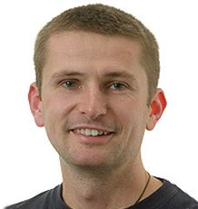 Richard E. Brazier合作论文数School of Geography, University of Exeter24
 Gary S Bilotta合作论文数School of Environment and Technology, University of Brighton22
 Christopher James Alexander Macleod合作论文数The James Hutton Institute20
 Philip M. Haygarth合作论文数Lancaster Environment Centre, Lancaster University17Steven J. Granger合作论文数12
 Kevin M. Hiscock合作论文数School of Environmental Sciences, University of East Anglia10p j butler合作论文数9
 Richard James Cooper合作论文数School of Environmental Sciences, University of East Anglia8
 Hilary Mcmillan合作论文数Department of Geography;University of Cambridge;Department of Geography, University of Cambridge8
 Cornelius Senf合作论文数8
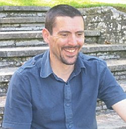 Barry G. Rawlins合作论文数British Geological Survey Keyworth Nottingham7
 Rossella Alba合作论文数Governance & Sustainabil Lab, Trier Univ6
 Heidi Kreibich合作论文数Geography Department, Humboldt-Universität zu Berlin;German Research Centre for Geosciences6
 Giuliano Di Baldassarre合作论文数Department of Earth Sciences, Uppsala University6J.M.B. Hawkins合作论文数6
 Junguo Liu (刘俊国)合作论文数School of Water Conservancy, North China University of Water Resources and Electric Power;School of Environmental Science and Engineering, Southern University of Science and Technology5
 Antje Bruns合作论文数Universität Flensburg Institut für Geographie und ihre Didaktik5
 Alex Inman合作论文数4
 Karen Eva Lebek合作论文数4
 Jaime Ricardo García Márquez合作论文数Leibniz Institute of Freshwater Ecology and Inland Fisheries4
 Josef Kaiser合作论文数4
 Hoseung Jung合作论文数IRI THESys, Humboldt Univ4
 Maria Rusca合作论文数Dept Earth Sci, Uppsala Univ4Laurence E. D. Smith合作论文数4
 Roland Bol合作论文数IBG3 Agrosphere Forschungszentrum Jülich4
 Patrick Hostert合作论文数Earth Observation Lab, Geography Department, Faculty of Mathematics and Natural Sciences, Humboldt Universität zu Berlin4
 A. Castellarin合作论文数Department of Civil, Chemical, Environmental, and Materials Engineering, Alma Mater Studiorum - Universita di Bologna4Patricia Butler合作论文数3Christopher J. A. Macleod合作论文数3
 Beril Ocaklı合作论文数THESys & Geography Department, Humboldt-Universität zu Berlin3
 Bruce Lankford合作论文数School of International Development, University of East Anglia3
 Dagmar Haase合作论文数Geography Department, Faculty of Mathematics and Natural Sciences, Humboldt-Universitat zu Berlin;Geographisches Institut, Mathematisch-Naturwissenschaftliche Fakultät, Humboldt-Universitat zu Berlin3
 Gemma Carr合作论文数Centre for Water Resource Systems, Vienna University of Technology3
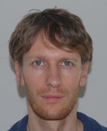 Alberto Viglione合作论文数Vienna University of Technology, Technische Universität Wien3
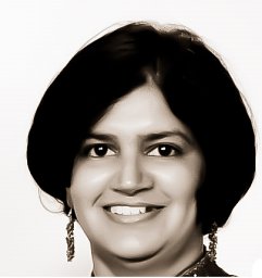 Veena Srinivasan合作论文数Ashoka Trust for Research in Ecology and the Environment, Ashoka Trust for Research in Ecology and the Environment3
 Alberto Montanari合作论文数Department of Civil, Chemical, Environmental and Materials Engineering, Alma Mater Studiorum Universita di Bologna3
 Anne Van Loon合作论文数Hydrol & Quantitat Water Management Grp, Wageningen Univ3
 Keith Beven合作论文数Lancaster Environment Centre, Lancaster University3
 N. Pedentchouk合作论文数University of Calgary;Department of Geology and Geophysics;Department of Geology and Geophysics, University of Calgary3Laura J. Gimbert合作论文数3
 Alfonso I. Mejía合作论文数3Burkhard Beudert合作论文数3
 Elena Toth合作论文数University of Bologna3Jean-Philippe Venot合作论文数IWMI, International Water Management Institute3
 Ida Westerberg合作论文数Department of Earth Sciences, Uppsala University3
 Paul J. Worsfold合作论文数School of Geography, Earth and Environmental Sciences, Faculty of Science and Engineering, University of Plymouth3
 Maria J. Polo合作论文数Andalusian Inst Earth Syst Res, Univ Cordoba3




