The Canada Basin's upper ocean structure is undergoing swift changes with the intrusion of warmer Pacific waters and sea ice loss with profound implications for sound propagation in this region. Two Seagliders measured high-resolution transects of temperature, salinity, and pressure across fronts and eddies, providing estimates of the spatial sound-speed variability in the upper ocean along transmission paths of an acoustic tomography array during the summer months of 2016 and 2017. The spatial analysis highlights the importance of placing the results within the context of the structure of the Beaufort Gyre. The measured profiles are used to quantify the depth-dependent contributions of internal waves, halocline eddies, and spice on sound-speed fluctuations. Results support and complement measurements from a sub-surface distributed vertical line array mooring and extend observations into the mixed layer. In the upper 100 m, spice is found to be the major driver of sound-speed fluctuations with a maximum of 3 m/s rms at 23 m, which corresponds to the bottom of the mixed layer. Fluctuations from the vertical displacement of isopycnals driven by halocline eddies and internal waves have three distinct peaks at 25, 60, and 270 m, with values of 0.73, 0.43, and 0.2 m/s rms respectively.
Spectrograms are used for time-frequency analysis and as preprocessing for signal classifiers and other algorithms. The conventional spectrogram is a tapered short-time Fourier transform, equivalent to a bank of bandpass filters. The taper defines filter-bank characteristics such as bandwidth and sidelobe levels. Although the conventional spectrogram uses minimal computational resources, its design requires a compromise between resolution and interference suppression. Adaptive spectrogram algorithms adjust the filter-bank based on incoming data, thereby allowing different bandwidth/sidelobe trade-offs at each frequency and time. Adaptation can simultaneously improve tonal resolution and reveal quiet sources but typically costs substantially more to implement. This paper presents an adaptive spectrogram designed for applications with limited computational resources, e.g., autonomous vehicles. The performance weighted blended (PWB) spectrogram combines the output of a set of conventional filter-banks designed with different tapers. By adapting its blend weights at each frequency and time, the new algorithm separates loud closely spaced tones and identifies quiet signals. Because it relies on conventional filter-banks, the PWB spectrogram requires significantly less computation than other adaptive algorithms that require expensive matrix computations. Analysis of underwater glider data demonstrates the algorithm's ability to reveal a quiet chirp signal in the presence of vehicle self-noise.
The RAFOS ocean acoustic monitoring (ROAM) tag is a miniature, low-cost, attachable device that is designed to augment oceanographic float instruments, autonomous vehicles, and marine wildlife with RAFOS-style subsurface acoustic geolocation. Equipped with an acoustic receiver, clock crystal, internal batteries, and temperature sensor, ROAM tags detect the arrival times of regularly scheduled signals from low-frequency underwater sound sources. Once the data are recovered, these records enable trilateration of subsurface positions over months to years. Tag success improves with proximity to the deep ocean sound channel (approximately 500-1300-m depth), where the range of sound sources can extend for hundreds of kilometers. Here, we analyze geolocation results from a pilot study using a tag-equipped glider in the vicinity of a moored sound source. We also evaluate predictions of transmission strength and positional uncertainty for different source configurations based on acoustic models. With this analysis and discussion, we aim to offer a comprehensive description of considerations for successful ROAM tag deployments, such as depth regime (shallow versus deep water), environmental characteristics of the water and sediments, and sound source arrangement.
Broadband acoustic transmissions from five moored transceivers were received by two autonomous Seagliders in August 2017 during the Canada Basin Acoustic Propagation Experiment. Long-range acoustic data from these receptions were utilized in a least squares inversion to obtain subsurface position estimates. Acoustic sources in this experiment did not transmit simultaneously and in some cases, position estimates spanned larger distances during the reception period than expected given typical horizontal vehicle speeds. Horizontal speeds derived from vehicle measurements can be used to impose a physical limit on the position estimation. Here, three iterations of the least squares model, using increasingly more vehicle data, are presented for two example acoustic receptions received on a Seaglider. The final iteration demonstrates how in situ vehicle measurements can be used to refine position estimates from long-range acoustic data.
Acoustic propagation in the Beaufort Sea is particularly sensitive to upper-ocean sound-speed structure due to the presence of a subsurface duct known as the Beaufort duct. Comparisons of acoustic predictions based on existing Arctic models with predictions based on in situ data collected by Seaglider vehicles in the summer of 2017 show differences in the strength, depth, and number of ducts, highlighting the importance of in situ data. These differences have a significant effect on the later, more intense portion of the acoustic time front referred to as reverse geometric dispersion, where lower-order modes arrive prior to the final cutoff.
The stratification of the Beaufort Sea has experienced significant changes over the last few decades resulting in a subsurface duct between 100- and 300-meters depths, known as the Beaufort Duct. This duct allows for long-range acoustic transmissions due to little interaction with the seafloor or sea surface. Acoustic arrival predictions for broadband acoustic sources centered around 250 Hz, such as those deployed in the Beaufort Sea in 2016–2017 show a peak acoustic arrival prior to the final cutoff centered on the sound speed minimum in the duct. This reverse dispersion feature in the acoustic time front can be connected back to the unique ducting features in the sound-speed profile. This relationship is explored using normal mode modeling and geometric optics. Modal speed predictions and ray path lengths and travel times are used to interpret the acoustic arrival patterns, particularly the dispersion feature present in the acoustic time front.
Knowledge on the occurrence and behaviour of baleen whales around sub-Antarctic regions is limited, and usually based on short, seasonal sighting research from shore or research vessels and whaling records, neither of which provide accurate and comprehensive year-round perspectives of these animals’ ecology. We investigated the seasonal acoustic occurrence and diel vocalizing pattern of baleen whales around the sub-Antarctic Prince Edward Islands (PEIs) using passive acoustic monitoring data from mid-2021 to mid-2023, detecting six distinct baleen whale songs from Antarctic blue whales, Madagascan pygmy blue whales, fin whales, Antarctic minke whales, humpback whales, and sei whales. Antarctic blue and fin whales were detected year-round whereas the other species’ songs were detected seasonally, including a new Antarctic minke whale bio-duck song sub-type described here for the first time. Antarctic minke and sei whales were more vocally active at night-time whereas the other species had no clear diel vocalizing patterns. Random forest models identified month and/or sea surface temperature as the most important predictors of all baleen whale acoustic occurrence. These novel results highlight the PEIs as a useful habitat for baleen whales given the number of species that inhabit or transit through this region.
The buoyancy glider is a quiet and persistent underwater acoustic receiving platform. Traveling in a sawtooth pattern, buoyancy gliders equipped with acoustic recorders can sample acoustic transmissions at many ranges and depths with respect to moored acoustic sources transmitting on a timed schedule. In the Beaufort Sea, six broadband acoustic tomography sources consecutively transmitted 135-s linear frequency modulated (LFM) swept-frequency signals centered near 250 Hz every 4 h. These signals were received by two Seagliders at ranges up to 500 km and depths between the surface and 800 m in the summer of 2017. Sources were moored within the Beaufort Duct, a sound-speed minimum characteristic of the region, at a depth of approximately 180 m. Due to the presence of this duct, many acoustic paths are focused within a relatively narrow depth span, resulting in a complicated arrival structure. Pulse-compressed acoustic signals received on the gliders are interpreted in the context of broadband acoustic arrival predictions. The individual snapshots of acoustic arrival structure that make up this unique dataset offer insight into the acoustic travel-time arrival structure as it evolves with range from a transmitting source.
The Seaglider, a type of underwater glider, is a relatively quiet vehicle in comacoustic receiving platform. Vehicle operations, such as pumping/bleeding oil to change buoyancy, shifting/rotating the battery to change pitch/roll, and oceanographic data collection, do, however, produce some self-noise. This system performance study analyzes the prevalence, frequency content, duration, and levels of self-noise associated with vehicle operations using data collected with a passive acoustic monitoring system mounted on the body of a Seaglider vehicle. Guidance and control functions, including pitch, roll, and buoyancy changes, were the major source of platform noise, producing broadband noise ranging from less than a second to over 3 min in duration, with sound pressure levels of 120-145.5 dB re 1 mu Pa. Frequencies below 10 kHz were the most impacted by self-noise, with a maximum 1/3 octave level of 137.5 dB re 1 mu Pa in the 2.5 kHz band caused by the pumping of oil in the variable buoyancy device. Guidance and control changes occurred during 4%-13% of the dive for dives greater than 500 m. The bulk of these operations, however, were performed near the surface and apogee of the dive and typically affected only about 6% of the dive cycle duration for deep dives.
Moving and depth-varying receivers, such as autonomous underwater vehicles (AUVs), provide a great tool for acoustic remote sensing applications. An array of acoustic sources can be used to provide long-range acoustic positioning for AUVs, but there are challenges in the form of subsea position uncertainties that can be exacerbated by Doppler delay shifts. During the Canada Basin Acoustic Propagation Experiment (CANAPE) two M1 Seagliders equipped with WHOI micromodem acoustic receivers were deployed during August 2017. Acting as moving receivers, the Seagliders navigated the Beaufort Sea in and around the CANAPE array, recording transmissions from the broadband acoustic sources at varying ranges and depths of 2–530 km and surface to 750 m, respectively. The sources transmitted 135-second linear frequency modulated signals with a bandwidth of 100 Hz centered around 250 Hz. This work focuses on the Doppler delay shift effects on acoustic ranging uncertainties using these signals. Using vehicle attitude measurements over the duration of the signal receptions, it was found that 91 percent of the acoustic receptions included ranging uncertainties of 10 m or more due to Doppler, with particular impact at closer ranges of 50 km or less.
An ocean glider is a specific type of Autonomous Underwater Vehicle (AUV) that operates using a buoyancy engine rather than traditional propellors or thrusters. This method of propulsion enables a glider to be deployed for weeks or months and is relatively quiet, making the ocean glider a desirable platform for persistent acoustic monitoring. A glider typically remains submerged for several hours, during which time it can be challenging to localize the vehicle precisely. Gliders are low-power platforms that operate in the mid-water column, and therefore subsea navigation technologies implemented on other types of AUVs, such as inertial navigation systems aided by Doppler velocity logs, may not be suitable. Acoustic signals from fixed broadband sources have been used for subsea localization of Seaglider, a commercially available glider platform. Measurements of the multipath acoustic arrival structure received on Seagliders at ranges up to hundreds of kilometers from transmitting sources were used for vehicle localization in both temperate and polar underwater sound propagation environments. Methodology and results for subsea localization of the Seaglider platform will be presented and placed in the context of a broader discussion of the advantages and challenges specific to the glider as a moving acoustic receiving platform.
A Seaglider instrumented with an inertial attitude and heading reference system was tracked for three days on an acoustic tracking range in Dabob Bay, Washington, operated by the Naval Undersea Warfare Center, Keyport, WA, USA. Inertial measurements were integrated to yield estimates of position and compared with tracked positions. Within 3 min, the integrated positioning results deviated from tracked positions by more than a kilometer. The addition of a depth constraint from pressure sensor measurements slowed the error growth over time, but even with this constraint, measurements were too noisy to accurately determine position without aid from additional sensors. Inertial data did contribute to accurate localization when used to estimate vehicle attitude and incorporated into an existing flight model; however, results did not demonstrate marked improvement over existing flight models. Although not a decisive demonstration of vehicle positioning with a standalone low-cost, low-power sensor, the results presented here provide a benchmark for comparison as MEMS inertial sensors continue to evolve using a valuable ground-truth of subsea Seaglider position not previously available.
A machine learning model was developed to automatically align underwater acoustic measurements taken at various depths and ranges from a transmitting source in the Philippine Sea to a reference model of long range acoustic arrival structure, simultaneously determining source-receiver range and travel-time offsets associated with multipath arrivals. Ocean sound-speed variability complicates the task as the measured arrivals may exhibit scattering not present in range-independent predictions. Monte Carlo style broadband parabolic equation simulations through random internal wave fields consistent with the Garrett-Munk internal wave energy spectrum were used to generate a large data set of simulated acoustic receptions including scattered multipath arrivals with known source-receiver ranges and imposed travel time offsets. These simulated receptions were used to train and evaluate the machine learning model for arrival pattern matching to the reference model. The inclusion of various data dimensions, such as peak amplitude and width, and contextual information, such as range and depth, were also explored as input to the model. Ranging results for the machine learning model were compared to a programmatic solution engineered for the same task.
Rapid warming of the Pacific Summer Water layer strengthens a subsurface duct in the Beaufort Sea, allowing for long-range propagation at low frequencies. An array of tomography sources was deployed within the duct as part of the Canada Basin Acoustic Propagation Experiment (CANAPE) to study acoustic propagation in this environment. The moored transceivers provide measurements of acoustic propagation at several ranges from 176 to 285 km. Additionally, two Seaglider vehicles equipped with hydrophone receivers navigated in and around the CANAPE array and recorded the transmissions from the moored sources at ranges as far as 530 km and as close as 2 km. A spatially variable sound speed environment was generated from in-situ data measured by the Seagliders and CTD casts from research vessels. Acoustic arrivals measured on the vehicles were matched to range-dependent acoustic predictions made with a broadband Parabolic Equation model to estimate source-receiver range. Acoustic receptions from multiple moored sources were used to localize the Seagliders. Here, we examine the close range (2–25 km) receptions and their impacts on acoustic localization.
An automated method was developed to align underwater acoustic receptions at various depths and ranges to a single reference prediction of long range acoustic arrival structure as it evolves with range in order to determine source-receiver range. Acoustic receptions collected by four autonomous underwater vehicles deployed in the Philippine Sea as part of an ocean acoustic propagation experiment were used to demonstrate the method. The arrivals were measured in the upper 1000 m of the ocean at ranges up to 700 km from five moored, low frequency broadband acoustic tomography sources. Acoustic arrival time structure for pulse compressed signals at long ranges is relatively stable, yet real ocean variability presents challenges in acoustic arrival matching. The automated method takes advantage of simple projections of the measured structure onto the model space that represents all possible pairings of measured peaks to predicted eigenrays and minimizes the average travel-time offset across selected pairings. Compared to ranging results obtained by manual acoustic arrival matching, 93% of the automatically-obtained range estimates were within 75 m of the manually-obtained range estimates. Least squares residuals from positioning estimates using the automatically-obtained ranges with a fault detection scheme were 55 m root-mean-square.
The three-dimensional (3D) propagation effects of horizontal refraction and diffraction were measured on a tetrahedral hydrophone array deployed near the coast of Block Island, RI. Linear frequency modulated chirp signals, centered at 1 kHz with a 400 Hz bandwidth, were transmitted from a ship moving out of the acoustic shadow zone blocked by the island from the perspective of the hydrophone array. The observed shadow zone boundary was consistent with the prediction made by a 3D sound propagation model incorporating high-resolution bathymetry and realistic sound speed obtained from a data-assimilated regional ocean model. The 3D modal ray calculation provided additional insight into the frequency dependence of the signal spreading. This analysis found that the modes at higher frequencies can propagate closer to the coast of the island with shallower modal cutoff depths, where the sound energy penetrates the sloping seafloor at supercritical incidence. The evidence of horizontal caustics of the sound was shown in the parabolic equation and modal ray models by comparing to the arrival pattern observed in the data. The arrival angle measurements on the tetrahedral array show the complex propagation patterns, including the diffracted energy in the island shadow and acoustic energy refracted away from the island.
Significant changes in the stratification of the Beaufort Sea over the last few decades have produced a subsurface duct located between 100- and 300-meters depth, known as the Beaufort Duct. This subsurface duct allows for long-range acoustic transmission with little to no interaction with the sea surface or seafloor. In August and September of 2017, acoustic transmissions from five active moored tomography sources were collected at ranges up to 530 km by two Seagliders along with in-situ environmental measurements. Sound-speed profiles from the Seaglider data were used as input for parabolic equation and normal mode predictions. Both the predictions and recorded acoustic data show a peak acoustic arrival prior to the final cutoff. We refer to this as a “foldover” feature in the acoustic timefront, and it can be connected back to the unique ducting features in the input sound speed profiles. The relationship between the extent of the foldover and the shape of the sound-speed profile in the duct is explored using normal modes. Modal group speed predictions for the low-order modes are used to understand which modes make up the foldover feature present in the acoustic timefront and to interpret the acoustic arrival patterns measured on the Seagliders.
Over the last few decades, environmental changes in the Arctic have resulted in a subsurface acoustic duct located between 100- and 300-m depth, known as the Beaufort Duct. This subsurface duct allows for long-range acoustic transmission with little to no interaction with the sea surface or seafloor. In a 2017 long-range acoustic tomography experiment, two Seagliders traversed between five active sources moored within the duct which transmitted linear frequency modulated (LFM) sweeps centered around 250 Hz. These Seagliders were equipped with conductivity, temperature, depth (CTD) sensors as well as passive acoustic receivers. The environmental measurements were used to create sound speed profiles for input into broadband parabolic equation and normal mode acoustic propagation models. The normal mode models provide physical insight into the relationship between the peak arrival and the final cutoff of the ducted acoustic receptions. Modal group speeds from the predictions are used to interpret the acoustic arrival patterns measured on the Seagliders.
Environmental changes in the Arctic over the last few decades have resulted in a subsurface sound speed duct located between 100- and 300-meters depth, known as the Beaufort Duct, which allows for long range acoustic propagation with little or no interference from the ocean surface or bottom. In 2017, two Seagliders traversed between five moored active acoustic sources transmitting linear frequency modulated (LFM) sweeps with frequencies around 250 Hz. During the experiment the Seagliders recorded acoustic arrivals and measured temperature, salinity, and pressure. These environmental measurements are used to calculate sound speed for use as an input to forward acoustic propagation models, including rays and broadband parabolic equation predictions of acoustic time fronts. Results are compared with acoustic propagation predictions based on sound-speed profiles from ocean models as well as measured acoustic data. The measured and modeled acoustic arrival times along with the calculated sound-speed profiles of the region are used to explore the inverse problem.
An automated method was developed to align underwater acoustic measurements taken at various depths and ranges to a reference model of acoustic arrival structure. Data used to demonstrate the method were collected by four autonomous underwater vehicles deployed in the Philippine Sea as part of an ocean acoustic tomography experiment. The arrivals were measured in the upper 1000 m of the ocean at ranges spanning several hundred kilometers from 5 moored acoustic tomography sources. The primary objective is to accomplish automatic source-receiver ranging by aligning measurements of long range acoustic arrivals to a single reference model. Acoustic arrival time structure for pulse compressed signals at long ranges is relatively stable, yet real ocean variability presents challenges in acoustic arrival matching. The presence of internal waves scatters the acoustic arrival structure and can introduce spurious arrivals in the measured data. This method takes advantage of simple projections of the measured structure onto the model space with constraints informed by scattering statistics consistent with the Garrett Munk internal wave energy spectrum. Compared to manual matching of the measured arrivals to eigenray models, more than 90% of the automatically obtained range estimates were within 150 m of the manually obtained range estimates.
 Peter F. Worcester合作论文数Scripps Institution of Oceanography, UC San Diego33
 Matthew Dzieciuch合作论文数Scripps Institution of Oceanography, University of California, San Diego30
 Sarah E. Webster合作论文数Department of Mechanical Engineering, Johns Hopkins University19
 Bruce M. Howe合作论文数Department of Ocean and Resources Engineering, School of Ocean and Earth Science and Technology, University of Hawai‘i at Mānoa18Cristian Graupe合作论文数10
 Eva-Marie Nosal合作论文数University of British Columbia10Jessica Desrochers合作论文数9
 Glenn S. Carter合作论文数9
 Kathleen E. Wage合作论文数8
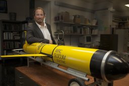 John A. Colosi合作论文数Dept Oceanog, Naval Postgrad Sch8
 Rex K. Andrew合作论文数6Luis O. Pomales Velázquez合作论文数5Kayla Thilges合作论文数4
 Brian Dushaw合作论文数Applied Physics Laboratory, University of Washington4
 Gopu R. Potty合作论文数University of Rhode4
 Daniel Rudnick合作论文数Scripps Institution of Oceanography, University of California, San Diego4
 Wendy E. Snyder合作论文数3
 Martin Renken合作论文数3
 Freeman Lauren A合作论文数National Research Council3
 Freeman Simon E合作论文数American Society for Engineering Education3
 Bruce D. Cornuelle合作论文数Scripps Institution of Oceanography|University of California , San Diego3
 Kevin D. Heaney合作论文数3
 James A. Mercer合作论文数3
 Craig Lee合作论文数Ocean Physics Department, Applied Physics Laboratory, University of Washington3B. M. Howe合作论文数2
 Jeff Tucker合作论文数George Mason Univ.2Campbell Richard L合作论文数2
 Roth Ethan H合作论文数Scripps Institution of Oceanography, University of California, San Diego2
 Andrey Shcherbina合作论文数Scripps Institution of Oceanography, University of California2
 Aleksandr Aravkin合作论文数Department of Applied Mathematics, University of Washington;Institute for Health Metrics and Evaluation, University of Washington2John a Mercer合作论文数2
 Ralph A. Stephen合作论文数Department of Geology and Geophysics;Woods Hole Oceanographic Institution;Department of Geology and Geophysics, Woods Hole Oceanographic Institution2
 Lee Freitag合作论文数Acoustic Communications Group, Woods Hole Oceanographic Institution2
 Erin M. Oleson合作论文数Scripps Institution of Oceanography, University of California San Diego2F. L. Bahr合作论文数1S. T. Bolmer合作论文数1Alexis Johnson合作论文数1Frederick R. Stahr合作论文数1
 Andrew W. White合作论文数1
 Burak Boyacıoglu合作论文数University of Washington1Jonathan Jonker合作论文数Department of Mathematics, University of Washington1Marcel van den Berg合作论文数1
 Sonia J. Rowley合作论文数Dept Earth Sci, Univ Hawaii Manoa1
 Nicholas M Kroeger合作论文数1Ronald Fick合作论文数1Levi Cai合作论文数Mediated Matter Group at the MIT Media Lab, Massachusetts,Institute of Technology,Cambridge,USA1James S. Bennett合作论文数1
 Fannie W. Shabangu合作论文数Mammal Res Inst Whale Unit, Univ Pretoria1Tarron Lamont合作论文数Department of Oceanography, University of Cape Town1




