The Canada Basin's upper ocean structure is undergoing swift changes with the intrusion of warmer Pacific waters and sea ice loss with profound implications for sound propagation in this region. Two Seagliders measured high-resolution transects of temperature, salinity, and pressure across fronts and eddies, providing estimates of the spatial sound-speed variability in the upper ocean along transmission paths of an acoustic tomography array during the summer months of 2016 and 2017. The spatial analysis highlights the importance of placing the results within the context of the structure of the Beaufort Gyre. The measured profiles are used to quantify the depth-dependent contributions of internal waves, halocline eddies, and spice on sound-speed fluctuations. Results support and complement measurements from a sub-surface distributed vertical line array mooring and extend observations into the mixed layer. In the upper 100 m, spice is found to be the major driver of sound-speed fluctuations with a maximum of 3 m/s rms at 23 m, which corresponds to the bottom of the mixed layer. Fluctuations from the vertical displacement of isopycnals driven by halocline eddies and internal waves have three distinct peaks at 25, 60, and 270 m, with values of 0.73, 0.43, and 0.2 m/s rms respectively.
In recent decades, the Canada Basin’s upper ocean structure has undergone changes with the intrusion of warmer Pacific Ocean waters and continued surface warming. These changes have direct implications for underwater acoustic propagation including the formation of a strong subsurface duct located around 180 m depth, referred to as the Beaufort duct. In summer 2016, a pentagonal array of tomography sources moored within the Beaufort duct over a region with a radius of approximately 150 km was deployed for a year to study acoustic propagation in this environment. In the summer of 2016 and 2017, two autonomous underwater vehicles (AUVs) profiled the upper 750 m of the water column. The AUVs, equipped with hydrophones, collected temperature and salinity profiles along with recordings of signals transmitted from the moored acoustic sources at ranges up to 530 km. In situ measurements are used to generate an empirical sound-speed perturbation field for acoustic predictions, used here to estimate acoustic ranging between moored sources and the AUV by matching received acoustic arrivals to the range-dependent acoustic predictions. Vehicle data are leveraged to Doppler correct ranging and to constrain localization solutions. Localization improvements and solutions within the tomographic array will be presented.
This paper describes the overall design and recent deployments of the Heavyweight Ice Gateway Buoy (IGB-H), developed at the University of Washington's Applied Physics Laboratory. IGB-H supports Arctic research both as a singular ice-hardened platform for hosting science sensors, and by serving as an underwater acoustic communication gateway and navigation source in collaboration with the Woods Hole Oceanographic Institution Acoustic Communications Group. It forms part of the Office of Naval Research Arctic Mobile Observing System (AMOS) in the Beaufort Sea. This paper will focus on the design of the buoy and its use as a robust sensor platform for Arctic science.
Broadband acoustic transmissions from five moored transceivers were received by two autonomous Seagliders in August 2017 during the Canada Basin Acoustic Propagation Experiment. Long-range acoustic data from these receptions were utilized in a least squares inversion to obtain subsurface position estimates. Acoustic sources in this experiment did not transmit simultaneously and in some cases, position estimates spanned larger distances during the reception period than expected given typical horizontal vehicle speeds. Horizontal speeds derived from vehicle measurements can be used to impose a physical limit on the position estimation. Here, three iterations of the least squares model, using increasingly more vehicle data, are presented for two example acoustic receptions received on a Seaglider. The final iteration demonstrates how in situ vehicle measurements can be used to refine position estimates from long-range acoustic data.
Acoustic propagation in the Beaufort Sea is particularly sensitive to upper-ocean sound-speed structure due to the presence of a subsurface duct known as the Beaufort duct. Comparisons of acoustic predictions based on existing Arctic models with predictions based on in situ data collected by Seaglider vehicles in the summer of 2017 show differences in the strength, depth, and number of ducts, highlighting the importance of in situ data. These differences have a significant effect on the later, more intense portion of the acoustic time front referred to as reverse geometric dispersion, where lower-order modes arrive prior to the final cutoff.
The buoyancy glider is a quiet and persistent underwater acoustic receiving platform. Traveling in a sawtooth pattern, buoyancy gliders equipped with acoustic recorders can sample acoustic transmissions at many ranges and depths with respect to moored acoustic sources transmitting on a timed schedule. In the Beaufort Sea, six broadband acoustic tomography sources consecutively transmitted 135-s linear frequency modulated (LFM) swept-frequency signals centered near 250 Hz every 4 h. These signals were received by two Seagliders at ranges up to 500 km and depths between the surface and 800 m in the summer of 2017. Sources were moored within the Beaufort Duct, a sound-speed minimum characteristic of the region, at a depth of approximately 180 m. Due to the presence of this duct, many acoustic paths are focused within a relatively narrow depth span, resulting in a complicated arrival structure. Pulse-compressed acoustic signals received on the gliders are interpreted in the context of broadband acoustic arrival predictions. The individual snapshots of acoustic arrival structure that make up this unique dataset offer insight into the acoustic travel-time arrival structure as it evolves with range from a transmitting source.
Moving and depth-varying receivers, such as autonomous underwater vehicles (AUVs), provide a great tool for acoustic remote sensing applications. An array of acoustic sources can be used to provide long-range acoustic positioning for AUVs, but there are challenges in the form of subsea position uncertainties that can be exacerbated by Doppler delay shifts. During the Canada Basin Acoustic Propagation Experiment (CANAPE) two M1 Seagliders equipped with WHOI micromodem acoustic receivers were deployed during August 2017. Acting as moving receivers, the Seagliders navigated the Beaufort Sea in and around the CANAPE array, recording transmissions from the broadband acoustic sources at varying ranges and depths of 2–530 km and surface to 750 m, respectively. The sources transmitted 135-second linear frequency modulated signals with a bandwidth of 100 Hz centered around 250 Hz. This work focuses on the Doppler delay shift effects on acoustic ranging uncertainties using these signals. Using vehicle attitude measurements over the duration of the signal receptions, it was found that 91 percent of the acoustic receptions included ranging uncertainties of 10 m or more due to Doppler, with particular impact at closer ranges of 50 km or less.
One of the biggest challenges in characterising a rock mass during block cave feasibility is to determine the spatial distribution of intact rock strength.Traditional methods such as uniaxial compression and the less accurate point load test require the selection and destruction of drillcore specimens.This is not always possible due to the large amount of core required and the expense of testing.Due to the low number of specimens usually sent for test work, the spatial distribution of rock strength is normally characterised by a few data points applied to geological rock units.This homogenises the rock mass and omits any variation in rock strength within each large-scale unit.To enable more accurate numerical modelling and geotechnical assessment, the Equotip hardness tester has been implemented onsite at CMOC-Northparkes.The method consists of a spring-loaded impact device which strikes the specimen and records the rebound velocity.The measure is then converted to Leeb hardness.At Northparkes Mine, the sampling of diamond drillcore at half metre intervals using this method provides significantly more data than traditional test work.The hardness values for rocks are then converted to uniaxial compressive strength (UCS) via site calibrated relationships.This then creates large spatially oriented datasets for use in geotechnical assessment.This paper highlights the recent Equotip logging of the MJH block cave prospect.The logging procedure, calibration and analysis methodology is presented which shows the quantitative and spatial strength distribution of the deposit.It was also found that the Equotip logging method could identify and delineate weakness zones within the deposit due to geological contacts and other structural features.This led to the ability to characterise the thickness and shape of these zones for future use in numerical modelling.Overall, the Equotip core logging method developed and implemented onsite, provides larger more spatially relevant datasets than UCS testing alone.The ability to develop and calibrate relationships to other physical measures of the rock enables more accurate assessment along with future potential in geometallurgical studies.This, combined with higher accuracy compared to point load testing, has cemented the process in geotechnical core logging at Northparkes Mine.
Rapid warming of the Pacific Summer Water layer strengthens a subsurface duct in the Beaufort Sea, allowing for long-range propagation at low frequencies. An array of tomography sources was deployed within the duct as part of the Canada Basin Acoustic Propagation Experiment (CANAPE) to study acoustic propagation in this environment. The moored transceivers provide measurements of acoustic propagation at several ranges from 176 to 285 km. Additionally, two Seaglider vehicles equipped with hydrophone receivers navigated in and around the CANAPE array and recorded the transmissions from the moored sources at ranges as far as 530 km and as close as 2 km. A spatially variable sound speed environment was generated from in-situ data measured by the Seagliders and CTD casts from research vessels. Acoustic arrivals measured on the vehicles were matched to range-dependent acoustic predictions made with a broadband Parabolic Equation model to estimate source-receiver range. Acoustic receptions from multiple moored sources were used to localize the Seagliders. Here, we examine the close range (2–25 km) receptions and their impacts on acoustic localization.
The Northparkes E22 deposit is a localised mineralisation area, separate to and approximately 2 km north of the E26 and E48 underground mines.The E22 orebody commenced using open pit mining methods in 2000 and over the two mining campaigns reached a depth of 230 m.Mining studies over the last 10 years have investigated extracting the remaining ore through numerous methods including further pit cutbacks, sublevel caving and block caving.The basis for the reserves has been a block cave where twin declines are mined from E48, the closest existing underground infrastructure, to form the ventilation and conveyor drives.This 3.7 km of development required to access the E22 orebody has positioned E22 as an investment with five years' upfront capital expenditure before production commences.In 2021, a pre-feasibility study evaluated in detail underground sublevel caving and block caving methods along with sub options for production rate, net smelter return value, material handling, mine access and ventilation infrastructure.From the viable sub options 13, cases were pursued for financial analysis with four cases put forward for detail design:• Sublevel cave conveying ore to the surface secondary screening facility.• Sublevel cave conveying to E48 and hoist ore stream.• Block cave conveying to E48 and hoist ore stream.• Block cave conveying ore to the surface secondary screening facility.The evaluation of this work indicated that, for the sublevel cave options, although bringing forward high-grade material, the operating and capital costs were greater than the block caving cases, to recover 40% less tonnes.The two block cave options differ in their quantity and discharge point of underground ore they deliver to the surface.Options incorporated into the existing material handling hoist system are bottlenecked to the hoist capacity.This means that total Northparkes mill production will rely on surface stockpiles and open pits to supply the additional material not able to be hoisted.Cases that convey directly to surface provide an opportunity to convey up to 8 Mtpa of E22 underground ore, in addition to the hoist capacity.This scenario provides a future opportunity to connect the surface conveyor to the top of bins/base of hoist location via a 1.1 km conveyor.This connection rethinks the Northparkes material handling strategy and allows future mines associated with GRP, E26, and Michael J House (MJH) orebodies to also be conveyed or hoisted to surface.
It is generally understood that rock mass strain increases from the intact, undisturbed zone towards a block cave edge damaged region and into the mobilised zone.The ability to observe this underground is restricted by a lack of safe observation points.However, from this information, the current understanding of cave growth is commonly described using the Duplancic & Brady (1999) caving model.Here, ground conditions transition from pseudo-continuous intact rock to seismogenic, degraded, and loosened rock, and finally, rock mobilised within the cave.The characteristics of the damaged cave zones are highly variable and impact the ongoing caveability, nearby mining activities and hydraulic conductivity.Numerical models can now model these pieces by coupling the interactions of the cave muck pile particle flow, geomechanical response to caving, and hydrological effects.The relationship between each of the components is non-linear and in terms of the hydrology, more definition is required.To improve the efficacy of the hydrological models, the authors are undertaking an experimental project to better define the relationship between hydrological properties and strain.The first triaxial experiment has been performed on the E26 core coupled with X-ray microcomputer tomography (XCT) imaging throughout the loading stages.The images presented here enable 3D visualisation of the complex failure mechanisms and the relationship between strain, fracture dilation, and fracture connectivity.At the same time, Northparkes has mined adjacent and into historic block caves where the development mines against the existing cave edge and in some instances, exposed the mobile caved zone.This allowed observations of the ground conditions transitioning from the pseudo-continuous intact ground through to the mobilised zone and the failure mechanisms encountered.This paper presents underground observations of the variable failure mechanisms encountered from the cave operations.These observations are reconciled against the geomechanical model results to show how strain presents in the mine.The modelling, failure mechanisms, and experiment imaging are brought together to better illustrate the coupling and non-linear relationship between strain, fracture mechanics, and hydraulic conductivity.
This article describes a microtomography experimental platform enabling in situ micro-mechanical study of failure and fragmentation in geomaterials. The system is based on an original high-pressure triaxial flow cell, which is fully integrated into a custom built microtomography scanner equipped with a laboratory x-ray source. The design of the high-precision mechanical apparatus was informed by the concurrent development of advanced tomographic reconstruction methods based on helical scanning and of algorithms correcting for hardware inaccuracies. This experimental system produces very high-quality 3D images of microstructural changes occurring in rocks undergoing mechanical failure and substantial fragmentation. We present the results of two experiments as case studies to demonstrate the capabilities and versatility of this instrumental platform. These experiments tackle various questions related to the onset of rock failure, the hydromechanical coupling and relaxation mechanisms in fractured rocks, or the fragmentation process in geomaterials such as copper ores.
Significant changes in the stratification of the Beaufort Sea over the last few decades have produced a subsurface duct located between 100- and 300-meters depth, known as the Beaufort Duct. This subsurface duct allows for long-range acoustic transmission with little to no interaction with the sea surface or seafloor. In August and September of 2017, acoustic transmissions from five active moored tomography sources were collected at ranges up to 530 km by two Seagliders along with in-situ environmental measurements. Sound-speed profiles from the Seaglider data were used as input for parabolic equation and normal mode predictions. Both the predictions and recorded acoustic data show a peak acoustic arrival prior to the final cutoff. We refer to this as a “foldover” feature in the acoustic timefront, and it can be connected back to the unique ducting features in the input sound speed profiles. The relationship between the extent of the foldover and the shape of the sound-speed profile in the duct is explored using normal modes. Modal group speed predictions for the low-order modes are used to understand which modes make up the foldover feature present in the acoustic timefront and to interpret the acoustic arrival patterns measured on the Seagliders.
The scheduling of a block cave mine is an iterative process, ranging from early exploration, sampling and metallurgical test work to conceptual designs encompassing footprint RL, drawpoint layout, development requirements, and production modelling.This paper discusses the iterative approach used by CMOC Northparkes for the mine design and production scheduling of the E22 block cave pre-feasibility study.During pre-feasibility, Northparkes uses the Geovia® Gems Dassault Personal Computer Block Cave (PCBC) software package for production scheduling and Deswik® for development scheduling.In this study, the cave development sequence is optimised by pairing the output of each platform, allowing a coupled feedback loop of scheduling decisions.More specifically, the modelling process at Northparkes consists of several stages, beginning with the initial design, which uses a resource block model and the Gems PCBC software package to determine an appropriate footprint RL alongside an approximate production profile.Once a suitable footprint and drawpoint layout is selected, the Deswik software package is used to create a mine design and development schedule, which are used to identify milestones for future production scenarios and ore flow simulations.It is found that the predominant impact of the development schedule on the production profile is the drawbell opening sequence.There were numerous constraints as to why an assumed opening sequence can/cannot be met.However, by diligently scheduling development, the scope of production scenarios can be limited to achievable plans.As models and simulations are developed throughout pre-feasibility study studies, limitations of production rates, caving sequences and development schedules are identified.These deficiencies are addressed by completing an iterative design and scheduling feedback loop within the production planning environment to produce a realistic mine plan.Northparkes have utilised numerical modelling for verifying production/caving scenarios and to understand the stability of the footprint design.This combined approach identified opportunities and limitations, which have been used to update the subsequent design and schedule iterations, leading to an optimised mine that is supported by realistic assumptions.This approach has allowed Northparkes Mines to progress the E22 block cave from the pre-feasibility study into the feasibility stage with confidence in a robust production and development schedule.
Over the last few decades, environmental changes in the Arctic have resulted in a subsurface acoustic duct located between 100- and 300-m depth, known as the Beaufort Duct. This subsurface duct allows for long-range acoustic transmission with little to no interaction with the sea surface or seafloor. In a 2017 long-range acoustic tomography experiment, two Seagliders traversed between five active sources moored within the duct which transmitted linear frequency modulated (LFM) sweeps centered around 250 Hz. These Seagliders were equipped with conductivity, temperature, depth (CTD) sensors as well as passive acoustic receivers. The environmental measurements were used to create sound speed profiles for input into broadband parabolic equation and normal mode acoustic propagation models. The normal mode models provide physical insight into the relationship between the peak arrival and the final cutoff of the ducted acoustic receptions. Modal group speeds from the predictions are used to interpret the acoustic arrival patterns measured on the Seagliders.
Northparkes operations consist of underground sublevel cave and block cave mines and an ore processing plant which produces copper and gold concentrate.Production is transitioning from the E48 Lift 1 to the E26 Lift 1 North block cave.Block cave ore will be supplemented with E26 sublevel cave and open cut ore.The E48 extraction level is located approximately 581 m below surface in a low to moderate stress state.The construction used a post-undercut strategy that was initiated in 2009, with production commencing in September 2010 and cave-through to the surface occurring approximately four months later in January 2011.The fast cave propagation and initial, low swell factor is uncharacteristic of block caves.The E48 cave experienced complex problems with large ground displacements that lead to drive and drawpoint closure.Lessons learned from the E48 experience were used to improve ground support design to minimise potential damage in the extension area. The mine was originally proposed with eight extraction drives and ten drives were developed. Through reserve upgrades the final extraction level now consists of 13 extraction drives and 270 drawpoints. Changes to the cutoff grade and price/earnings to growth ratio prices meant that Northparkes was able to develop anadditional two drives to the north of the existing cave and one additional drive to the south.Developing the extension drives mid-way through the cave life posed further challenges and learnings in the areas of mine design, ground support, undercutting geometry, caveability and reserve recovery.The reserves recovered have exceeded initial estimates and the evaluation of cave shapes defining tonnes from the footprint have required iterative, ongoing evaluations.In the final years of E48 the mine is focusing on management of extraction level stability, grade prediction and ramp down to closure of the drives and eventually the whole level.This paper looks at the life of the E48 block cave -the challenges, the failures, and the successes.
We examine acoustic Doppler current profiler (ADCP) measurements from underwater gliders to determine glider position, glider velocity, and subsurface current. ADCPs, however, do not directly observe the quantities of interest; instead, they measure the relative motion of the vehicle and the water column. We examine the lineage of mathematical innovations that have previously been applied to this problem, discovering an unstated but incorrect assumption of independence. We reframe a recent method to form a joint probability model of current and vehicle navigation, which allows us to correct this assumption and extend the classic Kalman smoothing method. Detailed simulations affirm the efficacy of our approach for computing estimates and their uncertainty. The joint model developed here sets the stage for future work to incorporate constraints, range measurements, and robust statistical modeling.
Environmental changes in the Arctic over the last few decades have resulted in a subsurface sound speed duct located between 100- and 300-meters depth, known as the Beaufort Duct, which allows for long range acoustic propagation with little or no interference from the ocean surface or bottom. In 2017, two Seagliders traversed between five moored active acoustic sources transmitting linear frequency modulated (LFM) sweeps with frequencies around 250 Hz. During the experiment the Seagliders recorded acoustic arrivals and measured temperature, salinity, and pressure. These environmental measurements are used to calculate sound speed for use as an input to forward acoustic propagation models, including rays and broadband parabolic equation predictions of acoustic time fronts. Results are compared with acoustic propagation predictions based on sound-speed profiles from ocean models as well as measured acoustic data. The measured and modeled acoustic arrival times along with the calculated sound-speed profiles of the region are used to explore the inverse problem.
Recent and underway development efforts promise to deliver long endurance and deep-diving autonomous underwater vehicles with the potential to persistently observe the deep (6000 m) ocean interior and sea floor over time scales of months to years. These assets and their shallow-diving (<1000 m) predecessors navigate primarily by dead-reckoning between surfacing for GPS fixes, a paradigm that precludes their use in missions where science objectives call for precise navigation deep in the water column or near the deep sea floor. Coupled with a single autonomous surface vessel, one-way travel time inverted ultra-short baseline positioning (OWTT-iUSBL) offers a compelling, but presently unrealized, alternative to infrastructure-intensive external acoustic aiding. Such systems could provide navigation aiding to multiple underwater vehicles while retaining a level of autonomy and endurance for the system as a whole comparable to that of a solitary vehicle.While the concept of OWTT-iUSBL is not new, we argue that the maturity of acoustic modem technology combined with the emergence of very low-power precision timing and attitude sensors will make it possible to deploy OWTT-iUSBL systems on low-power underwater vehicles in the near term. This paper presents two analyses in support of this conjecture. First, we discuss the factors that govern the achievable accuracy of OWTT-iUSBL navigation and present single-fix error budgets for specific system configurations using representative commercially-available components. Second, we consider the impact of a specific low-power configuration on the endurance of a deep-profiling autonomous underwater glider. Our analyses suggest that a practically realizable OWTT-iUSBL system could provide navigational accuracy 1-2 orders of magnitude superior to that presently achievable using periodic ascents to acquire global positioning system (GPS), and, for sufficiently deep deployments, actually yield more near-bottom data despite reducing overall vehicle endurance.
Northparkes Mines are located 27 kilometres north of Parkes in central New South Wales,
 Lora J. Van Uffelen合作论文数19
 Louis Whitcomb合作论文数Laboratory for Computational Sensing and Robotics, Department of Mechanical Engineering, Whiting School of Engineering, Johns Hopkins University;Department of Computer Science, Whiting School of Engineering, Johns Hopkins University12
 Peter F. Worcester合作论文数Scripps Institution of Oceanography, UC San Diego10
 Matthew Dzieciuch合作论文数Scripps Institution of Oceanography, University of California, San Diego9Jessica Desrochers合作论文数8
 Ryan M. Eustice合作论文数Department of Mechanical Engineering, University of Michigan;Department of Electrical Engineering & Computer Science, University of Michigan;Toyota Research Institute8Luis O. Pomales Velázquez合作论文数5Cristian Graupe合作论文数5
 Michael Jakuba合作论文数Woods Hole Oceanographic Institution5
 Aleksandr Aravkin合作论文数Department of Applied Mathematics, University of Washington;Institute for Health Metrics and Evaluation, University of Washington5
 Craig Lee合作论文数Ocean Physics Department, Applied Physics Laboratory, University of Washington5
 Hanumant Singh合作论文数Electrical and Computer Engineering, College of Engineering, Northeastern University4
 James C. Kinsey合作论文数Department of Applied Ocean Physics and Engineering;Department of Geology and Geophysics;Department of Applied Ocean Physics and Engineering|Department of Geology and Geophysics4Daniel Gomez-Ibanez合作论文数4
 Lee Freitag合作论文数Acoustic Communications Group, Woods Hole Oceanographic Institution4
 Dana Yoerger合作论文数Deep Submergence Laboratory, Department of Applied Ocean Physics & Engineering, Woods Hole Oceanographic Institution4c j taylor合作论文数3Jonathan Jonker合作论文数Department of Mathematics, University of Washington3Jason I. Gobat合作论文数3
 Stephen C. Martin合作论文数3James Buescher合作论文数3
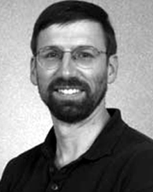 Jonathan Howland合作论文数3Barbara Fletcher合作论文数3Matthew Heintz合作论文数3john w bailey合作论文数2Chris Young合作论文数2Olinda Garcia合作论文数2Philip LaMothe合作论文数2
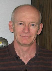 James V. Burke合作论文数Department of Mathematics, University of Washington2Donald B. Peters合作论文数2
 Andrew D. Bowen合作论文数2
 Glenn Mcdonald合作论文数University of Adelaide;Department of Plant Science;Department of Plant Science, University of Adelaide2
 Andrey Shcherbina合作论文数Scripps Institution of Oceanography, University of California2
 Gianluigi Pillonetto合作论文数Department of Information Engineering, University of Padova2
 Robert McCabe合作论文数2
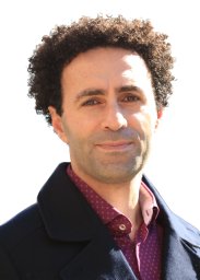 Mohammad Saadatfar合作论文数Department of Applied Mathematics;School of Physical Sciences and Engineering, Research;Australian National University;Research School of Physical Sciences and Engineering, Australian National University2Nicolas François合作论文数Centre de Génétique Moléculaire, CNRS FRE3144;Université;TELECOM & Management SudParis;Centre de Génétique Moléculaire, France|Université Paris-Sud 112Timothy P. Stanton合作论文数1James Partan合作论文数1Peter Brodsky合作论文数1
 Samuel Hulme合作论文数1Martin, S.C.合作论文数1charles e taylor合作论文数1Dennis Giaya合作论文数Applied Ocean Physics and Engineering, Woods Hole Oceanographic Institution1
 Burak Boyacıoglu合作论文数University of Washington1Levi Cai合作论文数Mediated Matter Group at the MIT Media Lab, Massachusetts,Institute of Technology,Cambridge,USA1
 Michael Ray Gallagher合作论文数USDA Forest Service, Northern Research Station1
 Mark Knackstedt合作论文数Department of Materials Physics, Research School of Physics, Australian National University1
 Christina Ramirez Kitchen合作论文数Department of Statistics, College of Physical Sciences, University of California1




