Future sediment transport from the North Sea coasts to the Dutch Wadden Sea for various future sea level scenarios has been studied because it influences the future sand nourishment demand for the maintenance of the coastline and because it determines bio-geomorphological development of the Wadden Sea. The present study focuses on two questions which have not yet been considered in the previous modelling studies using ASMITA: How will the transport develop around drowning of the intertidal flats in the Wadden Sea? How will tidal range change influence the future sediment exchange? By using SLR scenarios with faster acceleration and running the simulations for longer periods of time some inlets exhibited drowning, i.e., where the tidal flat volume vanishes. When drowning occurs, the sediment import rate approaches a maximum or a minimum, depending on the initial morphological state of the tidal inlet system. This maximum or minimum rate for a certain tidal inlet system depends on the SLR scenario. Theoretical analysis as well as modelling results show that tidal range change will influence the sediment import to the Wadden Sea. A tidal range increase will cause a decrease of the sediment demand in the Wadden Sea resulting into less sediment import to the Wadden Sea. It is thus important to study the tidal range development in the Wadden Sea by considering the interaction between SLR, tidal range change and morphological development in the system. It is further concluded that the empirical relation used in the previous studies is not representative of conditions in a tidal basin with fixed basin area, even though this relation has been derived from field observations in many tidal inlet systems worldwide. The equilibrium channel volume should be proportional to the tidal prism instead of to its 1.5th power.
The North Sea region is facing the effects of climate change, including sea level rise, more severe storm surges and heat stress along our coasts. These effects can have a detrimental impact on coastal zones. If coastal management does not adapt to these changes, the coasts will become more vulnerable to flooding, erosion, biodiversity loss, and higher life cycle cost of traditional grey infrastructure. Therefore, adaptive coastal management is needed to protect the coast and deliver a sustainable future for the North Sea region. Aware of these growing pressures, coastal authorities from Sweden, Denmark, Germany, the Netherlands, Belgium and France are working together in the MANABAS COAST project to set the stage for widescale implementation of Nature Based Solutions (NBS) along the North Sea coast. The project is co-funded by the Interreg North Sea (NS) Programme and builds upon the previous Interreg NS projects Building with Nature and C5A. MANABAS COAST runs from 2022 to 2027. MANABAS Coast focuses on breaking the pilot paradox by learning in different natural and socio-economic settings how we can implement NBS on different scales. We do this by implementing fifteen study pilots covering the coasts from the north of France up to southern Sweden. We use the six enablers identified by the public-private partnership EcoShape, which are crucial in mainstreaming NBS. In our pilots, we evaluate and learn from these enablers with respect to mainstreaming NBS. The enablers are: 1 Technology and system knowledge, 2 Multi-stakeholder approach, 3 Adaptive management, maintenance and monitoring, 4 Institutional embedding, 5 Business case, and 6 Capacity building. This learning-by-doing approach provides us with a wealth of information which is used to develop an accessible and evidence-based framework for widescale implementation of NBS in coastal areas to protect biodiversity and society. This presentation highlights our wide range of NBS study pilots and focuses on the differences in perceptions of the benefits and limitations across countries and regions. Each setting is unique in the readiness of the NBS technology and especially in the societal acceptance and institutional embedding of NBS. The site-specific contexts highlight different barriers and enablers for mainstreaming when viewing NBS pilot through the lens of the enablers. However, also several common themes become apparent. An example of such a theme is the interplay, and sometimes friction, between flood risk management and nature legislation.
•The papers in this VSI describe major results from the Coastal Genesis 2 research programme in the Netherlands.•Coastal Genesis 2 aimed at the development of a future-proof long-term coastal management strategy.•Three types of papers are included: policy development, lower shoreface, and Wadden Sea tidal inlet systems.
The long-term sediment demand of the Dutch coast is integral to the current Dutch Coastal Flood and Erosion Risk Management policy. The Coastal Genesis 2 research programme was initiated to address the sustainability of this policy under sea level rise by focusing on key uncertainties in the conceptual model of the sediment demand of the Dutch coast. The substantive scientific contributions of the Coastal Genesis 2 research programme are analysed in this paper by applying an output-outcome-impact framework. The direct outputs of the programme are categorised in terms of the knowledge types of a 5-element framework, namely measurement data, simulation models, system understanding, conceptual models, and policy and practice. The research outcomes arise from the interactions of these knowledge types. Our analysis of these outcomes highlights that synthesising new scientific insights into shared conceptual models is critical to achieving impact in policy and practice. In the Dutch situation, a new shared conceptual model of the long-term sediment demand enabled the development of four potential nourishment strategies aiming to meet the strategic goals of the Coastal Flood and Erosion Risk Management policy on a timescale up to 20 years. In 2021, the Minister of Infrastructure and Water Management officially articulated her intention to adopt the advised nourishment strategy from 2024 onwards. This represents a lasting impact of the Coastal Genesis 2 research programme in policy and practice. Further, the insight regarding the pivotal role of shared conceptual models as intermediary between science, policy and practice may prove useful in the design of future research programmes aiming to influence policy.
The development of the Coastal Genesis 2 research programme and its role in contributing to Dutch coastal policy are described in the paper. The organisation of policy development related to coastal flood risk and erosion in The Netherlands is addressed, highlighting the division of responsibilities between the policy and operational directorates of the Ministry of Infrastructure and Water Management. A conceptual model of the long term sediment budget of the Dutch coast that underpins the current Coastal Flood and Erosion Risk Management policy is detailed. The role of the operational directorate Rijkswaterstaat in coordinating a 'Research for Policy' cycle as a means of generating new insights on the coastal system and ensuring their subsequent inclusion in a new/revised conceptual model, is highlighted. By detailing the new conceptual model of the long term sediment budget, the paper demonstrates how key uncertainties related to this model guided the determination of the research agenda for Coastal Genesis 2. The paper concludes by reflecting briefly on the outcomes of the research programme and the role of the 'Research for Policy' cycle in ensuring the sustainable future of the Dutch coast.
To deliver infrastructure that sustain our communities, economy, and environment, we must innovate, modernize, and even revolutionize our approach to infrastructure development. Change takes courage, but as one starts down the path of innovation, what was once novel becomes more familiar, more established. The U.S. Army Corps of Engineers (USACE) is walking this path with our partners through the Engineering With Nature (EWN) Initiative, integrating human engineering with natural systems. The International Guidelines on Natural and Nature-Based Features for Flood Risk Management are the next step toward revolutionary infrastructure development—a set of real-world guidelines to help familiarize us with what was once novel. USACE and collaborators around the world have been building, learning, and documenting the best practices for constructing Natural and Nature-Based Features (NNBF) for decades. The consolidation of these lessons into a single guidance document gives decision-makers and practitioners a much-needed resource to pursue, consider, and apply NNBF for flood risk management while expanding value through infrastructure. Relationships and partnerships are vital ingredients for innovation and progress. The NNBF Guidelines was achieved because of the strong relationships in the nature-based engineering community. The magnitude and diversity of contributors to the NNBF Guidelines have resulted in a robust resource that provides value beyond a single agency, sector, or nation. Similarly, the work of incorporating NNBF into projects will require us to strengthen our relationships across organizations, mandates, and missions to achieve resilient communities. I hope you are inspired by the collaborative achievement of the NNBF Guidelines and will draw from this resource to develop innovative solutions to current and future flood risk management challenges. There is a lot we can achieve together along the path of revolutionary infrastructure development.
Infrastructure must become more resilient as the global climate changes and also more affordable in the economic and political context of a post-COVID world. We can solve this dual challenge and drive global infrastructure investment into a more sustainable direction by taking our cues from Nature.
The Sustainable Development Goals (SDGs) and associated targets focus on a wide range of global issues and can be useful in coastal challenges such as climate change and green economic growth. The aim of this study is to tailor the SDGs, as a universally recognized policy framework, to assess the sustainability performance for coastal flood protection management to enhance climate-resilient and adaptable coastal development. To operationalize this aim, the SDG Sustainability Impact Score (SDG-SIS) framework was developed. Based on system functionalities for the land–sea interface, 38 SDGs were identified in the SDG-SIS framework. Given the availability of public numeric data, only 12 SDG targets are connected with Key Performance Indicators (KPIs). The SDG-SIS framework was applied to two different sets of cases, including five coastline and five sand nourishment cases. This study shows that the geographical and socioeconomic characteristics of the two sets of cases should be considered in the selection of system functionalities as well as the consideration of SDG targets. Moreover, cross-linking cumulative consequences of SIS do not directly indicate the level of sustainability, but the individual SDG target data are essential to reveal the underlying details. This stresses the importance of prioritizing SDGs to serve as leverage for policymakers to optimize the climate resilience and adaptation of coastal management. The SDG-SIS framework enables the support of coastal policy by addressing long-term measures and providing a sustainable vision for future implementation.
In the light of challenges raised by a changing climate and increasing population pressure in coastal regions, it has become clear that theoretical models and scattered experiments do not provide the data we urgently need to understand coastal conditions and processes. We propose a Dutch coastline observatory named ICON.NL, based at the Delfland Coast with core observations focused on the internationally well-known Sand Engine experiment, as part of an International Coastline Observatories Network (ICON). ICON.NL will cover the physics and ecology from deep water to the dunes. Data will be collected continuously by novel remote sensing and in-situ sensors, coupled to numerical models to yield unsurpassed long-term coastline measurements. The combination of the unique site and ambitious monitoring design enables new avenues in coastal science and a leap in interdisciplinary research.
Climate change, and especially the associated acceleration of sea-level rise, forms a serious threat to the Wadden Sea. The Wadden Sea contains the world's largest coherent intertidal flat area and it is known that these flats can drown when the rate of sea-level rise exceeds a critical limit. As a result, the intertidal flats would then be permanently inundated, seriously affecting the ecological functioning of the system. The determination of this critical limit and the modelling of the transient process of how a tidal basin responds to accelerated sea-level rise is of critical importance. In this contribution we revisit the modelling of the response of the Wadden Sea tidal basins to sea-level rise using a basin scale morphological model (aggregated scale morphological interaction between tidal basin and adjacent coast, ASMITA). Analysis using this aggregated scale model shows that the critical rate of sea-level rise is not merely influenced by the morphological equilibrium and the morphological time scale, but also depends on the grain size distribution of sediment in the tidal inlet system. As sea-level rises, there is a lag in the morphological response, which means that the basin will be deeper than the systems morphological equilibrium. However, so long as the rate of sea-level rise is constant and below a critical limit, this offset becomes constant and a dynamic equilibrium is established. This equilibrium deviation as well as the time needed to achieve the dynamic equilibrium increase non-linearly with increasing rates of sea-level rise. As a result, the response of a tidal basin to relatively fast sea-level rise is similar, no matter if the sea-level rise rate is just below, equal or above the critical limit. A tidal basin will experience a long process of 'drowning' when sea-level rise rate exceeds about 80% of the critical limit. The insights from the present study can be used to improve morphodynamic modelling of tidal basin response to accelerating sea-level rise and are useful for sustainable management of tidal inlet systems.
The tidal basins in the Dutch coastal system exchanges sediment with the coast. This exchange is an important item for the sediment budget of the coast. Sediment exchange with the tidal basins is important for the sediment budget of the Dutch Coast. The sediment exchange between the coastal foundation and the tidal basins are influenced by supply, demand, and transport capacity. Each of them can be the limiting factor for the exchange. The tidal basins are disturbed by human interferences to different degrees. The degree of disturbance in a tidal basin determines the limiting factor for the sediment exchange with the coastal zone. In many cases the transport capacity is the limiting factor. The limiting factors for the various basins are identified, by considering the (empirical) equilibrium and physical processes. The consequences for managing the land-subsidence due to mining activities are discussed.
A new granted EU Interreg North Sea region (NSR) VB project, Building with Nature (BwN), focuses on the observed behavioural differences of beach and shoreface nourishments with respect to local coastal morphoand hydrodynamics. The application of BwN in the form of nourishments is already common practice since decades for most partners involved. A comparison of current practices was drafted. It showed that all partners apply beach nourishments, by using multiple parameters in the design in a consistent way. Shoreface nourishments, however, are not commonly applied. Their designs only roughly indicate a volume and location. The project aims to reveal links between presumable driving parameters and observed nourishment behaviour, by co-analysis using a shared methodology. The results will contribute to the effectiveness of BwN Solutions and will be drafted in a NSR guidance on nourishments.
This project aims at developing the knowledge required for the co-design of Building-with-Nature (BwN) type interventions in barrier island inlet systems. ‘Co-design’ stands for a collaborative design approach, in which the eventual design of a BwN solution is the product of the network of scientists, engineers and stakeholders, and its social dynamics. Therefore, this project not only aims at increasing the knowledge on the dynamics of inlet systems and the adjacent coast, but also on the role of natural systems understanding in the process of codesigning BwN solutions with stakeholders.
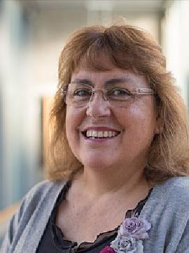 Jill Slinger合作论文数Faculty of Technology, Policy and Management, Delft University of Technology;Faculty of Civil Engineering and Geosciences, Delft University of Technology4
 Zhengbing Wang (王正兵)合作论文数Coastal Engineering, Department of Hydraulic Engineering, Faculty of Architecture and the Built Environment, Delft University of Technology4
 Ad van der Spek合作论文数3
 Adam J F Van Der Spek合作论文数Netherlands Centre for Coastal Research NCK/TU Delft3E.P.L. ELIAS合作论文数2C. VAN GELDER-MAAS合作论文数2
 Per Sørensen合作论文数2
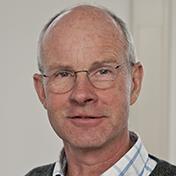 Dano Roelvink合作论文数Department of Water Science and Engineering, IHE Delft Institute for Water Education;Delft University of Technology2
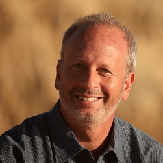 Michael W. Beck合作论文数Institute of Marine Sciences, University of California2
 Suzanne J. M. H. Hulscher合作论文数Water Engineering and Management;Faculty of Engineering Technology;University of Twente;Faculty of Engineering Technology, University of Twente2
 Kathelijne Wijnberg合作论文数Dept . of Water Engineering & Management;University of Twente2
 E. Elias合作论文数2
 Cor A Schipper合作论文数RIKZ, National Institute for Coastal and Marine Management2Carola van Gelder-Maas合作论文数1Jeffrey K King合作论文数1todd s bridges合作论文数1
 A.J. Wijdeveld合作论文数Deltares1Harry de Looff合作论文数1
 Jonathan Simm合作论文数1
 Bas Bolman合作论文数Deltares1
 B.G. Reguero合作论文数Environ. Hydraulics Inst. "IH Cantabria",, Univ. de Cantabria;c;Environ. Hydraulics Inst. "IH Cantabria",, Univ. de Cantabria1
 Marc Bierkens合作论文数Department of Physical Geography, Faculty of Geosciences, Utrecht University;Deltares1
 Brian Reed Silliman合作论文数Nicholas School of the Environment, Duke University1
 Siddharth Narayan合作论文数University of Southampton, University of Southampton1
 Gittman Rachel K合作论文数Institute of Marine Sciences, University of North Carolina at Chapel Hill1
 Ad J.H.M. Reniers合作论文数Environmental Fluid Mechanics, Department of Hydraulic Engineering, Faculty of Architecture and the Built Environment, Delft University of Technology1
 Matthieu de Schipper合作论文数Coastal Engineering, Department of Hydraulic Engineering, Faculty of Architecture and the Built Environment, Delft University of Technology1
 Susana Ferreira合作论文数Department of Planning and Environmental Policy, University College Dublin1
 Harriette Holzhauer合作论文数Faculty of Engineering Technology, University of Twente Water Engineering and Management1
 Brian Bledsoe合作论文数Department of Civil Engineering, Colorado State University1
 Jebbe J. Van Der Werf合作论文数Faculty of Engineering, University of Twente1I. H. Townend合作论文数1
 Marc Pieter Hijma合作论文数1
 Robert Costanza合作论文数Stockholm Resilience Center;Gund Institute of Ecological Economics, Rubenstein School of Environment and Natural Resources, The University of Vermont;Institute for Global Prosperity, University College London1
 Lydia Olander合作论文数Nicholas Institute of Energy, Environment & Sustainability, Duke University;Nicholas School of the Environment, Duke University1P. Hoekstra合作论文数Institute for Marine and Atmospheric Research Utrecht, IMAU Utrecht University1
 Ali Dastgheib合作论文数UNESCO-IHE1
 Sierd de Vries合作论文数Coastal Engineering, Department of Hydraulic Engineering, Faculty of Architecture and the Built Environment, Delft University of Technology1
 Gerben Ruessink合作论文数Department of Physical Geography, Faculty of Geosciences, Institute for Marine and Atmospheric Sciences, Utrecht University1
 Roshanka Ranasinghe合作论文数Department of Natural Resources1
 Ap Van Dongeren合作论文数Department of Coastal & Urban Risk & Resilience, IHE Delft Institute for Water Education;Deltares1
 Stefan Aarninkhof合作论文数Coastal Engineering, Department of Hydraulic Engineering, Faculty of Architecture and the Built Environment, Delft University of Technology1
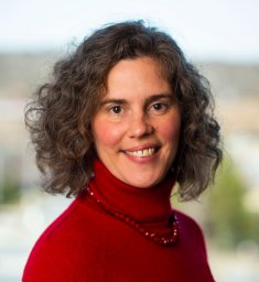 Ariana Sutton-Grier合作论文数USGS;Earth System Science Interdisciplinary Center;UMD1
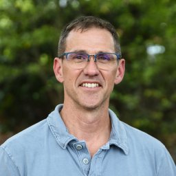 Donald R. Nelson合作论文数School of Dentistry, University of North Carolina1
 Elizabeth Losos合作论文数Center for Tropical Forest Sciences, The Smithsonian Institution1
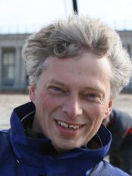 Tjeerd Bouma合作论文数Department of Estuarine & Delta Systems, NIOZ Royal Netherlands Institute for Sea Research1P. K. Tonnon合作论文数1




