Abstract Choosing management actions to protect biodiversity requires decisiveness amidst complexity. To identify barriers to effective conservation, we asked over 150 conservation practitioners working with the Canadian federal and provincial/territorial governments, non‐government organizations, and private industry about their experience with uncertainty when making decisions. Using inductive thematic coding, we identified that “data,” “resources”, and “governance” ranked as the most significant sources of uncertainty for respondents. Practitioners also proposed solutions that would reduce their uncertainty, which included improved funding processes, better collaboration, changes to governance processes, and the use of data and evidence in decision‐making. Conservation practitioners consistently mentioned elements of uncertainty that exist outside of their immediate control, indicating that substantial uncertainty in conservation decision‐making occurs due to broader dynamics in governance and society.
Growing demand for food coupled with climate commitments to reduce emissions will result in more land development for agriculture and renewable energy. Simultaneously, conserving land for biodiversity and nature's contributions to people (NCP) is imperative for achieving international climate, sustainable development, and biodiversity goals. Meeting these interconnected objectives requires efficient land allocation across sectors. Here, we present a flexible, multiple-objective framework for strategically allocating land to mitigate threats to biodiversity and NCP under climate change while supporting development. Application of this framework at a global scale through country-level targets shows that if future development is planned without consideration of nature, demands for land could impact nearly 1 million km2 of high-priority conservation areas. Multi-sector planning can mitigate potential conflict, reducing carbon loss and species exposure. Our findings underscore the need to conserve critical areas for nature, reduce land demand for food and energy, and intentionally coordinate land use across sectors.
Achieving area-based conservation Target 3 of the Kunming-Montreal Global Biodiversity Framework, which aims to protect, represent, and connect 30% of land and water by 2030, requires reporting on indicators of the level of protection and connectivity of a country’s protected area network. Key to measuring protection and connectivity is detailed mapping of human modification to estimate the structural connectivity of protected and conserved areas that addresses ecological representation and to characterize broader landscape context. For Canada, we calculated the average ecozonal protection and connectivity values and estimated that the percent protected in 2024 was 10.9% and the percent connected was 28.3%, with ecozones ranging from 1.8-17.8% and 2.4-71.3%, respectively. While protection has increased from 4.4% in 1990, the gap to meet 30% protected and connected by 2030 remains large. To facilitate progress towards Target 3, we provide a suggested ”conservation actions framework” to help guide conservation planning towards closing the conservation gap.
Swift action to restore forests is critical for mitigating climate change and preserving biodiversity. Canada has an ambitious program to plant two billion trees to help exceed the country's emissions targets while restoring forest habitat and providing social and economic benefits. We conducted a systematic analysis of where new tree cover can maximally achieve these benefits while minimizing implementation costs. Accounting for critiques of global restoration mapping that include the overestimation of mitigation potential and inadequate biodiversity and social safeguards, we find that 19.1 Mha are available, which is much more than the approximately 1.2 Mha needed to plant two billion trees. Optimization scenarios for 1.2 Mha revealed synergies and trade-offs. Scenarios prioritizing low costs, accessibility, and high growth are concentrated in temperate and coastal areas, overlapping partly with biodiversity scenarios, but with trade-offs of higher costs. A diverse portfolio of regionally restored sites, each tailored for specific attributes, is most likely to deliver multiple benefits at the pace demanded by the current crises.
Systematic conservation planning (SCP) is an operational and scientific framework that assists in deciding where, how, and when to implement conservation intervention. Studies using SCP approaches have proliferated due to their immediate relevance for applied conservation. For example, they can help identify cost-effective opportunities for expanding areas under conservation management to achieve high-level policy goals such as those of the Global Biodiversity Framework. Yet SCP can be conducted in various ways, and results can vary depending on problem formulation, parameterizations, contexts, and prioritization approaches. There is a need to facilitate comparison of SCP studies to understand key criteria and assumptions made in the planning process. Here, we propose a standardized reporting protocol for SCP that is readily applicable across study aims, realms, and spatial scales. The new Overview and Design Protocol for Systematic Conservation Planning (ODPSCP) describes the key steps from the design to the computational stages of SCP. It enables researchers, scientific editors, and decision- and policymakers to assess the scope and comprehensiveness of SCP exercises. To facilitate uptake and ease of reporting, the protocol is openly available through an interactive web interface and which can be further enhanced following methodological advancements in conservation planning. We encourage the conservation community to adopt the reporting protocol to promote transparency and reproducibility, standardized reporting as well as facilitate peer review and independent evaluation.
Freshwater quality and biodiversity are known to be affected by surrounding timber harvesting activities. However, variable impacts across studies make it difficult to predict the implications of harvesting for freshwaters. Evidence syntheses compile existing research to assess whether robust predictions of impact can be drawn and determine where gaps lie. Yet, no synthesis that we know of describes the overall evidence landscape of research assessing the effects of forest management for wood production (hereafter: timber harvesting) on water quality and aquatic biodiversity of running waters. We address this gap by creating an evidence map specifically focused on boreal and temperate biomes - which contribute heavily to timber production. Using Web of Science Core Collections, Scopus and Google Scholar, we located 638 relevant publications from which we identified three key primary research and evidence synthesis priorities focused on prediction of impact using existing literature. Most studies took place in the United States of America (56%, n = 358) and quantified two or more biotic or water quality indicators (range = 1-52, mean = 7, sd = 7). Water quality was more frequently assessed across studies (80 %, n = 511) than biotic indicators (39 %, n = 248), with benthic macroinvertebrates being the most commonly assessed taxon (50% of studies that quantified biotic indicators, n = 124). Biodiversity-specific biotic indicators (e.g. richness) were assessed at a similar frequency (51 % of all biotic indicator measurements, n = 606) to other types of biotic indicators (e.g. abundance) (49 %, n = 594). The majority of studies that contained temporal information collected data about water quality and biotic indicators for no longer than five years (56%, n = 358) and no more than five years after timber harvesting events (66%, n = 309 studies). Although numerous studies contained no information about the types of harvesting in their study regions (19 %, n =122), those that did mainly focused on effects of clearcutting (n = 458 studies). Most studies did not contain watershed-scale information about timber harvesting (58 %, n = 349). Together, these findings point toward three key primary research priorities which include: capturing a broader scope of effects, especially regarding biodiversity and other biotic indicators; increasing our ability to detect long-term changes related to timber harvesting; and, better accounting for watershed level processes. We provide suggestions for approaches to address each of these research priorities and examples of how evidence syntheses that utilize and build on the dataset we compiled for this map could improve understanding and prediction of the effects of timber harvesting on fresh waters.
Canada has committed to protecting 30% of its land by 2030, yet existing protected areas cover only 12.4% of Canadian lands, which is insufficient to protect terrestrial biodiversity. In this study, we identified priority areas for biodiversity conservation in Canada, using data on 1506 species across nine taxonomic groups. We first evaluated the effectiveness of existing protected areas in conserving at-risk and other species. Then, we applied optimization algorithms to determine priority areas that could enhance the existing system. Our results reveal that over 90% of the species studied have less than 30% of their spatial distribution currently protected. To meet a constant conservation target of protecting at least 30% of the spatial distribution for all species, Canada would need to expand its protected area system by 16%–17% of its total land area, focusing on regions like Nunavut, Quebec, and the Northwest Territories. Alternatively, when using relative conservation targets based on species’ range sizes, Canada would need to prioritize expanding protected areas by 4.56%–5.46% of its land, with new areas primarily in Ontario, British Columbia, and Quebec. Achieving these goals will require collaborative strategies that respect Indigenous rights and involve agreements with private landowners.
The escalating impacts of climate change have heightened concerns about the frequency and severity of natural disasters, particularly extreme flooding events. Future projections underscore the necessity for innovative flood prevention strategies, including broad-scale nature-based solutions. Here, we present the first comprehensive assessment of the flood prevention benefits provided by Canadian natural ecosystems and identify key areas crucial for human well-being. Using spatially explicit modeling, we (1) evaluated the potential runoff retention by natural ecosystems and (2) identified downstream urban and agricultural areas critically dependent on these natural benefits, particularly those in floodplains and close proximity to upstream natural ecosystems. The natural ecosystems within the top 5 % of sub-basins, representing regions with a high priority for conservation practices aimed at flood prevention, play a crucial role in safeguarding approximately 54 % (similar to 6,000 km(2)) of the total built-up area and 74 % (similar to 16,900 km2) of the total cropland situated within floodplains. Additionally, they are positioned upstream of floodplain-based urban zones belonging to 358 population centers, directly benefiting 3.7 million people (similar to 10 % of the Canadian population) and indirectly benefiting almost 20.1 million people (similar to 56 % of the Canadian population). Moreover, among Canada's 5.2 million km(2) of flood-preventing natural ecosystems, we identified a small fraction (10 %) whose loss or degradation would result in a significant (>50 %) increase in runoff. Several of these crucial ecosystems are situated in less populated northern regions, where local governments might want to incentivize conservation initiatives to support flood prevention. Our research underscores the imperative to integrate nature-based solutions into national strategies that consider the results of spatial planning analyses. Establishing other effective area-based conservation measures in the priority regions highlighted in this study can contribute towards reaching current ambitious environmental goals and provide critical flood prevention benefits. Additionally, our methods are transferable to other regions worldwide, leveraging globally available datasets and ensuring computational feasibility.
Almost all countries are making increasingly bold commitments to halt and reverse biodiversity loss, minimise the impacts of climate change, and transition to more sustainable development. The effective achievement of many of these commitments relies on integrated spatial planning frameworks that are adaptable to national circumstances, priorities and capabilities. This need is formally recognized by Target 1 of the Kunming-Montreal Global Biodiversity Framework (GBF), which specifies that all areas should be under such planning. Here, we describe the development and application of an operational framework for national-level integrated spatial planning: Essential Life Support Areas (ELSAs). This framework facilitates the identification of areas that - if protected, restored, or sustainably managed - can support the achievement of national commitments to biodiversity, climate, and sustainable development. The process of mapping ELSAs relies heavily on leadership by national experts and stakeholders and the integration of spatial data using systematic conservation planning tools. We showcase the ELSA process carried out for Ecuador, where the use of real-time scenario analyses enabled diverse stakeholder groups to collaborate to assess national priorities for nature, climate, and sustainable development, view trade-offs and synergies, and arrive at a spatial plan to guide national action. ELSA presented an actionable approach for Ecuador, and 12 other pilot countries, to create a spatial plan aimed at fulfilling their national and international commitments to nature, including to the GBF. ### Competing Interest Statement The authors have declared no competing interest.
Meeting global commitments to conservation, climate, and sustainable development requires consideration of synergies and tradeoffs among targets. We evaluate the spatial congruence of ecosystems providing globally high levels of nature’s contributions to people, biodiversity, and areas with high development potential across several sectors. We find that conserving approximately half of global land area through protection or sustainable management could provide 90% of the current levels of ten of nature’s contributions to people and meet minimum representation targets for 26,709 terrestrial vertebrate species. This finding supports recent commitments by national governments under the Global Biodiversity Framework to conserve at least 30% of global lands and waters, and proposals to conserve half of the Earth. More than one-third of areas required for conserving nature’s contributions to people and species are also highly suitable for agriculture, renewable energy, oil and gas, mining, or urban expansion. This indicates potential conflicts among conservation, climate and development goals.
Download This Paper Open PDF in Browser Add Paper to My Library Share: Permalink Using these links will ensure access to this page indefinitely Copy URL Copy DOI
Understanding how human activities are altering landscapes is critical to address habitat loss and biodiversity decline. Cumulative pressure mapping has emerged as a tool to quantify both the extent and intensity of multiple forms of human activities on the environment. However, there are several approaches to selecting and combining individual spatial layers into cumulative pressure maps, without clear guidance on how these methods affect the accuracy of the resulting maps. Here, we evaluated how the number of individual pressures, and changes in their intensity scores influenced the accuracy, measured against visual interpretation of high-resolution imagery, of a cumulative pressure map for a large, ecological diverse province, British Columbia, Canada. Additionally, we compared additive and antagonist models for combining pressures, which are among the most widely employed models in terrestrial studies. We started by identifying 16 human pressures and their associated spatial representation (i.e., layer) across the province. We then compared the validation values and the outcomes of 100,000 simulations in which we tested different perturbations of the human pressure model. Model accuracy improved with the inclusion of each additional pressure layer, reaching an average mean absolute error of 0.09 with the full spectrum of pressures. Our findings suggested that variations in intensity scores assigned to individual pressures only moderately influenced the resulting cumulative pressure score. In our final analysis, we observed a robust correlation between the additive and the antagonist models, particularly in regions that were either relatively free of human disturbance or highly modified by disturbances. Our study provides an empirical basis for continued improvements to practices for cumulative pressure mapping, addressing methodological challenges that were not formally considered in previous studies.
Plans for expanding protected area systems (prioritizations) need to fulfill conservation objectives. They also need to account for other factors, such as economic feasibility and anthropogenic land-use requirements. Although prioritizations are often generated with decision support tools, most tools have limitations that hinder their use for decision-making. We outlined how the prioritizr R package ( https://prioritizr.net ) can be used for systematic conservation prioritization. This decision support tool provides a flexible interface to build conservation planning problems. It can leverage a variety of commercial (e.g., Gurobi) and open-source (e.g., CBC and SYMPHONY) exact algorithm solvers to identify optimal solutions in a short period. It is also compatible with a variety of spatially explicit (e.g., ESRI Shapefile, GeoTIFF) and nonspatial tabular (e.g., Microsoft Excel Spreadsheet) data formats. Additionally, it provides functionality for evaluating prioritizations, such as assessing the relative importance of different places selected by a prioritization. To showcase the prioritizr R package, we applied it to a case study based in Washington state (United States) for which we developed a prioritization to improve protected area coverage of native avifauna. We accounted for land acquisition costs, existing protected areas, places that might not be suitable for protected area establishment, and spatial fragmentation. We also conducted a benchmark analysis to examine the performance of different solvers. The prioritization identified 12,400 km 2 of priority areas for increasing the percentage of species’ distributions covered by protected areas. Although open source and commercial solvers were able to quickly solve large-scale conservation planning problems, commercial solvers were required for complex, large-scale problems.. The prioritizr R package is available on the Comprehensive R Archive Network (CRAN). In addition to reserve selection, it can inform habitat restoration, connectivity enhancement, and ecosystem service provisioning. It has been used in numerous conservation planning exercises to inform best practices and aid real-world decision-making.
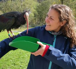
With only 700 individuals left in the wild, the northern bald ibis is considered to have a moderate risk of going extinct. What does it take to prevent a species from going extinct? Aside from ensuring there is adequate habitat and making sure the species is safe, knowledge about an animal’s behavior is key for conservation management. Which sites do these birds use for foraging and roosting? Do they move alone or in groups, and are there recurring patterns to their movements? These are just some of the questions we tried to answer in our study. We monitored the movements of 32 free-flying northern bald ibises over 4 years, by equipping the birds with GPS transmitters. We found that our birds are pretty predictable in their habits and that they preferably fly along valleys. Being aware of such preferences is important when planning to reintroduce new colonies into the wild.
Demand for land is increasing due to mounting energy and development needs. Growing demand for food coupled with climate policy commitments calling for reduced greenhouse gas emissions will result in more land being used for agricultural and renewable energy development. At the same time, conserving land for biodiversity and nature’s contributions to people (NCP) is imperative for achieving international climate, sustainable development, and biodiversity goals. Meeting these interconnected objectives requires the efficient and equitable allocation of land to different sectors. We present a flexible, multiple-objective framework for using integer linear programming to strategically allocate land under climate change to mitigate threats to biodiversity and NCP while supporting development. The application of the framework at a planetary scale shows that if agriculture and renewable energy development are planned without consideration of biodiversity and NCP, future demands for land (6.2 million km2 globally) could impact nearly 1 million km2 of high-priority areas for nature, habitats of 440 threatened vertebrate species, and 21 Gt of vulnerable carbon stocks. Multi-sector planning can mitigate potential land conflict, reducing the number of species exposed by 15% and the amount of carbon loss by 19%. If development proceeds without coordinated planning, there is insufficient land available to achieve conservation and development targets. Our findings underscore the need to ensure critical areas for biodiversity, carbon storage, and NCP are conserved; reduce land demand for food and energy; meet remaining demand more efficiently through spatial targeting; and coordinate land use across sectors more intentionally, such as through multi-functional landscapes.
Pollinators play a crucial role in global crop production, enhancing crop yields, nutritional value and fruit quality. However, their wild populations worldwide have been experiencing alarming declines. We investigated the contribution of wild pollinators to nutrition and farmer income in Canada, while examining the spatial distribution of pollination services. We used publicly available data on crop types, yields, nutrient content, and farm gate values, alongside information on natural habitats. Our findings suggest that wild pollinators in Canada help sustain the equivalent of approximately 24.4 million people each year in terms of nutrition and generate an annual income of nearly CAD$2.8 billion for farmers. To provide context, these estimates exceed half of the Canadian population and correspond to 5% of total national crop-related farm income. However, significant benefit gaps exist due to the lack of nearby pollinator habitat and insufficient pollination of dependent crops at a national scale. Addressing these gaps could potentially provide an additional nutrition supply for nearly 30 million equivalent people and increase farmer income by CAD$3 billion. We discuss how and where efforts focused on preserving and enhancing wild pollinator habitats, promoting sustainable farming practices, and raising awareness among stakeholders are crucial for the long-term viability of wild pollinator populations and the sustainability of agricultural systems in Canada. Our research underscores the urgent need for a national strategy aimed at safeguarding wild pollinators. Implementing such a strategy would not only contribute to strengthening local economies but also ensure the production of nutritionally essential food.
The conversion of forest to agriculture is considered one of the greatest threats to avian biodiversity, yet how species respond to habitat modification throughout the annual cycle remains unknown. We examined whether forest bird associations with agricultural habitats vary throughout the year, and if species traits influence these relationships. Using data from the eBird community-science program, we investigated associations between agriculturally-modified land cover and the occurrence of 238 forest bird species based on three sets of avian traits: migratory strategy, dietary guild, and foraging strategy. We found that the influence of agriculturally-modified land cover on species distributions varied widely across periods and trait groups but highlighting several broad findings. First, migratory species showed strong seasonal differences in their response to agricultural land cover while resident species did not. Second, there was a migratory strategy by season interaction; Neotropical migrants were most negatively influenced by agricultural land cover during the breeding period while short-distance migrants were most negatively influenced during the non-breeding period. Third, regardless of season, some dietary (e.g. insectivores) and foraging guilds (e.g. bark foragers) consistently responded more negatively to agricultural land cover than others (e.g. omnivores and ground foragers, respectively). Fourth, there were greater differences among dietary guilds in their responses to agricultural land cover during the breeding period than during the non-breeding period, perhaps reflecting how different habitat and ecological requirements enhance the susceptibility of some guilds during reproduction. These results suggest that management efforts across the annual cycle may be oversimplified and thus ineffective when based on broad ecological generalisations that are static in space and time.
Many bumble bee species are declining globally from multiple threats including climate change. Identifying conservation priority areas with a changing climate will be important for conserving bumble bee species. Using systematic conservation planning, we identified priority areas for 44 bumble bee species in Canada under current and projected climates (year 2050). Conservation priority areas were identified as those that contained targeted amounts of each species predicted occurrence through climate envelope models, while minimizing the area cost of conserving the identified conservation priority areas. Conservation priority areas in the two periods were compared to established protected areas and land cover types to determine the area of current and future priority sites that are protected and the types of landscapes within priority areas. Notably, conservation priority areas were rarely within established protected areas. Priority areas were most often in croplands and grasslands, mainly within the mountain west, central and Southern Ontario, Northern Quebec, and Atlantic Canada under all climate scenarios. Conservation priority areas are predicted to increase in elevation and latitude with climate change. Our findings identify the most important regions in Canada for conserving bumble bee species under current and future climates including consistently selected future sites.
 Joseph R Bennett合作论文数Paleoecological Environmental Assessment and Research Laboratory (PEARL),, Queen's University26
 Peter Arcese合作论文数Department of Forest & Conservation Sciences, Faculty of Forestry, The University of British Columbia18
 Amanda Rodewald合作论文数Department of Natural Resources and the Environment, College of Agriculture and Life Sciences, Cornell University11
 Jeffrey O Hanson合作论文数Univ Queensland, Sch Biol Sci, St Lucia, Qld, Australia9
 Matthias-Claudio Loretto合作论文数Konrad Lorenz Research Station8
 M. Strimas-Mackey合作论文数8
 Matthew Mitchell合作论文数Department of Forest Resources Management, Faculty of Forestry, The University of British Columbia;Institute for Resources, Environment and Sustainability, The University of British Columbia;Faculty of Land and Food Systems, University of British Columbia7
 Patrick R. Roehrdanz合作论文数Bren School of Environmental Science and Management, University of California;Bren School of Environmental Science and Management, University of California6
 Germain Ryan R合作论文数University of Copenhagen6
 Wilson Scott合作论文数Department of Forest Sciences, University of British Columbia6
 Hugh Possingham合作论文数Centre for Biodiversity and Conservation Science, Faculty of Science, The University of Queensland;Accounting for Nature Ltd6
 Oscar Venter合作论文数Faculty of Environment, University of Northern British Columbia6
 Thomas Bugnyar合作论文数Department for Behaviour, Neurobiology and Cognition, University of Vienna6
 Allison D. Binley合作论文数Department of Biology, Carleton University5Jaimie G. Vincent合作论文数4
 Hsien-Yung Lin合作论文数Inst Environm & Interdisciplinary Sci, Carleton Univ4Rachel T. Buxton合作论文数4
 Rebecca Chaplin-Kramer合作论文数Woods Institute for the Environment, Stanford University;Woods Institute for the Environment, Stanford University4
 Christina M Kennedy合作论文数Department of Computer Science;Brown University;Department of Computer Science, Brown University4Richard Pither合作论文数3Camille Ouellet Dallaire合作论文数Dept Geog, McGill Univ3
 Arnout van Soesbergen合作论文数United Nations Environment Programme World Conservation Monitoring Centre (UNEP-WCMC), 219 Huntingdon Road, CB3 0DL, United Kingdom3Daniel Fink合作论文数3
 James Watson合作论文数School of the Environment, Faculty of Science, The University of Queensland;Centre for Biodiversity and Conservation Science, Faculty of Science, The University of Queensland;Centre for Marine Science, Faculty of Science, The University of Queensland3
 McCune Jenny L合作论文数Department of Botany and Biodiversity Research Centre, University of British Columbia3
 Steven Cooke合作论文数Department of Biology, Carleton University;Institute of Environmental and Interdisciplinary Science, Carleton University3
 James R. Oakleaf合作论文数3
 Piero Visconti合作论文数Biodiversity, Ecology, and Conservation Research Group, International Institute for Applied Systems Analysis3
 Rachel A Neugarten合作论文数University of California3Frank A. La Sorte合作论文数3
 Justin Andrew Johnson合作论文数Department of Applied Economics, College of Food, Agricultural and Natural Resources Sciences, University of Minnesota3Adam C. Smith合作论文数2Ira G. Federspiel合作论文数2
 Bernardo Baeta Neves Strassburg合作论文数International Institute for Sustainability;Pontifical Catholic University of Rio de Janeiro2Julia Krejci合作论文数2
 Steve Polasky合作论文数Department of Applied Economics, University of Minnesota;Department of Ecology, Evolution, and Behavior, University of Minnesota2
 Calla V Raymond合作论文数Dept Biol, Carleton Univ2
 Brandon P. M. Edwards合作论文数Dept Biol, Carleton Univ2Hanna Rosner-Katz合作论文数Dept Biol, Carleton Univ2Nina Morrell合作论文数2
 Susan C Cook-Patton合作论文数Nature Conservancy, Arlington, VA 22203 USA2
 Gabriela Duarte合作论文数2
 Verena Puehringer-Sturmayr合作论文数University of Vienna2
 Laura E. Coristine合作论文数Unceded Terr Syilx Okanagan Peoples, Univ British Colombia Okanagan2
 Richard P. Sharp合作论文数Woods Institute for the Environment, Stanford University;Woods Institute for the Environment, Stanford University2
 Werner Kurz合作论文数Pacific Forestry Centre, Natural Resources Canada2
 Kharouba Heather M合作论文数Dept Biol, Univ Ottawa2
 Mark Mulligan合作论文数Department of Geography, School of Global Affairs, Faculty of Social Science & Public Policy, King’s College London2Delmore Kira E合作论文数Department of Anthropology, University of Calgary2




