National governments and multilateral institutions face difficult challenges reconciling biodiversity, climate, and economic development goals. We integrated spatial biophysical and economic data with optimization methods to develop sustainable landscape efficiency frontiers that show maximally feasible combinations of biodiversity conservation, land-based climate mitigation, and net economic value from agricultural crops, livestock, and forestry production. We applied this approach in 146 countries and found large potential gains in biodiversity, climate, and economic development from improved land use and land management. Summing national-level results shows the potential to increase climate mitigation by more than 200 billion metric tons of CO2 equivalents (>20% increase) or net economic value by more than US$350 billion (>80% increase), without loss in other objectives.
Authors: Lisa Mandle1, Andrew Shea2,3, Emily Soth1, Jesse A. Goldstein1, Stacie Wolny1, Jeffrey R. Smith4,5, Rebecca Chaplin-Kramer6,7, Richard P. Sharp6,8, Mayur Patel1AffiliationsNatural Capital Project, Stanford University, Stanford, CA 94305 USAGlobal Sustainable Finance, Morgan Stanley, New York, NY 10036Current affiliation: Frontier & Stripe Climate, Stripe, South San Francisco, CA 94080Department of Ecology and Evolutionary Biology, Princeton University, Princeton New Jersey 08544High Meadows Environmental Institute, Princeton University, Princeton, New Jersey 08544Global Science, WWF. 131 Steuart St., San Francisco, CA 94105Institute on the Environment, University of Minnesota, 1954 Buford Ave., St. Paul, MN 55108SPRING, 5455 Shafter Ave., Oakland CA 94618Abstract: Aligning economic activities with the global sustainable development agenda requires understanding companies' impacts on nature. Here, we present a new approach for quantifying the direct impacts of companies' physical assets on nature based on global maps for eight ecosystem services and biodiversity metrics. We apply this approach to a set of over 2,000 global, publicly traded companies with 580,000 mapped physical assets. We find that companies in utility, real estate, materials, and financial sectors have the largest impacts on average, but there is substantial variation among companies within all sectors. In addition, we use high-resolution satellite imagery to assess the impact of active lithium mines based on their footprints. We show that the impact varies substantially among mines and can also be tracked across time for a mine. This approach enables differentiation among companies and assets based on their impacts to nature relative to their revenue or production.
Meeting global commitments to conservation, climate, and sustainable development requires consideration of synergies and tradeoffs among targets. We evaluate the spatial congruence of ecosystems providing globally high levels of nature’s contributions to people, biodiversity, and areas with high development potential across several sectors. We find that conserving approximately half of global land area through protection or sustainable management could provide 90% of the current levels of ten of nature’s contributions to people and meet minimum representation targets for 26,709 terrestrial vertebrate species. This finding supports recent commitments by national governments under the Global Biodiversity Framework to conserve at least 30% of global lands and waters, and proposals to conserve half of the Earth. More than one-third of areas required for conserving nature’s contributions to people and species are also highly suitable for agriculture, renewable energy, oil and gas, mining, or urban expansion. This indicates potential conflicts among conservation, climate and development goals.
Existing approaches to evaluating companies on sustainability-related issues include limited accounting of impacts on nature and its contributions to human well-being. Here we present an approach for quantifying the direct impacts of companies' physical assets on nature based on global maps for eight ecosystem service and biodiversity metrics. We apply this approach to a set of over 2000 global, publicly traded companies with 580,000 mapped physical assets and find that companies in utility, real estate, materials, and financial sectors have the largest impacts on average, with substantial variation within all sectors. Using high-spatial-resolution satellite imagery to map individual mine footprints, we compare a set of active lithium mines and find that impacts vary substantially among mines and change over time. By using open-source models and drawing on the growing availability of high-spatial-resolution satellite imagery, this approach could provide more transparent measures of corporate impacts to nature for nature-related reporting. The direct impact of companies' physical assets on the environment can be estimated from global maps of ecosystem services and biodiversity to understand companies' nature-related risks and opportunities, according to an assessment of more than 2000 global companies.
Abstract The Kunming-Montreal Global Biodiversity Framework is a worldwide plan to urgently address and reverse biodiversity loss, intending to achieve a harmonious relationship between humanity and nature by 2050. This paper seeks to contribute to operationalising the framework, specifically concerning biodiversity conservation and nature's contributions to people. Using a global analytical approach, we identify optimised areas for conservation, restoration and agriculture, considering food production, urban expansion, population growth, and climate change projections. By formulating scenarios for increasing natural areas enabled by improvements in agricultural productivity and trade, and considering local and global constraints on restoration actions, we analyse potential outcomes for biodiversity and people. Our findings demonstrate that an optimised spatial allocation of land use could substantially mitigate projected negative impacts and even surpass the current situation, leading to significant socio-environmental gains. However, the best global scenarios for nature and people require integrated planning that considers mitigating climate change, reducing human pressure on natural habitats, increasing trade, and changing human behaviour. Aligning efforts to protect and restore nature with broader sustainability goals through coordinated and transformative action is central to implement the Global Biodiversity Framework and delivery of a more sustainable future.
Coastal ecosystems have the potential to contribute to disaster risk reduction and adaptation to climate change. While previous studies have estimated the value of current coastal ecosystems for reducing coastal risk, there have been relatively few studies that look at changes in ecosystem service provision, in the past and under climate change. We employ the probabilistic, event-based CLImate ADAptation platform (CLIMADA) to quantify the protection from tropical cyclones (TCs) provided by coastal ecosystems, modeling the number of beneficiaries in the past and under future climate change. We also investigate the potential of nature-based solutions (NbS), such as mangrove restoration. We find that currently, one in five (21%) of all people impacted annually by TCs in the global low-elevation coastal zone is within the protection distance of coastal ecosystems. Over the last 30 years, the share of protected people has decreased by approximately 2%, due to ecosystem loss. With climate change, the average annual number of people impacted will increase by 40%. Simultaneously, the proportion of people protected by coastal ecosystems with climate change decreases due to changes in TC distribution (−1%). The importance of current coastal protection, and the potential for increasing protection by NbS, varies widely between countries. While the number of people protected globally only increases slightly with mangrove restoration, the share of people protected in individual countries can increase by up to 39%. Our findings provide a basis for NbS planning and adaptation policy, by highlighting areas which will be crucial for coastal protection services in a world altered by climate change.
Abstract Sustaining the organisms, ecosystems, and processes that underpin human well-being is necessary to achieve sustainable development. Here we identify critical natural assets, natural and semi-natural ecosystems that provide 90% of the total current magnitude of 14 types of nature’s contributions to people (NCP). Critical natural assets for maintaining local-scale NCP (12 of the 14 NCP mapped) comprise 30% of total global land area and 24% of national territorial waters, while 44% of land area is required for maintaining all NCP (including those that accrue at the global scale, carbon storage and moisture recycling). At least 87% of the world’s population lives in the areas benefiting from critical natural assets for local-scale NCP, while only 16% lives on the lands containing these assets. Critical natural assets also overlap substantially with areas important for biodiversity (covering area requirements for 73% of birds and 66% of mammals) and cultural diversity (representing 96% of global Indigenous and non-migrant languages). Many of the NCP mapped here are left out of international agreements focused on conserving species or mitigating climate change, yet this analysis shows that explicitly prioritizing critical natural assets for NCP could simultaneously advance development, climate, and conservation goals. Crafting policy and investment strategies that protect critical natural assets is essential for sustaining human well-being and securing Earth’s life support systems.
Reforestation is an important strategy for nature-based climate solutions and identifying carbon storage potential of different locations is critical to its success. Applying average carbon values from forest inventories ignores the spatial heterogeneity in forest carbon and the effects of forest edges on carbon storage degradation. Here we show how spatially-explicit, predictive carbon modeling, that leverages satellite, social and biogeophysical datasets, can be used to identify more efficient restoration opportunities for climate mitigation than area-based carbon stock averages. Accounting for regeneration of forest edges, in addition to reforestation, boosts estimates of potential carbon gains by more than 20%. The total potential carbon gain that could be achieved through reforestation at the level indicated by the Bonn Challenge (350Mha) is 51 Gt CO2-eq, but the “missing carbon” in our current forests accounts for 64.6 Gt CO2-eq globally; the greatest potential carbon gains are found in areas of high fragmentation.
Natural infrastructure such as parks, forests, street trees, green roofs, and coastal vegetation is central to sustainable urban management. Despite recent progress, it remains challenging for urban decision-makers to incorporate the benefits of natural infrastructure into urban design and planning. Here, we present an approach to support the greening of cities by quantifying and mapping the diverse benefits of natural infrastructure for now and in the future. The approach relies on open-source tools, within the InVEST (Integrated Valuation of Ecosystem Services and Tradeoffs) software, that compute biophysical and socio-economic metrics relevant to a variety of decisions in data-rich or data-scarce contexts. Through three case studies in China, France, and the United States, we show how spatially explicit information about the benefits of nature enhances urban management by improving economic valuation, prioritizing land use change, and promoting inclusive planning and stakeholder dialogue. We discuss limitations of the tools, including modeling uncertainties and a limited suite of output metrics, and propose research directions to mainstream natural infrastructure information in integrated urban management.
A common objective of watershed management programs is to secure water supply, especially during the dry season. To develop such programs in contexts of low data and resource availability, program managers need tools to understand the effect of landscape management on the seasonal water balance. However, the performance of simple, parsimonious models is poorly understood. Here, we examine the behavior of a geospatial tool, developed to map monthly water budgets and baseflow contributions and forming part of the InVEST (integrated valuation of ecosystem services and trade-offs) software suite. The model uses monthly climate, topography, and land-use data to compute spatial indices of groundwater recharge, baseflow, and quickflow. We illustrate the model application in two large basins in Peru and Myanmar, where we compare results with observed data and alternative hydrologic models. We show that the spatial distribution of baseflow contributions correlated well with an established model in the Peruvian basin (r2 = 0.81 at the parcel scale). In Myanmar, the model shows an overall satisfactory performance for representing month to month variation (Nash-Sutcliffe-Efficiency 0.6-0.8); however, errors are scale dependent highlighting limitations in representing processes in large basins. Our study highlights modeling challenges, in particular trade-offs between model complexity and accuracy, and illustrates the role that parsimonious models can play to support watershed management programs.
We develop an integrated assessment model for spatially simulating water quality and social welfare from linked ecosystem services that extends prior modeling by incorporating a broader suite of pollutants than conventionally measured factors like phosphorus and nitrogen. Beyond demonstrating the feasibility of such a model, we provide guidance on the impact of omitting or holding constant relevant pollutants and their effect on estimates of water quality and willingness to pay. Applying the model to Narragansett Bay, we find that recent wastewater treatment upgrades and a legacy network of dams are providing millions in annual value to adjacent residents.
Globalisation and the dynamic development of information technologies, especially the Internet, has sealed the use and recognition of English as a global language. Social networks, created in the global virtual space, are spatial, temporal, mobile and flexible. The dominant language of online communication would appear to be English, which helps to make this language the planetary medium of interconnectedness. A survey conducted among students of modern languages at the University of Zielona Gora attempted to verify two hypotheses: 1. English is seen as a global language nowadays. 2. When used online by non-native speakers of English, it is mostly used with other non-native speakers of English. The survey contained questions about English being a dominant global language, as well as ones on respondents' personal online use of English, especially with non-native speakers of the language. The research sought to find any correlation between potential affective factors such as age, gender and study choice. Also this study investigates if students learn(t) English through online games and if they use the language to communicate with other internet users.
The magnitude and pace of global change demand rapid assessment of nature and its contributions to people. We present a fine-scale global modeling of current status and future scenarios for several contributions: water quality regulation, coastal risk reduction, and crop pollination. We find that where people’s needs for nature are now greatest, nature’s ability to meet those needs is declining. Up to 5 billion people face higher water pollution and insufficient pollination for nutrition under future scenarios of land use and climate change, particularly in Africa and South Asia. Hundreds of millions of people face heightened coastal risk across Africa, Eurasia, and the Americas. Continued loss of nature poses severe threats, yet these can be reduced 3- to 10-fold under a sustainable development scenario.
While the ecosystem services concept provides an innovative framework within which to harmonize stakeholder perspectives across multiple goals, efficient monitoring is critical to ensuring that all stakeholders' objectives are addressed. Environmental modeling and remote sensing are two technologies that can powerfully extend field-based monitoring programs to link together multiple ecosystem services-related outcomes. Here we share preliminary results generated by a new software platform developed in a collaborative multi-stakeholder context. In the Gobi Desert of Mongolia, one of the most important rangeland ecosystems worldwide, the Mongolian mining subsidiary Oyu Tolgoi (OT) is cooperating with Kering, an apparel conglomerate that sources cashmere from the region, to incentivize improved grazing practices. Our model-based monitoring platform provides crucial accountability and insight into the range of key ecosystem services impacted by changes in grazing management. The InVEST Rangeland Production model is an open-source tool based on the Century ecosystem model and the GRAZPLAN ruminant physiology model. As part of the InVEST (Integrated Valuation of Ecosystem Services and Trade-offs) software suite, the model is freely accessible and globally applicable. We demonstrate in the Mongolian context that by coupling this innovative process-based tool with earth observations data, we can predict likely changes in rangeland condition that are linked to multiple ecosystem services, including herder livelihoods, biodiversity, and habitat for wildlife.
This paper aims at examining Social Information Processing (SIP) (Walther, 1996; Walther, Anderson, & Park, 1994; Walther & Parks, 2002) approaches to relationship development in intra-organizational dyadic negotiations by analyzing the use of face-to-face (FTF) and e-mail channels. The study further studied the effect of power alteration on dimensions of relationship development such as dominance, trust, effect, depth, formality, and task/social orientation. People in organizations exploit technology-based tools such as e-mail to complete a variety of communication tasks. The paper offers a test and expansion of SIP regarding the effects of time on relationship development by verifying the theory within a highly social process like organizational negotiation where there is mixed-channel exploitation. This paper also offers a test of e-mail's unique characteristics and its effects on the growth of relationships in an intra-organizational environment. The hypotheses were verified by means of a dyadic data analysis technique known as the Actor-Partner Independence Model (APIM) (Cook & Kenny, 2005; Kenny et al., 2006). One hundred participants (75 dyads) contributed to the study and negotiated three times. For the first negotiation, all participants employed FTF to create a baseline relationship measure and for the next two negotiations half of the participants employed e-mail and the other half FTF. For the last two negotiations, a power difference was also presented so that in half of the dyads in each group, the seller had greater power than the buyer. The study described the results in three main areas regarding negotiation and computer-mediated communication, namely: (1) interpersonal relationships progress over lean media like e-mail; (2) the features of e-mail influence relationship development when likened to FTF; and (3) the preference of exploiting e- mail for future negotiations is shaped by former e-mail negotiation experience with one's partner, computer-mediated communication comfort, and the level of supremacy one's partner displays in e-mail negotiations. Regarding interpersonal relationships and negotiation, the study recommends that people should study how to manage their interpersonal relationships via email since it can be a valuable tool for managing one's persona. Bargaining power and bargaining roles were only of restricted influence on the expansion of interpersonal relationships when e-mail was employed to negotiate.
Sustainability challenges demand solutions, and the pace of technological and scientific advances in physical geography and Earth observation have great potential to provide the information needed to address these challenges. This paper highlights five online tools and initiatives that are lifting barriers to address these challenges. The enviroGRIDS project in the Black Sea catchment demonstrates how the use of spatial data infrastructures can facilitate data sharing. Google Earth Engine is providing solutions to challenges of processing big data into usable information. Additionally, application programming interfaces allow outsiders to elaborate and iterate on programs to explore novel uses of data and models, as seen in the Berkeley Ecoinformatics Engine. Finally, collaborative mapping tools, such as Seasketch/MarineMap and the InVEST software suite, allow engagement within and between groups of experts and stakeholders for the development, deployment, and long-term impact of a project. Merging these different experiences can set a new standard for online information tools supporting sustainable development from evidence brought by physical geography combined with socioeconomic conditions.
 Rebecca Chaplin-Kramer合作论文数Woods Institute for the Environment, Stanford University;Woods Institute for the Environment, Stanford University21
 Lisa Mandle合作论文数Woods Institute for the Environment, Stanford University;Woods Institute for the Environment, Stanford University12
 Perrine Hamel合作论文数Asian School of the Environment, Nanyang Technological University;Earth Observatory of Singapore9
 Carina M Mueller合作论文数Safety and Environmental Assurance Centre, Unilever;Safety and Environmental Assurance Centre, Unilever8
 Kishore Mosaliganti合作论文数The, Ohio State University8
 Randall Ridgway合作论文数8
 Gustavo Leone合作论文数Dept Biochem, Med Coll Wisconsin7Ivan Ramler合作论文数Department of Mathematics, Computer Science, and Statistics, St. Lawrence University;Department of Mathematics, Computer Science, and Statistics, St. Lawrence University7
 Kun Huang合作论文数Department of Biostatistics & Health Data Science, Indiana University School of Medicine;Department of Biostatistics, School of Public Health, Indiana University;School of Computer Science, Indiana University7
 Joel Saltz合作论文数Department of Biomedical Informatics, College of Engineering and Applied Sciences, Stony Brook University;Department of Computer Science, College of Engineering and Applied Sciences, Stony Brook University7
 Pamela L Wenzel合作论文数7
 Tony Pan合作论文数Modern Hydrogen;Unreasonable;YPO6
 Henry King合作论文数6
 Steve Polasky合作论文数Department of Applied Economics, University of Minnesota;Department of Ecology, Evolution, and Behavior, University of Minnesota5Stacie Wolny合作论文数5
 James Gerber合作论文数Institute on the Environment, University of Minnesota;Global Landscapes Initiative, University of Minnesota5Engstrom Peder M合作论文数5
 Paul West合作论文数Department of Applied Economics, College of Food, Agricultural and Natural Resource Sciences, University of Minnesota5
 Raghu Machiraju合作论文数Department of Computer Science and Engineering, The Ohio State University5
 Justin Andrew Johnson合作论文数Department of Applied Economics, College of Food, Agricultural and Natural Resources Sciences, University of Minnesota5
 Sarah Sim合作论文数5
 de Bruin Alain合作论文数Dept Pathobiol, Univ Utrecht4
 Virginia Anne Kowal合作论文数4
 Charlotte Weil合作论文数School of Architecture, Civil and Environmental Engineering, EPFL)3James Douglass合作论文数3
 Patrick R. Roehrdanz合作论文数Bren School of Environmental Science and Management, University of California;Bren School of Environmental Science and Management, University of California3
 Nick Haddad合作论文数W.K. Kellogg Biological Station, Michigan State University3
 Mary Ruckelshaus合作论文数Stanford Woods Institute for the Environment, Stanford University3
 Gretchen C. Daily合作论文数Center for Conservation Biology, Stanford University;Department of Biology, Stanford University;Woods Institute for the Environment, Stanford University3
 Adrian L. Vogl合作论文数Department of Biology, Texas State University3Hideyuki Yamamoto合作论文数2Wen-Yi Chen合作论文数2Geoffrey Dureska合作论文数2
 Chris Nootenboom合作论文数Inst Environm, Univ Minnesota2
 Rafael Schmitt合作论文数Woods Inst Environm, Stanford Univ2
 Arnout van Soesbergen合作论文数United Nations Environment Programme World Conservation Monitoring Centre (UNEP-WCMC), 219 Huntingdon Road, CB3 0DL, United Kingdom2
 Robert Mcdonald合作论文数Nature Conservancy2
 Mark Mulligan合作论文数Department of Geography, School of Global Affairs, Faculty of Social Science & Public Policy, King’s College London2
 David Hole合作论文数School of Biological and Biomedical Sciences, Durham University2
 Schuster Richard合作论文数2
 Michael Byrne Robinson合作论文数Department of Pediatrics, Perelman School of Medicine, University of Pennsylvania;Children's Hospital of Philadelphia;Intellectual and Developmental Disabilities Research Center2
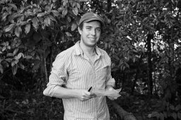 Jeffrey Robert Smith合作论文数Stanford Univ.2Rebecca Shaw合作论文数2
 Anne D. Guerry合作论文数Nat Capital Project, Stanford Univ2
 M. Strimas-Mackey合作论文数2
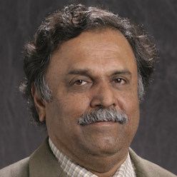 S.S. Iyengar合作论文数Knight Foundation School of Computing and Information Sciences, Florida International University2M. Okan Irfanoglu合作论文数Department of Computer Engineering, Boğaziçi University2
 Lizhao Wu合作论文数2




