During 2022, extreme rainfall occurred across southeast Australia, making it the wettest year on record. The oceanic impact of extreme rainfall events in normally ‘dry’ regions is not well understood, as their effects are challenging to observe. Here, we use unique multi-platform timeseries and spatial data from 36 autonomous ocean glider missions over 13 years, and we define an extreme salinity threshold inshore of the East Australian Current. We show that the freshwater plume extended fivefold further than previously thought. The compound effect of multiple large rainfall events resulted in a newly observed stratification (‘double-stacking’) dynamic, with the stratification being largely controlled by salinity. Extreme salinity events are known to be important for species composition of local fisheries as well as detrimental for coastal water quality. Such events and their impacts may become more common as extreme rainfall events are projected to become more frequent in a changing climate. Hence, comprehensive observing strategies facilitating identification of salinity extremes are essential.
Wind wave observations in shallow coastal waters are essential for calibrating, validating, and improving numerical wave models to predict sediment transport, shoreline change, and coastal hazards such as beach erosion and oceanic inundation. Although ocean buoys and satellites provide near-global coverage of deep-water wave conditions, shallow-water wave observations remain sparse and often inaccessible. Nearshore wave conditions may vary considerably alongshore due to coastline orientation and shape, bathymetry and islands. We present a growing dataset of in-situ wave buoy observations from shallow waters (<35 m) in southeast Australia that comprises over 7,000 days of measurements at 20 locations. The moored buoys measured wave conditions continuously for several months to multiple years, capturing ambient and storm conditions in diverse settings, including coastal hazard risk sites. The dataset includes tabulated time series of spectral and time-domain parameters describing wave height, period and direction at half-hourly temporal resolution. Buoy displacement and wave spectra data are also available for advanced applications. Summary plots and tables describing wave conditions measured at each location are provided.
In the state of New South Wales (NSW), Australia, recent legislative action has focused on identifying key threats to the marine estate. We used a systematic literature review to evaluate the knowledge status of the effects of estuarine outflows on coastal marine ecosystems, within the environmental, hydrological, and physicochemical context of NSW waters. Results focussed on studies that measured outcomes for marine biota (n = 56). Trace elements and organochlorines were the most frequently studied contaminant types, with reported biological concentrations often below guideline values but detected at the highest concentrations adjacent to urban sources. Few studies measured the impacts of legacy and emerging contaminants to animal health, or the flow on effects to marine ecosystems in NSW. Our review highlights key biological and geographical data gaps in estuarine outflow research in NSW, particularly of the impact on ecosystems of exported carbon and nutrients to the oligotrophic waters of NSW.
High quality seabed data are fundamental to a wide range of engineering, management and science research applications stretching from shallow-water coastal environments, across the shelf and out on to the abyssal sea floor. Coastal applications require high-resolution, quality bathymetry data to support models for understanding currents and waves, sediment transport and erosion, hazard and risk assessment as well as ensuring safe navigation and informing development associated with infrastructure and commercial projects. Combined with other seabed data types, the information supports research around changing climate and marine biodiversity and provides development opportunities associated with energy and food production in support of the Blue Economy.
Anchor scour from shipping is increasingly recognised as a global threat to benthic marine biodiversity, yet no replicated ecological assessment exists for any seabed community. Without quantification of impacts to biota, there is substantial uncertainty for maritime stakeholders and managers of the marine estate on how these impacts can be managed or minimised. Our study focuses on a region in SE Australia with a high proportion of mesophotic reef (>30 m), where ships anchor while waiting to enter nearby ports. Temperate mesophotic rocky reefs are unique, providing a platform for a diversity of biota, including sponges, ahermatypic corals and other sessile invertebrates. They are rich in biodiversity, provide essential food resources, habitat refugia and ecosystemservices for a range of economically, as well as ecologically important taxa. We examined seven representative taxa from four phyla (porifera, cnidaria, bryozoan, hydrozoa) across anchored and `anchor-free' sites to determine which biota and which of their morphologies were most at risk. Using stereo-imagery, we assessed the richness of animal forest biota, morphology, size, and relative abundance. Our analysis revealed striking impacts to animal forests exposed to anchoring with between three and four-fold declines inmorphotype richness and relative abundance. Marked compositional shifts, relative to those reefs that were anchor-free, were also apparent. Six of the seven taxonomic groups, most notably sponge morphotypes, exhibited strong negative responses to anchoring, while one morphotype, soft bryozoans, showed no difference between treatments. Our findings confirm that anchoring on reefs leads to the substantial removal of biota, with marked reductions of biodiversity and requires urgent management. The exclusion of areas of high biological value fromanchorages is an important first step towards ameliorating impacts and promoting the recovery of biodiversity.
A global fleet of more than 48,000 vessels conveys >80% of world trade by volume. Anchor damage to benthic habitats by these vessels, along with the burgeoning cruise ship industry, represents a key threat to benthic biodiversity and ecosystem function. Here, we use vessel positional information (Automated Identification System (AIS) data) to map anchoring activity. We then focus on the important role that high resolution habitat mapping will play in understanding the distribution of habitat types which may be impacted by anchoring ac-tivities. Many international ports have high-intensity anchor areas that remain unmapped and thus risks to benthic biodiversity are poorly understood and inadequately managed. We use case studies from an anchorage in south-eastern Australia, major trade routes in the Middle East and the anchoring of cruise vessels in the Caribbean to highlight the important role of habitat mapping in reducing anchoring impacts. We contend that mapping represents an important safeguard against anchoring impacts from unexpected events such as the COVID-related redirection of cruise vessels to anchorages and the blocking of the Suez Canal by the Ever Given grounding. With increasing maritime trade expected over coming decades there is a need to transition toward sustainable anchorage management practices and provide public confidence in stewardship of marine ecosystems by the maritime industry into the future.
The organic sulfur compounds dimethylsulfoniopropionate (DMSP) and dimethyl sulfoxide (DMSO) play major roles in the marine microbial food web and have substantial climatic importance as sources and sinks of dimethyl sulfide (DMS). Seasonal shifts in the abundance and diversity of the phytoplankton and bacteria that cycle DMSP are likely to impact marine DMS (O) (P) concentrations, but the dynamic nature of these microbial interactions is still poorly resolved. Here, we examined the relationships between microbial community dynamics with DMS (O) (P) concentrations during a 2-year oceanographic time series conducted on the east Australian coast. Heterogenous temporal patterns were apparent in chlorophyll a (chl a) and DMSP concentrations, but the relationship between these parameters varied over time, suggesting the phytoplankton and bacterial community composition were affecting the net DMSP concentrations through differential DMSP production and degradation. Significant increases in DMSP were regularly measured in spring blooms dominated by predicted high DMSP-producing lineages of phytoplankton (Heterocapsa, Prorocentrum, Alexandrium, and Micromonas), while spring blooms that were dominated by predicted low DMSP-producing phytoplankton (Thalassiosira) demonstrated negligible increases in DMSP concentrations. During elevated DMSP concentrations, a significant increase in the relative abundance of the key copiotrophic bacterial lineage Rhodobacterales was accompanied by a three-fold increase in the gene, encoding the first step of DMSP demethylation (dmdA). Significant temporal shifts in DMS concentrations were measured and were significantly correlated with both fractions (0.2–2 μm and >2 μm) of microbial DMSP lyase activity. Seasonal increases of the bacterial DMSP biosynthesis gene (dsyB) and the bacterial DMS oxidation gene (tmm) occurred during the spring-summer and coincided with peaks in DMSP and DMSO concentration, respectively. These findings, along with significant positive relationships between dsyB gene abundance and DMSP, and tmm gene abundance with DMSO, reinforce the significant role planktonic bacteria play in producing DMSP and DMSO in ocean surface waters. Our results highlight the highly dynamic nature and myriad of microbial interactions that govern sulfur cycling in coastal shelf waters and further underpin the importance of microbial ecology in mediating important marine biogeochemical processes.
Multi-decadal ocean time-series are fundamental baselines for assessing the impacts of environmental change, however, compiling and quality controlling historic data from multiple sources remains challenging. Here we aggregate, document, and release a number of long time-series temperature products and climatologies compiled from data obtained at 4 monitoring sites around Australia where sub-surface ocean temperature has been recorded nominally weekly to monthly since the 1940s/50s. In recent years, the sampling was augmented with data obtained from moored sensors, vertical profiles and satellite-derived data. The temperature data have been quality controlled, and combined using a rigorously tested methodology. We have packaged the multi-decadal, multi-depth, multi-platform temperature time-series at each site and produced a range of daily temperature climatologies from different data combinations and time periods. The 17 data products are provided as CF-compliant NetCDF files and will be updated periodically. The long-term temperature time-series will be useful for studies of ocean temperature variability, trends, anomalies and change. The data collection is supported by Australia’s Integrated Marine Observing System and data are open-access.
The potential response of shoreface depositional environments to sea level rise over the present century and beyond remains poorly understood. The shoreface is shaped by wave action across a sedimentary seabed and may aggrade or deflate depending on the balance between time-averaged wave energy and the availability and character of sediment, within the context of the inherited geological control. For embayed and accommodation-dominated coastal settings, where shoreline change is particularly sensitive to cross-shore sediment transport, whether the shoreface is a source or sink for coastal sediment during rising sea level may be a crucial determinant of future shoreline change. While simple equilibrium-based models (e.g. the Bruun Rule) are widely used in coastal risk planning practice to predict shoreline change due to sea level rise, the relevance of fundamental model assumptions to the shoreface depositional setting is often overlooked due to limited knowledge about the geomorphology of the nearshore seabed. We present high-resolution mapping of the shoreface-inner shelf in southeastern Australia from airborne lidar and vessel-based multibeam echosounder surveys, which reveals a more complex seabed than was previously known. The mapping data are used to interpret the extent, depositional character and morphodynamic state of the shoreface, by comparing the observed geomorphology to theoretical predictions from wave-driven sediment transport theory. The benefits of high-resolution seabed mapping for improving shoreline change predictions in practice are explored by comparing idealised shoreline change modelling based on our understanding of shoreface geomorphology and morphodynamics before and after the mapping exercise.
Western boundary currents (WBCs) redistribute heat and oligotrophic seawater from the tropics to temperate latitudes, with several displaying substantial climate change-driven intensification over the last century. Strengthening WBCs have been implicated in the poleward range expansion of marine macroflora and fauna, however, the impacts on the structure and function of temperate microbial communities are largely unknown. Here we show that the major subtropical WBC of the South Pacific Ocean, the East Australian Current (EAC), transports microbial assemblages that maintain tropical and oligotrophic (k-strategist) signatures, to seasonally displace more copiotrophic (r-strategist) temperate microbial populations within temperate latitudes of the Tasman Sea. We identified specific characteristics of EAC microbial assemblages compared with non-EAC assemblages, including strain transitions within the SAR11 clade, enrichment of Prochlorococcus, predicted smaller genome sizes and shifts in the importance of several functional genes, including those associated with cyanobacterial photosynthesis, secondary metabolism and fatty acid and lipid transport. At a temperate time-series site in the Tasman Sea, we observed significant reductions in standing stocks of total carbon and chlorophyll a, and a shift towards smaller phytoplankton and carnivorous copepods, associated with the seasonal impact of the EAC microbial assemblage. In light of the substantial shifts in microbial assemblage structure and function associated with the EAC, we conclude that climate-driven expansions of WBCs will expand the range of tropical oligotrophic microbes, and potentially profoundly impact the trophic status of temperate waters.
Recent multibeam and towed video surveys at Port Stephens have disclosed additional information on habitat extent and diversity on Australia's temperate southeast coast. Multibeam identified previously undescribed soft-sediment features at Seal Rocks and Broughton Island while also confirming broader geomorphological characteristics including the presence of a shelf sand body. While soft unconsolidated sediments dominate the seabed, reef, and mixed habitats covered 20%-40% of the seafloor over the inner- and mid-shelf and supported morphologically diverse sponge communities. Kelp, urchins, branching algae, and encrusting sponges were common to shallow sites (20-40 m) where depth variability was greatest. Sponges dominated over mid to deep-reef and mixed substrate areas and coexisted with ascidians (50-70 m) or sea whips and gorgonians (80-100 m). Multibeam was effective for identifying reef (82%) and soft-sediment (71%) areas but relatively less accurate at identifying mixed seabed. Further subdivisions within the current classification scheme are warranted if a more detailed and park-specific scheme is required.
The spatial distribution of a species assemblage is often determined by habitat and climate. In the marine environment, depth can become an important factor as declining light and water temperature leads to changes in the biological habitat structure. To date, much of the focus of ecological fish research has been based on reefs in less than 40 m with little research on the ecological role of mesophotic reefs. We deployed baited remote underwater stereo video systems (stereo-BRUVS) on temperate reefs in two depth categories: shallow (20-40 m) and mesophotic (80-120 m), off Port Stephens, Australia. Sites were selected using data collected by swath acoustic sounder to ensure stereo-BRUVS were deployed on reef. The sounder also provided rugosity, slope and relief data for each stereo-BRUVS deployment. Multivariate analysis indicates that there are significant differences in the fish assemblages between shallow and mesophotic reefs, primarily driven by Ophthalmolepis lineolatus and Notolabrus gymnogenis only occurring on shallow reefs and schooling species of fish that were unique to each depth category: Atypichthys strigatus on shallow reefs and Centroberyx affinis on mesophotic reefs. While shallow reefs had a greater species richness and abundance of fish when compared to mesophotic reefs, mesophotic reefs hosted the same species richness of fishery-targeted species. Chrysophrys auratus and Nemodactylus douglassii are two highly targeted species in this region. While C. auratus was numerically more abundant on shallow reefs, mesophotic reefs provide habitat for larger fish. In comparison, N. douglassii were evenly distributed across all sites sampled. Generalized linear models revealed that depth and habitat type provided the most parsimonious model for predicting the distribution of C. auratus, while habitat type alone best predicted the distribution of N. douglassii. These results demonstrate the importance of mesophotic reefs to fishery-targeted species and therefore have implications for informing the management of these fishery resources on shelf rocky reefs.
Here we outline the genesis of Seamap Australia, which integrates spatial data of the seabed of Australia's continental shelf (0-200 m depth) from multiple sources to provide a single national map layer of marine habitat. It is underpinned by a hierarchical classification scheme with registered vocabulary, enabling presentation of nationally consistent information at the highest resolution available for any point in space. The Seamap Australia website enables users to delineate particular areas of interest, overlay habitat maps with many other marine data layers, and to directly access the data and metadata underlying the maps they produce. This unique resource represents a step-change in capacity to access and integrate large and diverse marine data holdings and to readily derive information and products to underpin decision making around marine spatial planning and conservation prioritisation, state-of-environment reporting, and research. It is a world first fully integrated national-scale marine mapping and data service.
In 2017, the New South Wales (NSW) Office of Environment and Heritage (OEH) initiated a state-wide mapping program, SeaBed NSW, which systematically acquires high-resolution (2–5 m cell size) multibeam echosounder (MBES) and marine LiDAR data along more than 2000 km of the subtropical-to-temperate southeast Australian continental shelf. This program considerably expands upon existing efforts by OEH to date, which have mapped approximately 15% of NSW waters with these technologies. The delivery of high volumes of new data, together with the vast repository of existing data, highlights the need for a standardised, automated approach to classify seabed data. Here we present a methodological approach with new procedures to semi-automate the classification of high-resolution bathymetry and intensity (backscatter and reflectivity) data into a suite of data products including classifications of seabed morphology (landforms) and composition (substrates, habitats, geomorphology). These methodologies are applied to two case study areas representing newer (Wollongong, NSW) and older (South Solitary Islands, NSW) MBES datasets to assess the transferability of classification techniques across input data of varied quality. The suite of seabed classifications produced by this study provide fundamental baseline data on seabed shape, complexity, and composition which will inform regional risk assessments and provide insights into biodiversity and geodiversity.
 Jordan Alan合作论文数Fisheries Research, NSW Department of Primary Industries12
 Michelle Linklater合作论文数11
 Peter L.Davies合作论文数Department of Biomedical and Molecular Sciences, School of Medicine, Queen's University9
 Penelope Ajani合作论文数9
 David John Hanslow合作论文数NSW Dept. of Land and Water Conserv., New South Wales Department of Land and Water Conservation7
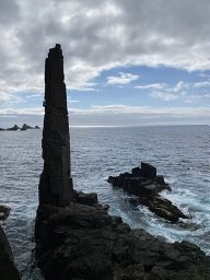 Hamish A. Malcolm合作论文数Solitary Islands Marine Park, NSW Marine Parks Authority6
 Anthony Richardson合作论文数Faculty of Science, University of Queensland6
 B.D. Morris合作论文数School of Civil and Environmental Engineering, University of New South Wales6
 Michael A. Kinsela合作论文数Office of Environment and Heritage5
 Shauna Murray合作论文数School of Biological Sciences, The University of Sydney5
 Martina Doblin合作论文数Department of Ocean, Earth and Atmospheric Sciences, Old Dominion University5
 Gustaaf M. Hallegraeff (Gustaaf Hallegraeff)合作论文数Institute for Marine and Antarctic Studies, University of Tasmania5
 Claire H. Davies合作论文数4Alex Coughlan合作论文数4
 Joe Neilson合作论文数Marine Planning, NSW Department of Primary Industries4
 Mark V Brown合作论文数School of Environmental and Life Sciences, University of Newcastle Australia4
 Jodie van de Kamp合作论文数CSIRO Oceans & Atmosphere, Hobart, Tas, Australia4
 Leanne Armand合作论文数Research School of Earth Sciences, Australian National University4Schultz Arthur L合作论文数4
 Martin Ostrowski合作论文数Department of Biological Sciences, University of4
 Peter A Thompson合作论文数The Commonwealth Scientific and Industrial Research Organisation4Scott L. Nichol合作论文数Marine and Coastal Environment Group, Geoscience Australia4
 Stephen D. A. Smith合作论文数University of New England National Marine Science Centre4
 Levente Bodrossy合作论文数Institute of Biophysics, Hungarian Academy of Sciences4Justin R. Seymour合作论文数Department of Civil and Environmental Engineering, Massachussets Institute of Technology4Drew Allen合作论文数3Edwina Foulsham合作论文数3Ar Jordan合作论文数3Renee Patten合作论文数3Steven Edgar合作论文数3
 Ian Jameson合作论文数3
 Linda Armbrecht合作论文数Sch Biol Sci, Univ Adelaide3
 Rafael Cabral Carvalho合作论文数Program of Computational Modelling, Federal University of Tocantins3
 Julian Uribe-Palomino合作论文数3
 Michael Hemming合作论文数School of Mathematics and Statistics, Faculty of Science, The University of New South Wales3
 Ferrari Renata合作论文数School of Biological Sciences, University of Sydney;School of Engineering, University of Sydney;University of Sydney, University of Sydney3
 Allison Broad合作论文数3
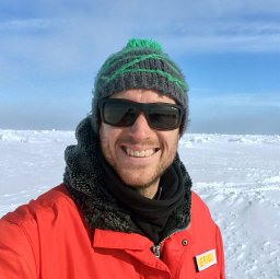 Raes Eric J合作论文数The Oceans Institute, University of Western Australia3Margaret Miller合作论文数3Tsuyoshi Kobayashi合作论文数3Peter Coad合作论文数3
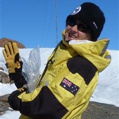 Ruth Eriksen合作论文数Australian Antarctic Division3Anya M. Waite合作论文数Centre for Water Research;University of Western Australia;Centre for Water Research, University of Western Australia3
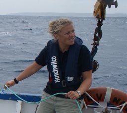 Sophie C. Leterme合作论文数School of Biological Sciences, Flinders University;Aquatic Sciences, South Australian Research and Development Institute;South Australian Research and Development Institute, Flinders University3
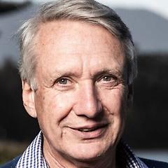 Colin David Woodroffe (Colin Woodroffe)合作论文数School of Earth and Environmental Sciences, University of Wollongong;Faculty of Science, Medicine and Health, University of Wollongong;GeoQuEST Research Centre, University of Wollongong3
 Mark E. Baird合作论文数School of Mathematics, University of NSW3
 Rachel Przeslawski合作论文数Marine and Coastal Environment Group, Geoscience Australia3Tim Pritchard合作论文数Waters and Catchments Science, Environment Protection Authority3
 Andrew R. Davis合作论文数Institute for Conservation Biology, University of Wollongong3




