The Cultivated Land Requisition-Compensation Balance Policy (CLRCBP) is a critical initiative in China's cultivated land protection practices, wherein cultivated land health is a comprehensive indicator to assess the policy's effectiveness. In this study, a cultivated land health evaluation system was developed based on the vitality-organization-resilience framework from the perspective of productivity and sustainability. The health gain-loss (HGL) of cultivated land requisition and compensation in the Pearl River Delta (PRD) region from 2000 to 2020 was quantitatively assessed. The ecological vulnerability of the region was assessed using the sensitivity-recovery-pressure model and spatial principal component analysis. Results revealed systematic implementation biases in the land requisition and compensation practices in the PRD region such as more requisition, less compensation; near requisition, distant compensation; prime requisition, inferior compensation; sustainable requisition; and unsustainable compensation. From 2000 to 2020, the average cultivated land health level fluctuated but marginally increased, whereas the health balance between requisitioned and compensated lands transitioned from deterioration to gradual improvement. The spatial heterogeneity in ecological vulnerability increased and 28.80 % of cultivated lands were located in high or relatively high vulnerability zones in 2020, indicating that a portion of cultivated land remained at high health risk. By integrating spatial ecological vulnerability assessments with HGL patterns, cultivated lands were classified into four distinct health risk categories to devise informed targeted management strategies. An adaptive governance framework was proposed for the CLRCBP that aligns with rapid urbanization dynamics and the functional transition requirements of contemporary cultivated land systems.
Improving land use efficiency (LUE) is an effective mean to address the imbalance between land resource supply and demand, while also reducing carbon emissions (CE) simultaneously. However, due to neglect of the differentiation of distinct land categories, tailored policies targeting the efficiency-carbon emissions dynamics of specific land categories have not been developed. Drawing on panel data spanning the years 2006 to 2019 from 284 prefecture-level cities in China, by employing a data envelopment analysis (DEA) approach, this paper measures the utilization efficiency of three categories of land with production capabilities-agricultural, industrial, and commercial land-as well as ecological land. Employing the spatial Durbin model (SDM), this paper empirically examines the influence of LUE on CE and their spatial spillover effects by analysing spatial heterogeneity across regions. The main research findings include the following: (1) Significant autocorrelation exists in CE in Chinese cities. China's agricultural LUE showed a declining trend, while industrial and commercial LUE exhibited a significant upwards trend, reflecting the overall development characteristics of the primary, secondary, and tertiary sectors during China's rapid urbanization phase. (2) The ecological LUE exhibits a notable positive spatial spillover effect on the CE of adjacent cities. Improving the utilization efficiency of agricultural, industrial, and ecological land contributes to a reduction in CE. (3) Regional heterogeneity analysis reveals that agricultural LUE demonstrates a positive spatial spillover effect on reducing CE in neighbouring areas within the central and western regions. In the eastern, central, and western regions, the ecological LUE exhibits a positive spatial spillover effect, contributing to the reduction of CE in neighbouring areas. The results provide references for further exploring the carbon reduction potential of differentiated land use systems.
Under China’s dual land ownership system, the use rights of urban land (state-owned) and rural land (collective-owned) are not equal. Understanding the roles of ownership type and government decision-making behaviors in the formation of land prices is crucial for further reform to promote “equal rights and equal prices” for urban and rural land. This paper analyzed the impact of ownership type on construction land prices using micro-level land transaction data from Wujin District, Changzhou City, from 2015 to 2021 and investigated the role of government decision-making behaviors such as spatial planning and supply plan in this relationship. The results show that collective ownership has a negative impact on land prices, and the development of collective-owned construction land has a positive impact on the prices of adjacent land. In addition, the boundary of downtown areas determined by spatial planning enhances the negative impact of collective ownership on land prices, thus widening the price gap between state and collective-owned land within the downtown areas. Furthermore, the proportion of collective-owned construction land in the annual land supply determined by the land supply plan strengthens the negative impact of collective ownership on land prices, meaning that an increase in the supply of collective-owned construction land leads to further downward pressure on land prices. This study can provide insights for policy making aiming to achieve “equal rights and equal prices” for land with different ownership type in China and in other countries with a dual land ownership system.
Rural collectively owned commercial construction land marketization (RCCCLM), a land policy that is still being piloted despite being allowed by law, has been regarded as an indispensable policy tool that can meet the land demand for rural development. This study aims to analyze the typical modes and key paths of RCCCLM for rural transformation theoretically and practically. We developed an innovative theoretical framework of “Situation-Structure-Implementation-Outcome” to illustrate the relationship between RCCCLM and rural transformation. By tracing the process of the impact of RCCCLM on rural transformation in typical areas, this study fills the gap in existing research that has not yet explored the theoretical mechanisms between RCCCLM and rural transformation. The results show that a combination of such factors as geographical location and rural land use status brings about three major ways of RCCCLM, namely, local marketization, adjustive marketization and consolidation-based marketization, to promote rural transformation. The influencing mechanism of RCCCLM on rural transformation mainly concerns rights granting, rural land use structure reshaping, the transformation of farmers’ livelihood and improvement in rural governance capacity. Rural transformation follows a basic rule and phased characteristics of evolving from single function to multiple functions, and RCCCLM displays a differentiated driving effect on the evolution of rural functions in different stages of rural development. These findings will provide new insights into rural land use and rural transformation in China and other developing countries and help solve the bottlenecks in rural transformation.
Eliminating poverty and achieving social justice are global concerns. China has focused on common prosperity. Comprehensive land consolidation is a potential policy tool that can contribute to common prosperity, but its effectiveness and implementation methods are yet to be verified and discussed. Therefore, we construct an analytical framework to understand how comprehensive land consolidation promotes common prosperity. The pilot area for comprehensive land consolidation in Ningbo City is used as a qualitative case study. The research results indicate that comprehensive land consolidation focuses on development and sharing to promote high-quality socio-economic development, social fairness, and justice. The paths for achieving development included the following: (1) a network governance structure consisting of multiple entities to enhance land governance; (2) various consolidation activities were conducted at the town scale to optimize the functionality and spatial pattern of public spaces; and (3) enabling the flow of urban and rural factors for improved resource allocation efficiency and providing an impetus for industrial development. The paths for achieving sharing included clarifying collective land ownership and promoting land transactions to provide diverse land values and ensure a shared distribution. This research provides new insights applicable to other Chinese cities and numerous developing countries engaged in land consolidation to address social distribution issues.
The gully areas on the Loess Plateau have always been ecologically fragile agricultural areas. These areas often face the common problem of intensified conflicts in production-livingecological space during economic development, and there is an urgent need for systematic spatial governance. This study innovatively developed a full process technical framework of "identification diagnosis - simulation optimization - coordinated governance" for potential conflicts in the production-living-ecological space, and used Huachi County in the gully area of the Loess Plateau as an example for empirical research. Under this framework, we analyzed the transfer patterns of production, living, and ecological space in the research area; Improved the spatial suitability evaluation index system of "multi-dimensional + multi-objective"; The conflict determination matrix was used to identify the scope, scale, type, and intensity of potential spatial conflicts; We conducted spatial optimization simulations under two scenarios: prioritizing ecological protection and prioritizing social and livelihood development, and designed an overall spatial optimization plan; Propose spatial collaborative governance strategies based on the theory of public space governance. Research shows that this framework has good applicability for the research area and is more direct for guiding subsequent spatial planning and policy practice. The potential conflict between production space and ecological space in Huachi County is the most common, the potential conflict intensity between living space and production space is the largest, and the potential conflict risk between living space and ecological space is rising. To coordinate potential conflicts in space, it is necessary to establish a vertical allocation type of spatial function coordination chain of "goal + collaboration + adjustment", as well as a horizontal negotiation type of spatial configuration coordination chain of "allocation + cooperation + balance", forming a "double vertical and double horizontal" spatial coordination framework.
Given the negative impacts of global warming on natural ecosystems and socio-economic development, addressing the challenges posed by climate change has become an area of concern for government agencies and academia. We explored the spatial heterogeneity of carbon emissions (CEs) and its impact mechanism based on carbon emission data from prefecture level cities in China from 1997 to 2017, using methods such as spatial autocorrelation model, centroid model, and geographically weighted regression. The results show that the national average CEs was 6522.98 million tons from 1997 to 2017. CEs were higher in the northeast and lower in the southwest of China. The main types of local spatial autocorrelation were high-high (H-H) and low-low (L-L), indicating that the high-value and low value areas of carbon emissions exhibit spatial clustering characteristics, respectively. The gravity center of the CEs shifted 128.48 km to the southwest during the study period. The general public budget expenditure, energy consumption per unit of GDP, and population density significantly influenced the spatial distribution of CEs. In over 70% of the study area, these factors, along with GDP per capita, have a positive impact on carbon emissions. These findings provide an important theoretical basis for China to achieve its “double carbon” goal by the middle of this century and are particularly useful for promoting green and low-carbon growth in developing countries across the world.
Comprehensive land consolidation is a national spatial governance tool that practices the concept of a living community of mountains,rivers,forests,fields,lakes,and grasses.It can directly connect with the construction of rural climate adaptation capacity.However,few stud-ies have been conducted from this perspective.Using literature review,theoretical analysis,and inductive deduction methods,this article attempts to explore the integration of comprehensive land consolidation and rural adaptation to climate change,as well as systematically explain the impact path and evaluation framework of comprehensive land consolidation on rural climate change adaptation.It will help to better understand the rich connotations of comprehensive land consolidation and assist in sustainable rural development.The main research findings are as fol-lows:(1)In the practical process,comprehensive land consolidation has formed a linkage sys-tem of"planning,consolidation,and operation",which has the characteristics of multi-function-ality and spatial constructions,enabling it to be embedded in the cultivation system of rural ad-aptation capacity to climate change.It can develop into a cross-departmental spatial governance tool in responding to natural disaster risks from the perspective of rural adaptation to climate change.(2)The comprehensive land consolidation and rural adaptation to climate change forms an interactive relationship named Tool-Field-Habit.The comprehensive land consolidation tool affects the rural climate adaptability through the chain of"climate adaptation and shaping of ru-ral spatial field and the formation of climate adaptation habits of multiple subjects",specifically forming a differentiated impact path for the rural agricultural management system,the rural hu-man settlements system and the rural ecosystem.(3)A framework for assessing the impact of comprehensive land remediation on rural climate change adaptation,with"resilience potential"as the core,has been established.Among them,rural climate resilience assessment is the foun-dation,and the difference between rural climate resilience before and after remediation is the impact potential.The study has opened up a new theoretical research perspective for under-standing the relationships and impact paths between comprehensive land consolidation and ru-ral climate change adaptation,and can provide theoretical reference for promoting sustainable development in rural areas under the background of climate change adaptation.
Against the backdrop of an urban-rural dual structure, governance structure significantly influences the fairness and sharing of land value increment profits from land consolidation in various regions. This paper develops a spatial-institutional analytical framework, reflects on the traditional government-led land quota planning management mechanism and advocates optimizing governance structures in land consolidation to facilitate urban-rural element flows and the sharing of land value increment profits. This paper selects two comprehensive land consolidation cases in the Fenghua District and Cixi City of Ningbo, representing government-led and village collective self-organized governance structures. The research shows that the Fenghua case adopts a government-led state-owned enterprise coordinated governance structure, which state-owned enterprises bear operational risks and the majority of profit sharing, while village collectives, as landowners, are insufficiently protected in benefit sharing. The Cixi case employs a government-embedded village-town governance structure, with the village collectives as the main operating body, allowing collective construction land to enter the market to ensure the sharing of community profits. Both governance structures promote the bidirectional flow of urban-rural land resource elements; the former significantly drives urban development, while the latter ensures better benefit sharing for village collectives. The research proposes that optimizing governance structures and improving land quota allocation mechanisms can further stimulate various entities’ participation in land consolidation and land value activation.
Understanding the intricate connections between ecosystem services (ESs) and resident well-being (RWB) is critical to managing ESs and achieving sustainable development goals (SDGs). However, it is difficult to quantify the impact mechanism between different ESs and RWB. We constructed a theoretical framework to analyze the impact mechanism of ESs on RWB under SDGs. We sought to quantify the spatiotemporal characteristics of ESs and RWB in Shanghai at the district scale and then explored the impact mechanism of ESs on RWB using a structural equation model (SEM). Results show that habitat quality, carbon storage capacity, food availability, and cultural services declined from 2000 to 2020. The level of RWB in the central urban area was higher than that in the suburbs. Material satisfaction grew in most districts but declined somewhat in Huangpu, Chongming. Spiritual fulfillment declined in most districts while it increased in Changning, Hongkou, and Pudong. Health and social relations improved in most districts, but the safety in suburbs has decreased. Supporting services directly promoted regulating services and cultural services but inhibited provisioning services. Cultural services had a negative impact on regulating services and provisioning services. Regulating services promoted provisioning services and suppressed cultural services while provisioning services promoted cultural services greatly and suppressed regulating services. Regulating and cultural services directly promoted the RWB, and provisioning services had an inhibitory effect on it. Supporting services indirectly promoted the RWB by promoting regulating and cultural services, while it suppressed the provisioning services to reduce the negative impact on RWB, it is crucial for improving RWB. Accordingly, we proposed several spatially targeted ecological measures. Community ecological parks should be constructed to promote the variety, stability, and sustainability of ecosystems in downtown areas. Supporting services should be improved by targeting habitat quality capacity to manage and restore the ecological environment. The cultural and tourism infrastructure of country parks in the suburbs should be improved to provide more employment opportunities and high-quality cultural services. The ecological compensation mechanism and market trading mechanism should be optimized to shorten the transition period of the ecological economy.
大城市居民作为最主要的乡村多功能消费者,是影响乡村多功能转型和价值显化的关键主体之一.该研究基于长三角城市群典型大城市宁波的调查问卷数据,利用KAP模型提出3个研究假设,从城市居民的知识(K)、态度(A)和行为(P)三方面探讨大城市居民对乡村多功能转型的响应机理.结果显示:①宁波居民对11个乡村功能的认知态度全部显著,其中,对乡村提供休闲放松功能、乡村农耕文化体验功能和养老功能最为认可,均值分别是5.99,5.88和5.79;②大城市居民对乡村多功能转型具有"知识获取(K)-认知态度(A)-行为意图(P)"的传导和响应路径,即居民获取的关于乡村的知识、居民对乡村多功能的认知态度显著影响他们的乡村消费行为意图;③宁波居民对乡村多功能的认知态度(A)主要受由媒体和人际传播产生的外源性知识影响;除农产品供应功能、工业发展功能和文创功能以外,居民对其他8个乡村功能的态度(A)与他们前往乡村居住、旅游、工作和养老的行为(P)之间存在显著相关.研究结论:促进大城市乡村多功能转型的政策,应当重视城市居民对乡村消费的多样化需求在信息传播、差异化发展和乡村公共基础设施改善方面更好的承接城市居民的"乡愁".
Main functional zone(MFZ)planning is one of the most important national strategies in economic development and ecological environment protection.It is very necessary to analyze the evolution characteristics of territorial space patterns and the carbon emission in the MFZ system.This study aims to determine the spatial and temporal evolution of territorial spatial patterns in the Yangtze River Delta region before and after the MFZ implementation using the land use data from 2000 to 2020.The spatial transfer of territorial space was then evaluated using carbon emission data and contribution rate analysis.The results show that:1)Urban and ecological space continued to increase,whereas,the agricultural space decreased in the study area.The agricultural main production,the optimized and the key development zones were dominated by the transfer of agricultural production space,while the ecological function zone was dominated by the mutual conversion of forest ecological space and agricultural production space.The rate of change in the territorial space tended to slow down after the MFZ implementation.2)Agricultural production space was the main type of transfer out,whereas,the transfer in was the agricultural living space,urban living space,and urban production space.There was a negative correlation between the increase and decrease in the number of spatial changes in the territory within each MFZ,indicating the significant spatial heterogeneity.3)Net carbon emissions decreased(in C units)by 14 956.57 kg/(m2·a)with a spatial distribution of high in the west and low in the east.Among them,the high-value areas were clustered and distributed in the key development zones and the agricultural main production zone.Regional agglomeration was enhanced by the net carbon emissions enhancement in the key development and ecological function zone.The reduction zone was distributed mainly in the main production areas of agricultural products.There was an increase in the number of carbon emissions that converted to carbon sinks on the grid scale after the MFZ implementation.4)The reduced net carbon emissions were attributed to the conversion of agricultural production space into forest ecological space.There was a decrease in the carbon emissions in other main functional zones,due mainly to the conversion of agricultural living space to agricultural production space.Furthermore,the conversion of agricultural to urban space was attributed to the increase in carbon emissions in each subjective functional area.A diversified type of territorial space was attributed to the variations in the carbon emissions after the implementation of the MFZ planning.As such,the MFZ system should be further improved to reduce carbon but increase sinks in the territorial space.Territorial spatial planning should be compiled with the local conditions in low-carbon-oriented activities.Therefore,green and low carbon utilization can be realized with the goal of reducing carbon and increasing sinks in the territorial space.
Capital outflow during industrialization and urbanization is a primary reason for global rural recession, and China is no exception. Since China focuses on the integrated development of urban and rural areas, urban-rural capital flow affects the transformation and sustainable development of rural areas. However, few studies have focused on this issue. Based on long-term field observations of Wufang Village in Shanghai, we established an analytical framework to describe how urban-rural capital flow promotes rural reconstruction. The research results show that the influx of urban industrial and commercial capital results in market-oriented organization and reconstruction focusing on land, industry, and capital: (1) Land-use optimization changes the land ownership and spatial structure of rural areas and improves the spatial value of rural areas. (2) Industrial development is focused on diverse development and the integration of primary, secondary, and tertiary industries in rural areas. (3) Capital investment is performed by a consortium of state-owned enterprises, private enterprises, and rural collective enterprises—which jointly invest, obtain revenue, and share profits—while considering the balance between attracting capital to rural areas and achieving independent development. The experience of Wufang Village has implications for the rural transformation policies of other large cities in China and other countries in Asia and Africa during urbanization.
The analysis of land use change (LUC) characteristics and the impact of policies related to urban ecological space is required to improve spatial planning and to support decision making regarding green infrastructure (GI) investment. This study employed Geo-informatic Tupu analysis and Fluctuation Potential Tupu analysis methods to analyze the characteristics of LUC in an urban ecological corridor (EC). To help understand the influence of land use policy on GI governance and support the optimization of spatial planning, we proposed a situation–structure–implementation–outcome (SSIO) policy cascade analysis framework. SSIO takes “place” as its starting point, then couples the local policy with the governance structure to promote the sustainability of urban commons governance. The results show that the land use type within an EC in the city is mainly cultivated land. However, between 2009 and 2019, cultivated land, construction land, and facility agricultural land all showed a decreasing trend, while forest land and garden land types underwent increasing trends. The LUC Tupu unit highlights the transition from cultivated land to forest land. Forest land has the greatest increase in area and accounts for 52.34% of the area of increasing land use. Cultivated land shows the greatest decrease in area and accounts for 70.30% of the area of decreasing trends. Based on the local policy situation of the metropolis, a land policy governance mechanism can be constructed by the establishment of a governance structure with local government as the core, using land consolidation as the platform, taking ecological spatial planning and inefficient construction land reduction as typical policy tools, and experimentally integrating the concept of Nature-based Solutions (NbS). In general, these findings may be applicable to other rapidly urbanizing cities around the world that are developing complex land use policies for ecological space governance.
实行党政同责是落实"长牙齿"的耕地保护硬措施的亮点.准确把握耕地保护党政同责的内涵,将耕地保护治理体制转型为"全员、全链、全域、全时、全息、全生命周期"的治理体制,对贯彻耕地保护党政同责、推动良田粮用和保障粮食安全具有重要意义.
探索低效工业用地减量化治理对优化土地资源利用格局、促进产业升级和城市高质量发展具有重要意义.在分析低效工业用地治理复杂系统特征的基础上,建构"情境—结构—行为—结果"分析框架,以超大城市上海市为例,采用扎根分析方法,揭示减量化过程和运行机理.结果显示:(1)低效工业用地减量化具有规划限制性、公共利益性和乡村嵌入性特征,由外部环境、用地效益、主体角色和减量化治理共同构成"外缘—内核"式的复杂适应系统.(2)建设用地"天花板"刚性约束下的宏观资源—环境—发展压力与微观用地效益是减量化的外部情境;内源性主体治理能力不足与外源性主体基于公共利益主动介入共同构成基于价值共享的治理结构;刚性政策、激励政策和支持政策形成了"三元互补"系统推动了集体行动;结果则呈现出城市高质量发展与资源再配置的协调,而平衡生态保护与经济发展、解决减量化短期压力将成为持续开展减量化的重点与难点.研究结果可为长三角其他城市开展低效工业用地治理提供经验和案例的借鉴.
住宅地价和房价的关系十分复杂,住宅地价房价比受国家制度、住房制度与政策、区域社会经济发展、城市基础设施完善程度、人口数量、财政收入等多种因素的影响.结合杭州市区商品住宅2000~2017年的地价和房价数据,深入研究杭州市区商品住宅房价与地价的因果关系,分析影响商品住宅地价房价比的因素及合理性,建议杭州住宅市场调控应建立房价与地价联动预警机制,同时注重"城市不同区域间协同联动",取消相应的行政干预措施.
Ecological risks (ERs) are external threats to ecosystem structure and function, and the evaluation of ER is valuable for understanding the extent of the disturbance of ecosystems by human activities. An objective investigation of the spatio-temporal characteristics of ER and its affecting elements can contribute to the improvement of the ecological environment and the sustainable development of regional resources. The Funiu Mountains were chosen as the study area, the ecological risk index was built using landscape interference and landscape separation, and the spatial–temporal properties and scale effect of the ER were assessed. The findings of ER may be separated into four distinct zones to study the variations in ER levels from 2000 to 2015: modest, mild, moderate, and high. Furthermore, geographically weighted regression (GWR) was used to ascertain the degree to which environmental factors impact ER and regional disparities. The results show: (1) Ecological risk assessment was sensitive to scale transformation, and there are variations in the spatial pattern of ER on diverse scale units. With the scale following a 1 km grid to the watershed, Global Moran’s I values dropped from 0.53 to 0.04, and 1 km × 1 km was the most suitable unit. (2) The ecological and environmental quality of the Funiu Mountains improved from 2000 to 2015. The extent of the high ecological risk zone dropped by 398.07 km2, but other types of ecological risk regions rose, owing to the execution of policies aimed at restoring cropland to forests. The ER presented a transitional distribution from a high risk in the surrounding area to low risk in the central area. (3) From the perspective of correlations among the influencing factors, altitude and slope had a negative correlation with other influencing factors, while others were positively correlated. The correlation coefficient between land-use degree and human activities intensity and ER was the highest. Each environmental factor had significant effects on the ERs and spatial variation existed, where the land-use degree and human activities intensity were the main obstacle factors limiting ER improvement. Population density, altitude, slope, and maximum temperature all displayed effects on ER with different directions and intensities.
研究目的:探索在"人才—文化制度子系统—资源产业子系统"理论模型指导下城市周边闲置宅基地盘活利用的治理对策,为实现乡村振兴提供有效路径.研究方法:案例研究法、扎根方法.研究结果:宅基地盘活利用是一个涉及资源、产业、文化、制度、人才等维度的综合系统.其中人才是连通其他子系统的枢纽;文化子系统为宅基地盘活利用提供了行为规范;制度子系统形成"自上而下"的宅基地盘活利用制度体系,并通过绩效考核和部门任务两个途径落实;资源子系统围绕宅基地整合了经济资源、生态资源和人力资源等多维度要素,成为盘活利用的基础条件;产业子系统则给出了以产业带动宅基地盘活利用的三条路径,即发展特色产业、搭建产业平台、对接产业园区.研究结论:城市周边乡村宅基地盘活利用在治理上强调乡村人才的统筹作用,使乡村振兴的多维度因素形成"合力",实现发展要素的优化配置,为乡村振兴提供动力.
The spillover effect of seniors on housing prices has become a hot issue. Previous studies focused on the macro impact of aging on housing prices, paying less attention to the characteristics of seniors in micro-community. This study attempts to fill this gap by assessing the spillover effect of the number, education levels, and occupations of senior neighbors on housing prices. Based on seniors' characteristics in 3,565 neighborhood committees within the Sixth Ring Road in Beijing and 247,079 housing transactions from 2011 to 2019, this study utilized the hedonic price model and reached the following conclusions. (1) Housing prices decreased slightly with an increase in the total number of seniors in neighborhoods. (2) The spillover effects of some specific socioeconomic characteristics of seniors significantly improved housing prices. For every 10% increase in the proportion of well-educated seniors or seniors who worked in government institutions, the housing price premium was 0.6% and 0.3%, respectively, with a comprehensive effect stronger than that of the total number of seniors. (3) The total number of seniors in neighborhoods had a nonlinear spillover effect on housing prices. (4) The characteristics of seniors have heterogeneous effects on housing prices based on location, housing price, and building age.
 Duo Chai (柴铎)合作论文数School of Government, Central University of Finance and Economics18
 Xiaokun Gu (谷晓坤)合作论文数China Institute for Urban Governance, Shanghai Jiao Tong University;School of International and Public Affairs, Shanghai Jiao Tong University17
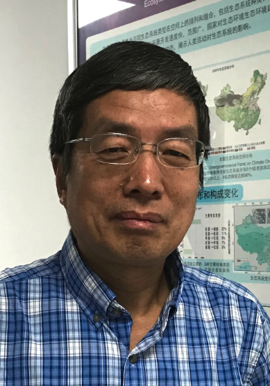 Xiaoke Wang (王效科)合作论文数State Key Laboratory of Regional and Urban Ecology, Research Center for Eco-Environmental Sciences, Chinese Academy of Sciences8
 Linzhang Yang (杨林章)合作论文数Institute of Soil Science, Chinese Academy of Sciences7
 Peiqiang Hou合作论文数6LI Xiaotian (李小天)合作论文数5XiaoFeng Xu (徐晓锋)合作论文数5
 Fei Lu (逯非)合作论文数Research Center for Eco-Environmental Sciences, Chinese Academy of Sciences;University of Chinese Academy of Sciences5
 Zhiyun Ouyang (欧阳志云)合作论文数Research Center for Eco-Environmental Sciences, Chinese Academy of Sciences5SHEN Duanshuai (申端帅)合作论文数4YanXia Lu (卢艳霞)合作论文数4
 Feixiang Zheng (郑飞翔)合作论文数Institute of Environment and Sustainable Development in Agriculture, Chinese Academy of Agricultural Sciences4
 Fan Dong (董藩)合作论文数School of Government, Beijing Normal University4Shu-qiong YU (余述琼)合作论文数3
 Hongxing Zhang合作论文数3Qing WANG (王情)合作论文数3BaiYuan Wang (王柏源)合作论文数3JianGuo Wang (王建国)合作论文数3Xiaonan Duan合作论文数3Lijie Song (宋丽洁)合作论文数3Yufen Ren (任玉芬)合作论文数3Linyi Zhao (赵琳祎)合作论文数2Xiaotian Li合作论文数2Xiao Lu合作论文数2Boyan Liu (刘博研)合作论文数2Hui ZHANG (张辉)合作论文数2
 Le Yang合作论文数2Silu ZHANG (张思露)合作论文数2
 Lan Yang合作论文数2Mengrou LIN (林梦柔)合作论文数2Wenlong Peng合作论文数2BinFeng Sun (孙滨峰)合作论文数2Song Zhao (赵松)合作论文数2Hui Qian (钱辉)合作论文数2
 Wenzhao Liu (刘文兆)合作论文数Institute of Soil and Water Conservation, Northwest A&F University2
 Junzhu Pang (庞军柱)合作论文数College of Forestry, Northwest A&F University2
 Yan Song (宋彦)合作论文数Department of City and Regional Planning, University of North Carolina at Chapel Hill;Center for Urban & Regional Studies, College of Arts and Sciences, University of North Carolina at Chapel Hill2
 Lei Tong (佟磊)合作论文数Institute of Urban Environment, Chinese Academy of Sciences;University of Chinese Academy of Sciences2
 Zongwei Feng (冯宗炜)合作论文数Research Center for Eco-Environmental Sciences, Chinese Academy of Sciences2Wenzhi Song (宋文质)合作论文数2
 Yingjie Zhang (张英杰)合作论文数School of Economics & Management, Beijing Forestry University2Yanan Wang合作论文数1
 Wenzheng Lu (卢文正)合作论文数School of International and Public Affairs, Shanghai Jiao Tong University;China Institute for Urban Governance, Shanghai Jiao Tong University1Yuyao Wang合作论文数1Yuchen Chen合作论文数1Xianghai Wang合作论文数1yuqing feng (冯宇晴)合作论文数1
 Dongqi Sun (孙东琪)合作论文数University of Chinese Academy of Sciences;Institute of Geographic Sciences and Natural Resources Research, Chinese Academy of Sciences1ZHU Qirui (祝琪瑞)合作论文数1




