Anthropogenic/artificial light at night (ALAN) may have detrimental effects on individual organisms, ecosystem structure and integrity, and human sleep and circadian rhythms. The wavelength dependence of diverse biological photosensory systems is thus an appropriate consideration when quantifying ALAN. We propose spectral weighting functions for biological detection in animals (BA(λ)) and all organisms (BE(λ)) based on established features of biological spectral sensitivity. Light metrics employing B(λ) provide a biologically relevant way to measure ALAN and evaluate solutions to reduce it through spectral tuning.
Light is the primary cue driving zooplankton diel vertical migration (DVM), a strategy that balances predation risk with resource access. However, DVM is often oversimplified, with limited consideration of how light-driven risks and resource needs vary across taxa and life stages. This simplification is partly due to constraints on collecting high-resolution, size-resolved data —especially at night, when subtle shifts in illumination reshape nocturnal risk landscapes. To overcome these limitations, we deployed a high-resolution in situ modular Deep-focus Plankton Imager and an image-recognition approach to quantify fine scale DVM and body sizes of Cladocerans and Copepods in Lake Stechlin, Germany. Data was collected from day into night and across moonrise and was compared with environmental data from vertical profiling sondes. Typical DVM patterns emerged, with deeper daytime distributions, however, moonlight introduced additional behavioural complexity: larger individuals avoided illuminated layers, likely managing predation risk, while smaller individuals moved into these layers, possibly exploiting foraging opportunities and reduced risk. These light-mediated shifts were further shaped by ecological conditions; copepods tracked food-rich layers regardless of light levels at night, while cladocerans showed light-dependent responses to both temperature and food, such that light caused them to avoid otherwise favourable (warm, food-rich) layers. Our approach provides new insight into how zooplankton navigate nocturnal lightscapes, revealing size- and taxon-specific strategies. By establishing size-dependent responses to natural moonlight, this work provides a crucial baseline for predicting how artificial light at night may restructure zooplankton communities and destabilize freshwater food webs.
Anecdotal reports in angling media suggest that using fluorescent lures may increase catch rates in dim light or at high turbidity. We conducted a controlled angling experiment, comprising 501 30-min experimental fishing trials in three meso- to eutrophic waterbodies and assessed catch rates and sizes of European perch (Perca fluviatilis) caught when offered two soft plastic lures (fluorescent vs. nonfluorescent) with similar reflective spectra. We also examined fluorescent properties of a range of market-available lures and modeled the experimental lure’s fluorescing effects under natural lake light. Considering the specific light environment of the study waters, the experimental fluorescent lure could get excited by downwelling visible daylight and fluoresce at depths of up to 3 m. Based on a sample catch of 331 perch, and after controlling for interactions with illuminance, cloud cover, water depth and daytime, the fluorescence of the experimental lure did, however, neither affect the catch rate nor the size of perch caught. Lure fluorescence maybe less important than many anglers believe, but further studies in different lake conditions are needed.
Artificial light at night (ALAN) contributes to the globally observed insect decline. ALAN attracts nocturnal insects from their native ecosystems and disturbs their functions in the food web. Road lights in this context are ubiquitous and relevant ALAN sources that are often not considered in conservation approaches. In a previous study we showed that shielded LED road lights are suited to be part of conservation measures by effectively reducing the attraction of nocturnal insects. Here we show that this positive effect holds true for parasitoid wasps in an experimental BACI design (Before-After-Control-Impact). Combining morphological with molecular and phylogenetic analyses, we identified 106 individuals (62 morphotypes) of a minimum of 45 genera out of 13 Hymenoptera families. We were able to identify 21 species, 11 of which are newly reported in Southern Germany (Baden-Württemberg). Further combining knowledge on life history and host appearance from our data and the literature, we discuss potential impacts of ALAN ranging from an influence on nocturnal pollination via parasitoid pressure on moth species and biological control of invasive pest species to tritrophic interactions between primary and secondary parasitoids. We conclusively think that shielded LED road lights will reduce the ecological impact of ALAN on parasitoid wasps in a large and undescribed number of taxa with different host associations, likely affecting associated ecosystem functions such as biological control.
Light pollution poses significant ecological challenges for nocturnal animals reliant on natural light for migration, orientation, and circadian rhythms. The physiological effects of abrupt exposure to artificial light at night (ALAN) on migratory fish, such as the light experienced passing near illuminated infrastructures, remain poorly understood. This study investigates the physiological responses of brown trout (Salmo trutta) smolts to low-intensity (0.02 lx) and short-term (30 s) ALAN, simulating nocturnal migration light conditions near illuminated bridges. To evaluate the influence of social dynamics, trout were tested individually (solitary) or in groups of six. Using continuous cardiac monitoring with data storage tags, alongside analyses of oxidative stress markers and adenylate kinase (AK) activity in the heart, we identified distinct patterns of physiological responses. Solitary fish exhibited significant heart rate variability (HRV) increases following repeated ALAN exposure, suggesting impaired physiological regulation under repeated ALAN exposure. In contrast, trout in groups displayed consistently lower HRV over the entire 90-min experiment, implying that social dynamics likely influenced a sustained oxidative stress response, corroborated by increased AK activity. Oxidative stress markers further reflected social effects, with significant upregulation of key antioxidant enzymes (sod1, sod2, gpx1, gpx4) and elevated lipid peroxidation, identifying lipids as primary oxidative targets. The observed divergence between superoxide dismutase (SOD) activity and sod gene expression suggests adaptive post-transcriptional regulation to maintain redox balance under combined environmental and social stress. These findings reveal that social dynamics under ALAN can amplify physiological stress, potentially affecting migratory outcomes.
Artificial light propagating towards the night sky can be scattered back to Earth and reach ecosystems tens of kilometres away from the original light source. This phenomenon is known as artificial skyglow. Its consequences on freshwaters are largely unknown. In a large-scale lake enclosure experiment, we found that skyglow at levels of 0.06 and 6 lux increased the abundance of anoxygenic aerobic phototrophs and cyanobacteria by 32 (±22) times. An ecosystem metabolome analysis revealed that skyglow increased the production of algal-derived metabolites, which appeared to stimulate heterotrophic activities as well. Furthermore, we found evidence that skyglow decreased the number of bacteria-bacteria interactions. Effects of skyglow were more pronounced at night, suggesting that responses to skyglow can occur on short time scales. Overall, our results call for considering skyglow as a reality of increasing importance for microbial communities and carbon cycling in lake ecosystems.
Light pollution is an emerging ecological threat. To mitigate its negative consequences, creative inter- and transdisciplinary solutions and societal interactions are needed. To this end, we introduce nocturnal umbrella species representative of light-sensitive biodiversity whose protection will safeguard vital ecosystem services and a wide range of co-occurring species.
In recent years, many studies have shown that light pollution adversely affects wildlife, ecosystems, and human well-being. To assess and mitigate these impacts, it is crucial that measurements of night sky quality are reliable and comparable across sites and instruments. However, the lack of standardised night sky brightness metrology and the use of a wide variety of measurement instruments with varying spectral responsivity and field-specific measurement units hinder meaningful comparison. We collected night sky spectra from 44 nights at dark locations (existing and proposed dark sky parks). Based on this observational dataset, we created a larger random set of spectra. These data served to fit conversion parameters for a wide variety of units. We demonstrate that RGB cameras, when used as multichannel measuring devices, enable the retrieval of measurements that facilitate conversions between different units. Furthermore, even airglow can be quantified from a given measurement, enabling the determination of oxygen and sodium emission line contributions. Since this contribution is not negligible, quantitative measurements of its magnitude are crucial for accurately assessing light pollution at dark-sky sites. Using our spectral measurement database, we constructed the most probable transformation from the cameras' R, G, and B channel dsu values to other units, such as the astronomical Bessel V band magnitudes. The unit conversion formulas provided in this paper are valid for mildly polluted sites (existing and proposed dark sky places), in the 21-22 magV/arcsec2 range.
Artificial light at night (ALAN) disrupts ecosystems by altering natural light cycles and affecting the physiology and behaviour of species, and represents a widespread and increasingly recognised global ecological threat. This meta-analysis investigates the effects of varying wavelengths and illuminance levels of ALAN on organisms. Broad-spectrum 'cool' light, enriched with blue and ultraviolet radiation, strongly disrupts circadian rhythms, melatonin production and nocturnal activity. However, contrary to common assumptions, broad-spectrum 'warm' light can be nearly as impactful as broad-spectrum 'cool' light lacking ultraviolet radiation, despite the predominant influence of short wavelengths on physiological processes. The impact of ALAN is not consistently dose-dependent, as even low light levels (< 5 lx) can cause substantial biological disruptions. Thus, effective mitigation strategies require tailored solutions to specific ecological contexts and should generally avoid nocturnal illumination unless clearly needed, as there is no single 'safe dose' and 'safe spectrum' of ALAN.
The growing utilization of remote sensing data in lake studies provides crucial spatial insights into biogeochemistry and biology. However, clarity regarding the development and intended use of remote sensing products is often lacking. This letter aims to elucidate the tradeoffs for the utilization of remote sensing data in limnological studies with an example of based on the estimation of chlorophyll a due to its importance as a water quality indicator. The analysis initiates with a meticulous product selection, requiring an evaluation of its capacity to address the optical complexity of freshwater systems. Assessing atmospheric correction and product limitations ensures alignment with the study's objectives. Subsequently, rigorous validation of remote sensing products is essential, accompanied by a cautious interpretation of the data. This letter advocates for the use of remote sensing data, offering key strategies for their optimal utilization in lake studies. The use of satellite remote sensing for monitoring water quality in inland water systems has been growing in the last decades especially due to the development of new orbital sensors (Kutser et al. 2020; Ogashawara 2021). Earth observations provide new angles for limnology, such as a universal perspective of multiple aquatic ecosystems simultaneously, regional to global coverage, the potential to acquire time series of data and its valuable input to predictive models. Additionally, it allows the retrieval of several parameters across the surfaces of an increasing number of smaller lakes, providing not only the surface area and elevation, but also surface biogeochemical data. The exponential growth of studies using this technology highlights that the improved computing resources, increased amount of satellite imagery, and development of operational remote sensing algorithms to understand complex inland water systems is now a reality (Topp et al. 2020). With the increasing access to satellite data, several organizations are developing remote sensing-based products for water quality. These products are currently distributed by national and international agencies (i.e., European Space Agency [ESA], US Geological Survey [USGS]), international programs (i.e., Copernicus Marine, Copernicus Land, and Copernicus Climate Change), academic research (i.e., Minnesota Lake Browser, https://lakes.rs.umn.edu/), and private industry (i.e., CyanoLakes, https://www.cyanolakes.com/; CyanoAlert, https://cyanoalert.com/). Typically, the data behind these products have undergone substantial processing including atmospheric correction, identification of quality issues, and bio-geo-optical algorithms to derive the desired bio-geophysical variables. Figure 1 exemplifies the main procedures for generating a quality controlled remote sensing-based water quality product (inland, coastal, and marine). Procedures are divided into five types: (1) the initial data needed (the Level 1 satellite imagery, the in situ radiometric data, the in situ bio-geo-optical properties [especially inherent optical properties] and in situ water quality curated data); (2) the remote sensing processes (atmospheric correction and bio-geo-optical modeling), 3) the validation processes (of the remote sensing processes using in situ collected data); (4) the remote sensing-based products such as the atmospheric and glint correction imagery; and (5) the water quality products which are produced by applying the selected bio-geo-optical algorithms (locally and seasonally adapted to the dominating water constituents and validated with in situ water quality data) to the atmospherically corrected image. Finally, the remote sensing-based product needs to pass a quality assurance and quality control (QA/QC) to generate a final curated product. As presented in Fig. 1, obtaining remote sensing-based water quality products is intricate, particularly for inland waters where optical properties are highly variable due to the naturally wide fluctuation in optically active constituents (OACs; i.e., phytoplankton pigments, colored dissolved organic matter [CDOM] and sediment) in the water column (Ogashawara et al. 2017). To illustrate this complexity, algal blooms can manifest in brown waters rich in CDOM and mobilized sediments that induce turbidity (Lebret et al. 2018). Due to this optical complexity, many remote sensing-based ocean color products mask out turbid waters, resulting in the exclusion of numerous freshwater systems. To promote the utilization of remote sensing technology and to enhance the understanding of the tradeoffs using remote sensing data, this letter addresses (i) the primary issues leading to problems in interpreting remote sensing data; (ii) the consequences of the misinterpretation; and (iii) suggests strategies for the utilization of remote sensing data, along with approaches to contribute to the reliable calibration and validation of remote sensing-based water quality products. The selection of the remote sensing product is one of the primary considerations for limnological studies. Remote sensing-based products are designed for open ocean (ocean color products), coastal or inland waters, and it is crucial to discern the differences among them before making a choice. These differences arise from the light availability within the water column, where, in a first approximation: (1) open ocean waters predominantly absorb the red part of visible light, (2) coastal waters and clear inland waters absorb both blue and red light, and (3) turbid inland waters strongly absorb from short wavelengths to the red part of visible light (Kirk 2011). Understanding these variations in the interaction between light and water facilitates the decision for the appropriate spectral region to be used during remote sensing data processing for atmospheric correction and bio-geo-optical modeling. One example highlighting the importance of selecting the appropriate spectral region is the computation of chlorophyll a (Chl a) concentration from satellite data. Processing algorithms developed for the open ocean rely on the blue and green spectral band ratio due to Chl a absorption around 440 nm and the very low CDOM background signal (O'Reilly and Werdell 2019). In contrast, coastal water products utilize the entire spectrum with a Neural Network approach (Brockmann et al. 2016), while inland water remote sensing products so far typically base calculations on the ratio of aquatic reflectance at 665 nm (red peak of Chl a absorption) and the red-edge around 700 nm (scattering of algal cells, Gitelson 1992). Given the low Chl a concentration in the open ocean, spectral bands within the red range are often dominated by water absorption and become unsuitable for Chl a retrieval. In inland waters (where CDOM is usually present), blue spectral bands are usually dominated by CDOM absorption, masking Chl a absorption at 440 nm, thus favoring the use of Chl a absorption at 665 nm. As a comparison, in situ Chl a sensors have recently been developed that use red light excitation rather than the traditional blue light excitation, in response to these optical challenges typical for coastal and inland waters. Additionally, it is crucial to highlight that open ocean, coastal, and inland water Chl a remote sensing products have been optimized for different concentration ranges, a factor that should be considered before using the data. Due to the intricate relationships between different water types and light, understanding the remote sensing data processing approaches in a remote sensing-based water quality product is essential for understanding the advantages and disadvantages of each product. Figure 2A presents examples of typical aquatic reflectance spectra (remote sensing reflectance) from different aquatic environments which visually highlights the contrast interactions between light and water. To showcase the importance of selecting the most suitable approach for estimating Chl a concentration Fig. 2BD,F presents three remote sensing-based Chl a products from the Sentinel 2 MultiSpectral Instrument (MSI) over lakes located in the Mecklenburg–Brandenburg Lake District in northeastern Germany (Ogashawara et al. 2021). We selected traditional remote sensing approaches for (i) open ocean (Fig. 2B), (ii) inland waters, and (iii) coastal waters (Fig. 2F). The visual differences among these three different remote sensing-based products for the Sentinel 2 MSI image (Scene ID: GS2A_20190726T102031_021369_N02.08) are further supported by scatter plots of the respective remote sensing estimated Chl a concentration and a water sample-based laboratory measurement of Chl a concentration using high-performance liquid chromatography (HPLC) done on the same day (Fig. 2C,E,G, respectively). In these examples, it was observed that the open ocean approach (Fig. 2C) underestimates the Chl a concentrations, the inland water approach (Fig. 2E) underestimates the Chl a for more eutrophic waters and the coastal approach (Fig. 2G) showed an underestimation for all Chl a concentrations. These results agree with the previous paragraph that when applying an open ocean approach in lakes the results may be strongly underestimating the true concentration of Chl a, especially in turbid waters, as the use of the blue and green regions of the visible spectrum are heavily affected by CDOM. It also highlights the importance of using in situ data to validate the selected satellite product—as the validation process is essential for the QA/QC (see Fig. 1). A major challenge for remote sensing data processing in inland waters (Fig. 1) is the atmospheric correction (Pahlevan et al. 2021). Atmospheric correction is the process of removing the optical effects of the atmosphere in the view field of a satellite or airborne sensor observing a target on the Earth's surface. A part of the atmospheric correction, is the glint correction which removes both the measured signal from light that is specularly reflected at the water surface from the sun, as well as reflected from the sky toward the sensor. Approximately, 90% of the total signal measured by a satellite stem from the atmosphere (IOCCG 2010), and the intensity of the glint can be higher than the intensity of the water leaving radiance, depending on the brightness of water, solar azimuth angle and on wavelength. Therefore, the accuracy requirements of the correction methods are much higher over water than over land. Figure 3 presents average reflectance spectra of a eutrophic lake for a Sentinel 2 MSI image without atmospheric correction (top-of-atmosphere reflectance—RTOA), with a land based atmospheric correction (surface reflectance—SR) and using an aquatic atmospheric correction for the computation of the Remote Sensing Reflectance (Rrs). A recent study performed a similar comparison for the Landsat SR products and showed that the use of SR products for the green and red spectral bands had uncertainties close to 30%, whereas the uncertainties in the blue and coastal-aerosol bands ranged from 48% to 110% when compared to in situ Rrs (Maciel et al. 2023). These results highlight the importance of having an aquatic atmospheric correction and to carefully evaluate the tradeoffs of the use of SR in limnological studies. Considering that there is no universally acceptable inland water atmospheric correction processor, limnological studies need to first validate different atmospheric correction processors as highlighted in Fig. 1. This validation of the atmospheric correction is crucial to make sure that the remote sensing data used as input for the studies using machine learning and artificial intelligence approaches (in which data quality is absolutely critical) are not largely biased. However, it becomes challenging because it requires in situ radiometric data to perform this validation. This type of data is still not commonly used by most scientists not specialized in remote sensing, despite that it is crucial to develop and calibrate the water atmospheric correction processors for inland and coastal waters. How to choose the right remote sensing-based water quality product? Before incorporation of remote sensing data in aquatic research, it is important to look for the Algorithm Theoretical Basis Document (ATBD) of the remote sensing-based product and the proper reference of the product to precisely understand its development and limitations. Another recommendation is to use remote sensing-based products, which have been standardized and quality controlled by a reputable organization, such as the Committee on Earth Observation Satellites (CEOS) that recently created a minimum set of requirements for different remote sensing-based products (CEOS 2021). With this verification of quality by CEOS, it will be easier to identify if the retrieved information is trustful or not. Finally, a simple recommendation is to always use a remote sensing-based product developed for the specific type of water under investigation: open ocean, coastal or inland waters. While ocean color products (made for open ocean) are easy to find for inland waters, inland water global products are still scarce due to the optical complexity of these aquatic environments. Nevertheless, some products were developed for global inland waters based on a blended algorithm approach which first classifies the aquatic system by its optical similarities (optical water typology) and then estimates other parameters. Some examples of these products are the Copernicus Land Lakes Water Quality product (https://land.copernicus.eu/global/products/lwq) and the European Space Agency Lakes Climate Change Initiative (https://climate.esa.int/en/projects/lakes/). While these initiatives are based on lakes, they also include reservoirs, however, these are global products and may not be optimized for a specific study site. Additionally the US Geological Survey (USGS) has a provisional product of aquatic reflectance which is produced after running an aquatic atmospheric correction (https://www.usgs.gov/landsat-missions/landsat-provisional-aquatic-reflectance), however it is still not fully validated for inland waters and it is still in provisional phase. How to choose the right remote sensing processes? To help with the selection of the best approach, Neil et al. (2019) proposed a tree scheme to simply identify the best bio-geo-optical algorithm to use for Chl a concentration estimation based on the trophic state of the aquatic system where: the open ocean approach should be used for oligotrophic waters, the inland water approach should be used for mesotrophic and eutrophic waters and a quasi-analytical approach should be used for hypertrophic waters. This decision tree is very helpful for an initial selection of the remote sensing data processing approach; however, there are aquatic systems which are not covered, for example, aquatic systems with very high CDOM concentration (polyhumic waters). Similarly, Pahlevan et al. (2021) tested different atmospheric corrections processors and provided a ranking per optical water type which can facilitate the selection of the atmospheric correction approach. How to improve remote sensing-based water quality products for my study site? To improve these products for a regional level, it is useful to follow the indicated processing chain of Fig. 1. This will require in situ radiometric data, thus there is an urge for the collection of this type of data. However, matching data with satellite passages is a big challenge. From the total 12,000 worldwide Rrs spectra compiled by Maciel et al. (2023) just a small part (N = 1100) had match-ups with satellite data. This fact highlights the need to align field sampling with satellite passages on cloud free days, which can be difficult for some parts of the world where cloud cover is unpredictable. In these areas, the deployment of sensors could be an alternative for the acquisition of in situ radiometric, optical properties and water quality data. Ideally, such deployed systems should be equipped with autonomous in situ systems for all required parameters, and they need to be deployed in carefully selected aquatic reference systems which would cover a gradient of organic matter, different trophic levels, and different catchments. This would allow to acquire match-up data for calibration and validation that can be extended to optically similar waters. A well-validated atmospheric correction can strengthen the accuracy of water quality products, which depend on your choice of the bio-geo-optical model. Regarding the existing water quality monitoring programs, the data collection of the absorption coefficient of CDOM (aCDOM), the concentration of total suspended solids (TSS) and the concentration of phytoplankton pigments should be emphasized as essential variables. How to use remote sensing data without in situ radiometric data to validate the atmospheric correction? Considering that in situ radiometric data is still not a common measurement for many scientists working in inland and coastal waters, it is important to highlight the existence of aquatic reflectance products such as: the Copernicus Land Lakes Water Quality product, the European Space Agency Lakes Climate Change Initiative and the USGS provisional product of aquatic reflectance. These products could be carefully used for limnological studies—including machine learning and artificial intelligence of big data analysis. Another alternative is the use of different atmospheric correction approaches based on the optical water type of your system (as in Pahlevan et al. 2021) and to use the existing in situ water quality data to validate the estimation from satellite data coming from different atmospheric correction processors. This acknowledges the importance of having an atmospheric correction targeting inland waters and can be used to calculate the uncertainties of this process. How to best align scientists working in inland and coastal waters, with remote sensing scientists? Fortunately, inland water remote sensing is rapidly developing as a new discipline and several initiatives have been launched recently to disseminate remote sensing applications and products better. International networks such as the Group of Earth Observation (GEO) AquaWatch, the International Water Association (IWA) and the World Water Quality Alliance (WWQA) have been offering free webinars to inform the inland water research community on the current state-of-the-art of inland water remote sensing. With the global reach of these networks helping to disseminate the knowledge of remote sensing to non-remote sensing experts. Another network is the Global Lake Ecological Observatory Network (GLEON) which started in the United States and has been expanding worldwide and currently hosts a working group on Aquatic Remote Sensing which was created to establish the relationship between aquatic ecologists and remote sensing experts. These initiatives are complemented by online training which are available to anyone in the world such as the courses offered by the National Aeronautics and Space Administration (NASA) program on Applied Remote Sensing Training (ARSET). The continuous growth and acceptance of remote sensing technology in limnology coupled with the standardization of satellite-based water quality products and the increase in data collection for calibration and validation offers the unique opportunity of operational use of such technology for reliable inland water monitoring. This will be achieved when aquatic sciences and remote sensing communities will join forces for the calibration and validation of the remote sensing-based water quality products with in situ radiometric and biogeochemical data. This will enable users to put results into adequate context and to understand the tradeoffs of the use of remote sensing data in the future. More synergies between these communities are needed to harmonize products, offer training materials and guides for the best use of remotely sensed data, as well as re-evaluate previously published material based on the newer approaches outlined above. Such synergies will effectively help to overcome methodological limitations and improve our ability to accurately monitor our rapidly changing inland waters. This work was funded by a collaborative research grant of the Leibniz Competition within the project CONNECT—Connectivity and synchronization of lake ecosystems in space and time (No. K45/2017). IO was partially supported by the H2020 project Water-ForCE (GA No. 101004186). Open Access funding enabled and organized by Projekt DEAL. The authors have declared no conflict of interest.
Illuminated bridges have become important assets to navigable aquatic systems. However, if artificial light at night (ALAN) from illuminated bridges reaches aquatic habitats, such as rivers, it can threaten the river's natural heterogeneity and alter the behavioural responses of migratory fish. Here, via a pilot study, we quantified levels of ALAN at illuminated bridges that cross a river and, propose a conceptual model to estimate its potential implications on two migrating fish species with contrasting life histories. Night-time light measurements on the river Spree in Berlin were performed continuously along a transect and in detail at seven illuminated bridges. Photometric data of the pilot study showed rapidly increased and decreased light levels at several illuminated bridges from which we derived several model illumination scenarios. These illumination scenarios and their potential effect on migrating Atlantic salmon smolts (Salmo salar) and European silver eel (Anguilla anguilla) are presented as a conceptual model, considering illuminated bridges as behavioural barriers to fish migration. ALAN's adverse effects on freshwater habitats must be better researched, understood, managed, and properly communicated to develop future sustainable lighting practices and policies that preserve riverscapes and their biodiversity.
The attraction of insects to artificial light is a global environmental problem with far-reaching implications for ecosystems. Since light pollution is rarely integrated into conservation approaches, effective mitigation strategies towards environmentally friendly lighting that drastically reduce insect attraction are urgently needed. Here, we tested novel luminaires in two experiments (i) at a controlled experimental field site and (ii) on streets within three municipalities. The luminaires are individually tailored to only emit light onto the target area and to reduce spill light. In addition, a customized shielding renders the light source nearly invisible beyond the lit area. We show that these novel luminaires significantly reduce the attraction effect on flying insects compared to different conventional luminaires with the same illuminance on the ground. This underlines the huge potential of spatially optimized lighting to help to bend the curve of global insect decline without compromising human safety aspects. A customized light distribution should therefore be part of sustainable future lighting concepts, most relevant in the vicinity of protected areas. A customized and shielded street lighting design significantly reduces the lethal attraction of flying insects in various environments. The approach harmonizes human needs with minimizing the ecological impact of artificial light at night.
This study examines the impact of Artificial Light at Night (ALAN) on two coral species, Acropora eurystoma and Pocillopora damicornis, in the Gulf of Aqaba/Eilat Red Sea, assessing their natural isotopic responses to highlight changes in energy and nutrient sourcing due to sensory light pollution. Our findings indicate significant disturbances in photosynthetic processes in Acropora eurystoma, as evidenced by shifts in δ13C values under ALAN, pointing to alterations in carbon distribution or utilization. In Pocillopora damicornis, similar trends were observed, with changes in δ13C and δ15N values suggesting a disruption in its nitrogen cycle and feeding strategies. The study also uncovers species-specific variations in heterotrophic feeding, a crucial factor in coral resilience under environmental stress, contributing to the corals' fixed carbon budget. Light measurements across the Gulf demonstrated a gradient of light pollution which possess the potential of affecting marine biology in the region. ALAN was found to disrupt natural diurnal tentacle behaviors in both coral species, crucial for prey capture and nutrient acquisition, thereby impacting their isotopic composition and health. Echoing previous research, our study underscores the need to consider each species' ecological and physiological contexts when assessing the impacts of anthropogenic changes. The findings offer important insights into the complexities of marine ecosystems under environmental stress and highlight the urgency of developing effective mitigation strategies.
In recent decades, inland water remote sensing has seen growing interest and very strong development. This includes improved spatial resolution, increased revisiting times, advanced multispectral sensors and recently even hyperspectral sensors. However, inland waters are more challenging than oceanic waters due to their higher complexity of optically active constituents and stronger adjacency effects due to their small size and nearby vegetation and built structures. Thus, bio-optical modeling of inland waters requires higher ground-truthing efforts. Large-scale ground-based sensor networks that are robust, self-sufficient, non-maintenance-intensive and low-cost could assist this otherwise labor-intensive task. Furthermore, most existing sensor systems are rather expensive, precluding their employability. Recently, low-cost mini-spectrometers have become widely available, which could potentially solve this issue. In this study, we analyze the characteristics of such a mini-spectrometer, the Hamamatsu C12880MA, and test it regarding its application in measuring water-leaving radiance near the surface. Overall, the measurements performed in the laboratory and in the field show that the system is very suitable for the targeted application.
One of the most dramatic changes occurring on our planet is the ever-increasing extensive use of artificial light at night, which drastically altered the environment to which nocturnal animals are adapted. Such light pollution has been identified as a driver in the dramatic insect decline of the past years. One nocturnal species group experiencing marked declines are moths, which play a key role in food webs and ecosystem services such as plant pollination. Moths can be easily monitored within the illuminated area of a streetlight, where they typically exhibit disoriented behavior. Yet, little is known about their behavior beyond the illuminated area. Harmonic radar tracking enabled us to close this knowledge gap. We found a significant change in flight behavior beyond the illuminated area of a streetlight. A detailed analysis of the recorded trajectories revealed a barrier effect of streetlights on lappet moths whenever the moon was not available as a natural celestial cue. Furthermore, streetlights increased the tortuosity of flights for both hawk moths and lappet moths. Surprisingly, we had to reject our fundamental hypothesis that most individuals would fly toward a streetlight. Instead, this was true for only 4% of the tested individuals, indicating that the impact of light pollution might be more severe than assumed to date. Our results provide experimental evidence for the fragmentation of landscapes by streetlights and demonstrate that light pollution affects movement patterns of moths beyond what was previously assumed, potentially affecting their reproductive success and hampering a vital ecosystem service.
Bridge illumination gave rise to night-time illuminated paths across aquatic systems. However, if bridge artificial light at night (ALAN) reach waterbodies, it can result in polarised light pollution (PLP), which might alter the optical conditions of a river by night and potentially interfere with moonlight polarisation signals reflected off the water’s surface. It is a night-time phenomenon that can detrimentally change the behaviour of organisms sensitive to horizontally reflected polarised moonlight, a navigational cue and signal known to be used by flying water-seeking insects to detect suitable aquatic habitats to reproduce and lay eggs. In this study, we quantify the reflection of ALAN-induced polarisation patterns at the water’s surface near seven illuminated bridges crossing the river Spree in Berlin. The photometric data shows that bridge illumination induces PLP, which reflects from the water’s surface when measured at specific locations in space considered as potential flying paths for polarotactic aquatic insects. ALAN-induced polarisation findings at illuminated bridges suggest that PLP is a pollutant that illuminates aquatic areas. It requires better research as it can potentially affect polarimetric navigation in flying aquatic insects. As the extent of light pollution reaches riverine systems and aquatic habitats, the potential effects of PLP on freshwaters need the proper development of sustainable lighting solutions that can aid in preserving riverine nightscapes.
Light pollution has increased globally, with 80% of the total population now living under light-polluted skies. In this Review, we elucidate the scope and importance of light pollution and discuss techniques to monitor it. In urban areas, light emissions from sources such as street lights lead to a zenith radiance 40 times larger than that of an unpolluted night sky. Non-urban areas account for over 50% of the total night-time light observed by satellites, with contributions from sources such as transportation networks and resource extraction. Artificial light can disturb the migratory and reproductive behaviours of animals even at the low illuminances from diffuse skyglow. Additionally, lighting (indoor and outdoor) accounts for 20% of global electricity consumption and 6% of CO2 emissions, leading to indirect environmental impacts and a financial cost. However, existing monitoring techniques can only perform a limited number of measurements throughout the night and lack spectral and spatial resolution. Therefore, satellites with improved spectral and spatial resolution are needed to enable time series analysis of light pollution trends throughout the night. Increasing light emissions threaten human and ecological health. This Review outlines existing measurements and projections of light pollution trends and impacts, as well as developments in ground-based and remote sensing techniques that are needed to improve them.
Live music is often linked to elaborate light shows, particularly at large outdoor music festivals. However, artificial light at night is one form of environmental pollution, light pollution, and because outdoor festivals emit a substantial amount of artificial light into the environment, they are a potential source of light pollution. So far, no studies that quantified the impact of such festivals on urban light pollution and skyglow exist. Here, the light pollution produced by a major rock festival (Lollapalooza Berlin 2016 with 70,000 visitors per day in an urban park) was investigated with ground-based radiometry and night-time light data. A small night-sky radiometer installed near the main stages and a calibrated digital camera from a nearby observation spot inside of the park were used to quantify changes in night sky brightness and direct light emissions within the park. The impact of the music festival on the urban skyglow was indeed measurable. Zenith luminance increased locally by up to a factor of 8 and illuminance increased by about 50% at the observation spot within the park. The radiance detected by night-time satellite was also increased during the festival. This is the first time, that light pollution from such a major rock music event was quantified.
Anthropogenic light at night (ALAN) has pervasive ecological effects on species, habitats, and ecosystems. Research into the impact of ALAN has increased dramatically in the past decade, however, we find (through a literature review of 341 publications) a troubling lack of consistency and conceptual organization in the measurement of night-time light and related organismal responses. To address this, we propose a holistic framework that considers space, time, taxonomic uniqueness, and the physics of light. Principally, we suggest that light measurements should both match the mechanism of influence and the unique photoreceptor system of the organism being studied. Anthropogenic light at night is continuing to increase globally, as are its impacts on organisms and biodiversity (from genes to ecosystems). A measurement framework for disentangling the loss of natural night-time darkness and disruption of ecological systems provides a deeper insight into the nature of these relationships and is important for establishing paths forward in the face of intensifying global change.
 Ralf Menzel合作论文数Institut für Physik und Astronomie, Universität Potsdam38
 Franz Hölker合作论文数Leibniz-Institute of Freshwater;Ecology and Inland Fisheries;Ecology and Inland Fisheries, Leibniz-Institute of Freshwater38
 Axel Heuer合作论文数Institute of Physics, University of Potsdam18
 Erik W. Streed合作论文数MIT-Harvard Center for Ultracold Atoms;Department of Physics;Massachusetts Institute of Technology;MIT-Harvard Center for Ultracold Atoms, Massachusetts Institute of Technology16
 Christopher Kyba合作论文数German Research Center for Geoscience15David Kielpinski合作论文数Atomwise15Danilo Skoczowsky合作论文数15
 Benjamin Norton合作论文数14z kollath合作论文数Dept Phys, Eszterhazy Karoly Univ10
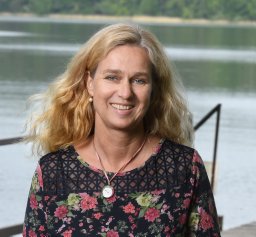 Stella A. Berger合作论文数Dept Biol 2, Univ Munich10Volker Raab合作论文数10
 Jens Christian Nejstgaard合作论文数Bergen High Technology Centre, University of Bergen9
 Sibylle Schroer合作论文数9
 Sabine Wollrab合作论文数Department Biologie II, Ludwig-Maximilians-Universität München8
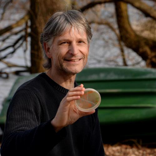 Hans Peter Grossart合作论文数Department of Plankton and Microbial Ecology, Leibniz-Institute of Freshwater Ecology and Inland Fisheries8m j petrasiunas合作论文数7
 Mark Gessner合作论文数Department of Plankton and Microbial Ecology, Leibniz Institute of Freshwater Ecology and Inland Fisheries;Department of Ecology, Faculty VI Planning Building Environment, Berlin Institute of Technology7m cenkier合作论文数6
 Karolina M Zielinska-Dabkowska合作论文数Gdansk Univ Technol, Fac Architecture, Gdansk, Poland6
 van Grunsven Roy H A合作论文数Nature Conservation and Plant Ecology Group, Wageningen University6
 Joachim Sacher合作论文数6Sandra Stry合作论文数6
 Martin Aube合作论文数5
 Catherine Perez Vega合作论文数Leibniz Inst Freshwater Ecol & Inland Fisheries5
 Christine Kiel合作论文数5
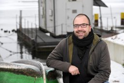 Gregor Kalinkat合作论文数Dept Biol & Ecol Fishes, Leibniz Inst Freshwater Ecol & Inland Fisheries I5
 Henning Kurzke合作论文数5
 Igor Ogashawara合作论文数Remote Sensing Div, Natl Inst Space Res5
 Travis Longcore合作论文数The Urban Wildlands Group5
 Salvador J. Ribas合作论文数5Gabriel A. Singer合作论文数5v blums合作论文数4
 Christof Zink合作论文数4
 Franziska Kupprat合作论文数Fac Life Sci, Humboldt Univ4
 Tobias Degen合作论文数4
 Shatwell Tom合作论文数Department of Ecohydrology, Leibniz-Institute of Freshwater Ecology and Inland Fisheries (IGB),4
 Sánchez de Miguel Alejandro合作论文数4Tim J. W. Walles合作论文数3
 Andreas Hanel合作论文数3
 Aryan Jakhar合作论文数Sch Biol, Indian Inst Sci Educ & Res Thiruvananthapuram3Susanne Stephan合作论文数Department Experimental Limnology, Leibniz Institute of Freshwater Ecology and Inland Fisheries, Stechlin, Germany.3
 Mona Storms合作论文数3
 Katrin Kohnert合作论文数Dept Expt Limnol, Leibniz Inst Freshwater Ecol & Inland Fisheries3Kiethe, J.合作论文数3Seefeldt, M.合作论文数3Spoelstra Henk合作论文数3
 Degen Jacqueline合作论文数3
 Brian Espey合作论文数3
 Thomas Hovestadt合作论文数Field Station Fabrikschleichach, University of Würzburg3




