Shell middens in Gippsland along the eastern half of Victoria's coastline have usually been characterised as small, short-duration camp sites with relatively low shell densities and low taxonomic diversity. Here we present new excavation results from a dense, high-diversity site at Red Bluff near the eastern end of GunaiKurnai Country, a location that features the first intertidal rocky platform habitat between Wilsons Promontory in the west and Cape Conran in the east (a distance of 230 km). We found that the climbing sand dune at Red Bluff began to accumulate c. 2500 cal BP, and that over the past c. 1000 years in particular, the Old Ancestors kept the dune environment relatively open through cultural burning, repeatedly camping on the dune to obtain a range of resources from the adjacent rocky shore and sandy beach, estuary and river mouth. These resources include a broad range of shellfish taxa consistently dominated by high numbers of Mytilus planulatus and Lunella undulata and small to medium-sized fish, probably from rock platforms and sandy shallows, processed with locally sourced stone artefacts. Although exhibiting a degree of similarity in the harvesting of specific mollusc taxa through time, there is notable variability in taxonomic richness and diversity that emphasises differences in subsistence activities and an active engagement with structurally complex nearshore environments. Les amas coquilliers de Gippsland, le long de la moiti & eacute; orientale du littoral de l'Etat/la r & eacute;gion de Victoria, ont g & eacute;n & eacute;ralement & eacute;t & eacute; d & eacute;crits comme de petits campements & eacute;ph & eacute;m & egrave;res, caract & eacute;ris & eacute;s par une faible densit & eacute; de coquillages et une faible diversit & eacute; taxonomique. Nous pr & eacute;sentons ici les r & eacute;sultats de nouvelles fouilles men & eacute;es sur un site riche en biodiversit & eacute; situ & eacute; & agrave; Red Bluff, pr & egrave;s de l'extr & eacute;mit & eacute; orientale du territoire GunaiKurnai. Ce site abrite la premi & egrave;re plateforme d'habitat rocheux en zone intertidale entre Wilsons Promontory & agrave; l'Ouest et Cape Conran & agrave; l'Est (distance de 230 km). Nos r & eacute;sultats indiquent que la dune de sable de Red Bluff a commenc & eacute; & agrave; se former il y a environ 2500 ans. Et, durant le dernier mill & eacute;naire, les Anc & ecirc;tres ont su maintenir l'environnement dunaire relativement ouvert par des feux dirig & eacute;s, campant r & eacute;guli & egrave;rement sur la dune pour exploiter diverses ressources provenant du rivage et de la plage de sable adjacents, de l'estuaire et de l'embouchure du fleuve. Ces ressources comprennent une grande vari & eacute;t & eacute; de mollusques, domin & eacute;e par une forte concentration de Mytilus planulatus et de Lunella undulata, ainsi que des poissons de petite et moyenne taille probablement issus des criques et des zones sableuses peu profondes, transform & eacute;s & agrave; l'aide d'outils en pierre d'origine locale. Bien que la r & eacute;colte de certains mollusques pr & eacute;sente une certaine similarit & eacute; au fil du temps, la richesse et la diversit & eacute; taxonomiques varient consid & eacute;rablement, soulignant les diff & eacute;rences dans les modes de subsistance et l'interaction avec des environnements c & ocirc;tiers complexes.
In this paper we report on faunal remains recovered from a legacy archaeological excavation undertaken in the rockshelter entrance of Waribruk (New Guinea II Cave), a GunaiKurnai site located on the west bank of the Snowy River, East Gippsland, southeastern Australia. From 1980 to 1985, archaeologist Paul Ossa undertook a 5 m-deep excavation in the cave's rockshelter entrance, but due to a poorly defined stratigraphy and insufficient radiocarbon ages, he was unable to establish a reliable chronostratigraphy and the excavated materials were never analysed in any detail. Here we present a series of new accelerator mass spectrometry radiocarbon ages on charcoal collected and bagged by Ossa. We show that the dated portion of one square and the upper third of an adjacent square are in excellent chronostratigraphic order, but the deeper levels are not. Taphonomic characteristics of the deposits indicate that animal bones were primarily accumulated by owls and people. The Late Pleistocene and Holocene faunas were dominated by forest and woodland species, but warmer, wetter Holocene conditions correlate with an influx of grassland, heath and swamp-adapted taxa. The subtle faunal changes observed in sediments dating to the Late Pleistocene-Holocene transition may be explained by local environmental shifts that accompanied post-glacial warming, and/or changing configurations of local GunaiKurnai hunting and foraging catchments. The taxonomic range of Waribruk's pre-colonial archaeological fauna was more diverse than its modern counterpart, indicating that colonial settlement has led to the local extinction of several species and global extinction of at least one.
Archaeobotanical evidence paired with GunaiKurnai cultural knowledge has established that plants were central to activities of the Old Ancestors in Cloggs Cave, GunaiKurnai Country. Here, we undertake a study of phytoliths from the stratified archaeological deposits to provide a complimentary line of evidence of people–plant relations across 25,000 years of cave engagement. Alongside the phytoliths of the archaeological sediments, we analyse the phytolith contents of individual, well-preserved buried possum scats to better clarify animal vs. anthropic processes of phytolith deposition in the cave. We found burnt phytoliths to be an unequivocal indicator of human activities related to plants and their subsequent accumulation within the cave. Phytoliths from grasses dominate the archaeological assemblage, while woody plant phytoliths and ash pseudomorphs of woody plants were detected in low amounts or are otherwise absent. Phytolith morphotypes from all parts of the grass plant including the inflorescences and leaves/culms indicate that the Old Ancestors intentionally selected and transported whole grass plants to the cave. Burnt phytoliths from all anatomical parts of grasses were identified from thin, laterally expansive ashy layers, suggesting that the grasses were brought into the cave to create layers of ash. With the exception of burnt phytoliths, we were unable to unequivocally discriminate between phytoliths that accumulated via the activities of people vs. those of possums (through their scats). It is, therefore, probable that in the non-ashy layers, the phytoliths represent a mixture of plants that entered the cave through the activities of both people and animals. Issues inherent in phytolith analysis, namely morphotype redundancy and differential phytolith production, limit the paleoecological inferences that can currently be made from the Cloggs Cave phytoliths, and demonstrate the value of analysing multiple independent botanical proxies to reveal how people used plants in the past.
We describe the systematic breakage of Macropodidae calcanea excavated in 1980–1985 from the entrance of Waribruk, an archaeological cave in GunaiKurnai Country, southeastern Australia. The Waribruk calcanea sequence spans the past c. 18,000 years. All but one of the 33 large and medium-sized macropodid calcanea were broken in the same way. Due to their leap-adapted mode of locomotion, extant kangaroos and wallabies have very robust calcanea that are not usually found broken in palaeontological assemblages. Here we use machine learning, taphonomic and ethnographic methods to explore if the Waribruk calcanea were broken by people to extract marrow, to make tools, as a byproduct of tendon extraction, for ritual, or through post-depositional taphonomic processes. We show that the calcanea (1) contain tiny amounts of marrow and were not broken in a way that would facilitate bone marrow extraction; (2) do not show any evidence of use-wear or impact marks, suggesting they were not broken through tool-making or tool use; and (3) do not show weathering that would indicate post-depositional breakage. This suggests they were broken either through extraction of the leg tendon that attaches to the calcaneus, or for ritual practice. We address these two options through local GunaiKurnai ethnography.
Zooarchaeology recognises that animal remains can register social relationships, ritual, identity, memory, and place, yet in Australia zooarchaeological interpretations have historically tended to emphasise diet and subsistence, at times narrowly framed through notions of economic optimisation or maximisation under the guise of 'adaptation'. In this paper, we present a framework of relatedness for faunal interpretations in GunaiKurnai Country (Gippsland region, southeast Australia) by detailing nineteenth century ethnographic records read alongside contemporary GunaiKurnai knowledge. Across these sources, animals emerge as socially active participants: Ancestral Beings, kin, environmental interpreters, and sentient anchors of Country. The framework proffered here treats archaeological faunal remains as the outcomes of socially governed pathways informed by local Indigenous philosophies and world views rather than automatic signifiers of subsistence and economic rationalism. It shifts interpretation from asking only about what was eaten, to asking what kinds of place-based and kin-centric connections, duties and activities shaped how animal bodies and substances were handled, restricted, shared, and deposited. Applied to Gippsland archaeology, this approach strengthens inference by enquiring into local existential-cosmological, production, consumption and depositional pathways to better position zooarchaeological remains (including subsistence practices) as social and cultural domains, and by reading faunal patterning through local, culturally grounded understandings of animal sociality at nested spatial scales.
Land-bridges are key regions of human connectivity, yet how geography affected peoples' movement during flooding is poorly understood. Bass Strait is one of the most important land-bridges in Australasia, separating Lutruwita/Tasmania from the mainland of Australia. The land-bridge forms a key part of Country among the region's First Peoples, with people able to move across the clan estates and residential places of the exposed Bass Strait by foot until its flooding after the Last Ice Age. In this study, we utilise high-resolution bathymetry to understand landscape change during sea-level rise. We find that rates of shoreline transgression can exceed 30 m/yr, signalling that 15 km of land would have been drowned in a persons lifetime. This rapid rate of change is within a person's life-span and would have profoundly affected individuals as they resided in and travelled across Country. We also find that people first crossed the land-bridge very soon after its exposure during climate cooling events. The analysis provides a benchmark for understanding land-bridge flooding and in turn its impact on human migrations.
We examined a zooarchaeological assemblage from Badger Island, a 12.4 km 2 landbridge island in the Furneaux Group, Bass Strait, south-eastern Australia. The accumulation consisted of Pleistocene and Holocene strata that were rich in mammal remains. Small mammal remains were accumulated by owls, whereas large mammal remains were accumulated by people and/or autochthonous mortality. The Pleistocene fauna was dominated by grassland mammals, particularly Mastacomys fuscus (Broad-toothed Rat), but these gradually declined and were largely replaced by forest–woodland dwelling mammals in the Holocene. The same pattern of faunal change has been observed on the large main island of Tasmania (∼65,000 km 2 ), suggesting changes observed at Beeton Rockshelter are representative of the region. Because all of the Furneaux Group Islands were united as one landmass in the past, the fossil fauna observed in Beeton Rockshelter is relevant to conservation-oriented mammal-restoration initiatives, which are being considered throughout the entire Furneaux Group.
Recent excavations at Millukmungee 1, a limestone rock shelter along the upper bank of the Buchan River in GunaiKurnai Country (southeastern Australia), uncovered archaeological evidence of Mid- to Late Holocene occupation spanning c. 5000 years. Here we report on the stone artefacts and faunal remains, especially in light of a paucity of published details on artefact types and technologies for this part of southeast Australia. Results indicate that this part of the site was occupied only rarely from 5590-5050 cal BP (the uncertainty range for the oldest artefact from the excavation) to 2340-2030 cal BP. During this period, most of the artefacts were made from silcrete, quartz, chert, and quartzite. Small backed artefacts are present during this phase, all dating between 4570-1940 cal BP. A single, much larger backed artefact (elouera) dates to later, <= 290 cal BP. After 1960 cal BP, activities focussed on the production of flakes from locally available quartz and, to a lesser extent, hornfels; large pebbles obtained from the nearby Buchan River channel were flaked during this period. Occupation ceased with the onset of settler colonialism in the mid-1800s CE.
In southeastern Australia, GunaiKurnai caves are known by current Aboriginal Elders and from nineteenth century ethnographic documents as special places used by mulla-mullung (“clever men” and “clever women”) for the practice of magic and medicine. Pollen analysis conducted on sediments from one such cave, Cloggs Cave, reveals an unusually well-preserved and well-stratified pollen sequence extending back >25,000 years, with much of the pollen introduced into the cave by people carrying flowering plants. High concentrations of pollen, rare for limestone cave settings, were recovered, including pollen clumps of individual taxa representing deposition of in situ flowering material. These taxa are dominated by plants known through GunaiKurnai knowledge and ethnography to have special cultural uses and that match the plants known to have been used by mulla-mullung, and some edible plants. These include taxa such as Banksia spp., Pimelea spp. (rice flower), and Plantago spp. (plantain) and the plant families of Asteraceae (daisy) and Poaceae (grass). The largely anthropogenic pollen assemblage also signals the presence of plants from cooler and drier climates dominated by more open vegetation during the Last Glacial Maximum than that observed around Cloggs Cave in recent times. The Early Holocene pollen then reflects a warmer and wetter climate that supported the expansion of woodland elements. Together, the pollen record of Cloggs Cave provides remarkable insights into two articulating histories: the cultural practices of the GunaiKurnai Old Ancestors in a special, secluded cave; and the environmental history of Country.
Aboriginal manufacture and use of pottery was unknown in Australia prior to European settlement, despite wellknown ceramic-making traditions in southern Papua New Guinea, eastern Indonesia, and the western Pacific. The absence of ancient pottery manufacture in mainland Australia has long puzzled researchers given other documented deep time Aboriginal exchange networks across the continent and the close proximity of potterybearing Lapita and post-Lapita maritime communities in the western Pacific with ocean-going watercraft and sophisticated navigation abilities. We report the oldest securely dated ceramics found in Australia from archaeological excavations on Jiigurru (Lizard Island Group) on the Great Barrier Reef, northeast Australia. Comprehensive radiocarbon dating and Bayesian modelling constrains ceramic deposition to between 2950-2545 cal BP and 1970-1815 cal BP. This timing overlaps with late Lapita and post-Lapita ceramic traditions of southern Papua New Guinea. Geological characterisation of the sherds strongly suggests local manufacture as the vessels belong to three temper and clay groups locally sourced to northeast Australia, and most likely to Jiigurru. The oldest occupation layers date to 6510-5790 cal BP, making Jiigurru the earliest offshore island occupied on the northern Great Barrier Reef. The results demonstrate that northeast Australian First Nations communities had sophisticated canoe voyaging technology and open-sea navigational skills and were intimately engaged in ancient maritime networks, connecting them with peoples, knowledges, and technologies across the Coral Sea region.
This paper provides new insights into the long-term history of Aboriginal use of mountainous Victoria over the past 25,000 years. It presents results of excavations at Garden Range 2 rock art site located on the edge of the Strathbogie Ranges in central Victoria. The excavations were a research collaboration between the Taungurung Land and Waters Council (TLaWC) and Monash University. Results indicate possible ephemeral visitation by the Old People during the Last Glacial Maximum, clear evidence of occupation over the past 11,000 years, and increased activity since 1600 cal BP. The stone artefact assemblage is dominated by flakes of local quartz. Three igneous flakes from ground-edge axes, dating to after 700 cal BP, are contemporary with a grinding stone showing use-wear and residues from stone axe maintenance. The faunal assemblage is dominated by forest and grassland animals, such as macropod and emu, with mussel shells and fish bones indicating the use of nearby Seven Creeks. The rarity of ochre within sediments precludes insights into the age of rock art paintings on the shelter's surface. Fossil pollen documents the nineteenth-century European forest clearances, a period when Taungurung people's use of the site became unsafe. Unburnt fragments of rabbit and sheep bone suggest subsequent use of the site as a fox den. Garden Range 2 illustrates Aboriginal use of mountainous central Victoria during periods of significant environmental changes in the Early Holocene and possibly in the Late Pleistocene. These chronological patterns, including increased activity in the central Victorian uplands during the Late Holocene, match emerging chronological patterns of long-term use of other mountainous regions of southeastern Australia. How sites like Garden Range 2 relate to broader long-term Aboriginal use of more elevated sub-alpine and alpine (snow country) zones of central and eastern Victoria is a question for future archaeological research.
In societies without writing, ethnographically known rituals have rarely been tracked back archaeologically more than a few hundred years. At the invitation of GunaiKurnai Aboriginal Elders, we undertook archaeological excavations at Cloggs Cave in the foothills of the Australian Alps. In GunaiKurnai Country, caves were not used as residential places during the early colonial period (mid-nineteenth century CE), but as secluded retreats for the performance of rituals by Aboriginal medicine men and women known as ‘mulla-mullung’, as documented by ethnographers. Here we report the discovery of buried 11,000- and 12,000-year-old miniature fireplaces with protruding trimmed wooden artefacts made of Casuarina wood smeared with animal or human fat, matching the configuration and contents of GunaiKurnai ritual installations described in nineteenth-century ethnography. These findings represent 500 generations of cultural transmission of an ethnographically documented ritual practice that dates back to the end of the last ice age and that contains Australia’s oldest known wooden artefacts.
We use fossil, sub-fossil and contemporary records of the Broad-toothed rat, Mastacomys fuscus, to model changes in its range over the last 21 thousand years. Mastacomys fuscus was exposed to, and flourished in, a much broader range of environmental conditions in the recent past than it occupies today. It also currently occupies a much smaller range than it did in the Late Pleistocene. Apart from a weak response to sea-level rise in the Holocene, the decline of M. fuscus does not correlate with known climate change. Instead, the contraction of the species' distribution on mainland Australia to high-elevation areas occurred recently and rapidly. Small changes in the 1000 year BP and present-day projected distributions imply some contraction of the area of suitable climate to higher elevations of the mainland subspecies M. f. mordicus, up to 2200 m above sea level. However, M. f. mordicus also persists near sea level at Cape Otway (southwestern Victoria) and from sea level to 1500 m above sea level at Barrington Tops (eastern New South Wales, Australia). This suggests suitable habitat may still exist in coastal Victoria and the central Tablelands/Blue Mountains areas. This research highlights the importance and value of using sub-fossil data to understand changes in the distribution and niche occupation of threatened species as the basis for conservation planning.
Abstract Recent archaeological mapping of, and excavations at, Cloggs Cave, in GunaiKurnai Aboriginal Country in Southeastern Australia, have revealed a rich underground landscape of stone arrangements, broken stalactites, and what appear to be crushed crystalline minerals and ritual ash layers. Here we examine the stone artifacts to determine how they can shed further light on how the cave was used, and what a GunaiKurnai perspective can tell us about how the Old Ancestors lived and interacted with kin and more distant groups, spirit-beings, and ancestral presences operating under customary Law. The status and social logic of Cloggs Cave as a secluded site of special power within Krauatungalung clan Country, where caves are associated with mysterious creatures, restricted knowledge, and magic, are explained through connections that exist between special stones such as bulk and groggin, mulla-mullung or individuals of high degree, and magic power. By presenting the results of technological, use-wear and residue analyses on the excavated stone artifacts through historical and contemporary GunaiKurnai views, we expand not just our understanding of the cave, but how research questions posed by First Nations peoples can merge with academic research methods to reveal cultural (hi)stories fundamentally informed by descendant community perspectives.
Global ecosystems underwent major changes through the Quaternary, as climates cycled from cool and dry glacial conditions to relatively warm and humid interglacial conditions. How these changes affected the diversity and composition of small-mammal communities is mostly unknown, especially for the southern-temperate regions of Australia. We used fossil assemblages from owl regurgitates to investigate changes in small mammals from Tasmania's forest environments over the last 20,000 years, encom-passing the transition from cold glacial conditions of the Last Glacial0 Maximum (LGM) into the warmer Holocene. During the early part of this period, Tasmania was connected to mainland Australia via a low -elevation land bridge, but was transformed into a large island by rising sea levels during the Late Pleistocene -Holocene transition. Despite these changes, the regional small-mammal fauna appears to have been persistent over this entire period, with no loss of species. However, the relative abundance of most species changed dramatically, apparently in response to habitat changes, which also provoked substantial shifts in community composition and diversity. A strong indicator of the magnitude of change is Mastacomys fuscus, a graminivorus specialist murid, which dominated the assemblage prior to and during the LGM, but declined as temperature and sea level rose during the Late Pleistocene -Holocene. In contrast, the generalist rodent Pseudomys higginsi, along with the small forest-dependent marsupials Cercartetus spp. and Antechinus spp., became more common during the Holocene. The continued survival of these species to the present, despite divergent environmental needs, implies that Tasmania's complex geomorphology provided multiple refugia that conferred resilience in the face of environmental change. (C) 2022 Elsevier Ltd. All rights reserved.
AbstractPalaeontological animal bone deposits are rarely investigated through research partnerships where the local First Nations communities have a defining hand in both the research questions asked and the research processes. Here we report research undertaken through such a partnership approach at the iconic archaeological site of Cloggs Cave (GunaiKurnai Country, East Gippsland), in the southern foothills of SE Australia's Great Dividing Range.A new excavation was combined with detailed chronometric dating, high‐resolution 3D mapping and geomorphological studies. This allowed interpretation of a sequence of stratigraphic layers spanning from a lowermost excavated mixed layer dated to between 25,640 and 48,470 cal BP, to a dense set of uppermost, ash layers dated to between 1460 and 3360 cal BP. This long and well‐dated chronostratigraphic sequence enabled temporal trends in the abundant small mammal remains to be examined.The fossil assemblage consists of at least 31 taxa of mammals which change in proportions through time. Despite clear evidence that the Old Ancestors repeatedly carried vegetation into the cave to fuel cool fires (no visible vegetation grows in Cloggs Cave), we observed little to no evidence of cooking fires or calcined bone, suggesting that people had little involvement with the accumulation of the faunal remains. Small mammal bones were most likely deposited in the cave by large disc‐faced owls,Tyto novaehollandae(Masked Owl) orTyto tenebricosa(Sooty Owl).Despite being well dated and largely undisturbed, the Cloggs Cave assemblage does not appear to track known Late Quaternary environmental change. Instead, the complex geomorphology of the area fostered a vegetation mosaic that supported mammals with divergent habitat preferences. The faunal deposit suggests a local ancestral landscape characterised by a resilient mosaic of habitats that persisted over thousands of years, signalling that the Old Ancestors burned landscape fires to encourage and manage patches of different vegetation types and ages within and through periods of climate change.Read the freePlain Language Summaryfor this article on the Journal blog.
Extinctions stemming from environmental change often trigger trophic cascades and coextinctions. Bottom–up cascades occur when changes in the primary producers in a network elicit flow‐on effects to higher trophic levels. However, it remains unclear what determines a species' vulnerability to bottom–up cascades and whether such cascades were a large contributor to the megafauna extinctions that swept across several continents in the Late Pleistocene. The pathways to megafauna extinctions are particularly unclear for Sahul (landmass comprising Australia and New Guinea), where extinctions happened earlier than on other continents. We investigated the potential role of bottom–up trophic cascades in the megafauna extinctions in Late Pleistocene Sahul by first developing synthetic networks that varied in topology to identify how network position (trophic level, diet breadth, basal connections) influences vulnerability to bottom–up cascades. We then constructed pre‐extinction (~80 ka) network models of the ecological community of Naracoorte, south‐eastern Sahul, to assess whether the observed megafauna extinctions could be explained by bottom–up cascades. Synthetic networks showed that node vulnerability to bottom–up cascades decreased with increasing trophic level, diet breadth and basal connections. Extinct species in the Naracoorte community were more vulnerable overall to these cascades than were species that survived. The position of extinct species in the network – tending to be of low trophic level and therefore having relatively narrow diet breadths and fewer connections to plants – made them vulnerable. However, these species also tended to have few or no predators, a network‐position attribute that suggests they might have been particularly vulnerable to new predators. Together, these results suggest that trophic cascades and naivety to predators could have contributed to the megafauna extinction event in Sahul.
In this paper we report on new research at the iconic archaeological site of Cloggs Cave (GunaiKurnai Country), in the southern foothills of SE Australia's Great Dividing Range. Detailed chronometric dating, combined with high-resolution 3D mapping, geomorphological studies and archaeological excavations, now allow a dense sequence of Late Holocene ash layers and their contents to be correlated with GunaiKurnai ethnography and current knowledge. These results suggest a critical re-interpretation of what the Old People were, and were not, doing in Cloggs Cave during the Late Holocene. Instead of a lack of Late Holocene cave occupation, as previously thought through the conceptual lens of 'habitat and economy', Cloggs Cave is now understood to have been actively used for special, magical purposes. Configured by local GunaiKurnai cosmology, cave landscapes (including Cloggs Cave's) were populated not only by food species animals, but also by 'supernatural' Beings and forces whose presence helped inform occupational patterns. The profound differences between the old and new archaeological interpretations of Cloggs Cave, separated by five decades of developing archaeological thought and technical advances, draw attention to archaeological meaning-making and highlight the significance of data capture and the pre-conceptions that shape the production of archaeological stories and identities of place.
The 2016 version of the FosSahul database compiled non-human vertebrate megafauna fossil ages from Sahul published up to 2013 in a standardized format. Its purpose was to create a publicly available, centralized, and comprehensive database for palaeoecological investigations of the continent. Such databases require regular updates and improvements to reflect recent scientific findings. Here we present an updated FosSahul (2.0) containing 11,871 dated non-human vertebrate fossil records from the Late Quaternary published up to 2018. Furthermore, we have extended the information captured in the database to include methodological details and have developed an algorithm to automate the quality-rating process. The algorithm makes the quality-rating more transparent and easier to reproduce, facilitating future database extensions and dissemination. FosSahul has already enabled several palaeoecological analyses, and its updated version will continue to provide a centralized organisation of Sahul’s fossil records. As an example of an application of the database, we present the temporal pattern in megafauna genus richness inferred from available data in relation to palaeoclimate indices over the past 180,000 years.
Conservation and natural resource management are frequently hampered by poor understanding of how species distributions have changed over time. Species Distribution Models (SDMs) correlate known occurrences with environmental variables to predict a species’ potential range. These models can then be projected to unsurveyed areas or time periods to overcome gaps in data on species’ distribution. The eastern quoll Dasyurus viverrinus is restricted to Tasmania but until recently occurred over a large area of south-eastern mainland Australia. We used SDMs to reconstruct the distribution of climates suitable for D. viverrinus during the mid-Holocene and present day and identified areas likely to remain suitable in the future which could be prioritised for conservation. Climatically suitable habitat has mostly remained stable since the mid-Holocene, with some expansion. The historic contraction of the species’ distribution was evidently due to threatening processes other than climate change, which are still operating. Under current conditions, large areas of south-eastern Australia still provide suitable habitat for eastern quolls and will continue to do so under predicted climate change scenarios for 2055. Suitable areas include offshore islands, in particular islands within the Nooramunga Marine and Coastal Park in Victoria, and islands that make up the Furneaux Group in the Bass Strait. Translocations to these islands would establish populations in climatically suitable areas separate from threatening processes.
 Bruno David合作论文数School of Philosophical, Historical and International Studies, Faculty of Arts, Monash University16
 Fiona Petchey合作论文数Radiocarbon Dating Laboratory;University of Waikato;Radiocarbon Dating Laboratory, University of Waikato15
 Joanna Fresløv合作论文数13Jerome Mialanes合作论文数13
 Gavin J. Prideaux合作论文数School of Biological Sciences Flinders, University of South Australia13Russell Mullett合作论文数11
 Jean-Jacques Delannoy合作论文数Laboratoire Environnements et Dynamiques des Territoires de Montagnes, Université de Savoie/Centre National pour la Recherche Scientifique11
 Jeremy Ash合作论文数School of Philosophical, Historical and International Studies, Faculty of Arts, Monash University11
 Lee J Arnold合作论文数School of Geography and the Environment, University of Oxford11
 Helen Green合作论文数School of Geography, Earth and Atmospheric Sciences, Faculty of Science, The University of Melbourne10Joe Crouch合作论文数9
 Vanessa Wong合作论文数Fenner School of Environment and Society;Australian National University;Fenner School of Environment and Society, Australian National University8Michael Bunce合作论文数7
 Rachel Wood合作论文数Faculty of Classics, University of Oxford7
 G. Medlin合作论文数7Johan Berthet合作论文数STYDX4D5
 Ashleigh J. Rogers合作论文数Sch Social Sci, Univ Queensland5
 Christopher A. Johnson合作论文数Department of Ecology and Evolutionary Biology, University of Washington5
 Chris Urwin合作论文数School of Philosophical, Historical and International Studies, Faculty of Arts, Monash University5Birgitta Stephenson合作论文数4Alicia Grealy合作论文数The Australian National Herbarium, CSIRO4
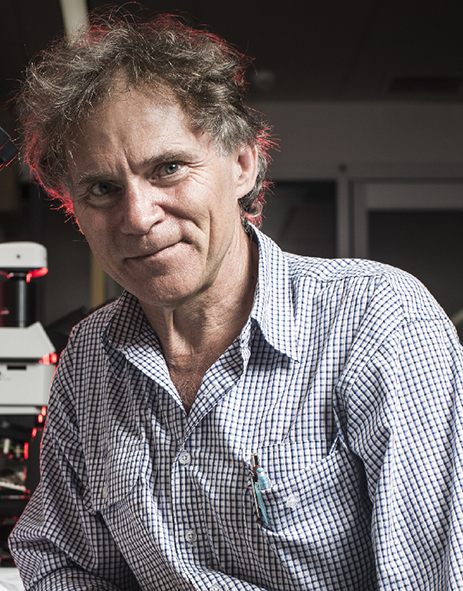 Richard Fullagar合作论文数Faculty of Science, Medicine and Health, University of Wollongong/School of Earth and Environmental Sciences, University of Wollongong4
 Barry Brook合作论文数School of Biological Sciences, University of Tasmania4Alexander Baynes合作论文数4Dalal Haouchar合作论文数3
 Diana A Fusco合作论文数Coll Sci & Engn, Flinders Univ S Australia3
 Katharina J. Peters合作论文数Flinders Univ S Australia, Sch Biol Sci, Adelaide, SA 5001, Australia3
 David M. Kennedy合作论文数School of Geography, Earth and Atmospheric Sciences, Faculty of Science, The University of Melbourne3
 Frederik Saltre合作论文数CEFE UMR 5175, CNRS - Université de Montpellier - Université Paul-Valéry Montpellier - EPHE;School of Earth and Environmental Science, The University of Adelaide;CNRS - Université de Montpellier, The University of Adelaide3
 Corey Bradshaw合作论文数College of Science and Engineering, Flinders University3
 Katherine Szaboand合作论文数3
 James Haile合作论文数Natural History Museum and Institute of Biology, University of Copenhagen3
 Sean Ulm合作论文数Studies Unit;University of Queensland;Studies Unit, University of Queensland3
 Lynette Russell合作论文数School of Philosophical, Historical and International Studies, Faculty of Arts, Monash University3
 John Hellstrom合作论文数School of Earth Sciences, The University of Melbourne3Clancy Retallick合作论文数2Georgia L. Roberts合作论文数2
 Jessie C. Buettel合作论文数ARC Centre of Excellence for Australian Biodiversity and Heritage2
 Janelle Stevenson合作论文数School of Culture, History & Language, College of Asia and the Pacific, The Australian National University2
 Peacock David合作论文数Biosecurity South Australia2
 Matthew Phillips合作论文数School of Biology & Environmental Science,
Faculty of Science, Queensland University of Technology2Murray Dáithí C合作论文数2
Matthew Phillips合作论文数School of Biology & Environmental Science,
Faculty of Science, Queensland University of Technology2Murray Dáithí C合作论文数2 Tobias Friedrich合作论文数Algorithm Engineering Group, Hasso Plattner Institute, University of Potsdam;Digital Engineering Faculty, University of Potsdam2Metz Laure合作论文数2Skelly Robert合作论文数School of Philosophical, Historical and International Studies, Faculty of Arts, Monash University2
 F. Donald Pate合作论文数Department of Archaeology;Flinders University;Department of Archaeology, Flinders University2
 Geraldine Jacobsen合作论文数Australian Nuclear Science and Technology Organisation2
 Ian McNiven合作论文数Monash Indigenous Studies Centre, Monash University2
 Rod Wells合作论文数2




