Study region The Yangtze River Basin (YZRB). Study focus As a key indicator of atmospheric evapotranspiration capacity, potential evapotranspiration (ET0) plays a fundamental role in water-energy exchange processes. This study investigated the spatiotemporal variability and underlying mechanisms of ET0 in the YZRB. Based on a long-term ET0 dataset, the sensitivity analysis was conducted to assess the response of ET0 to meteorological factors influencing its temporal variability, and the Multiscale Geographically Weighted Regression (MGWR) model was implemented to identify the drivers shaping the spatial variability of ET0. New hydrological insights The mean annual ET0 in the YZRB from 1975 to 2018 was approximately 930 mm, exhibiting a significant increasing trend of 0.63 mm/yr, with a clear upward shift in mean values after 2003. Temperature (T) dominated the spatial heterogeneity of ET0 in most seasons except spring, with MGWR spatial regression coefficients (SRC) of 0.466 at the annual scale and exceeding 0.60 at seasonal scales. Besides, solar radiation (RS) had the greatest effect on the temporal variation of ET0, especially in summer when the temporal sensitivity coefficients (TSC) of ET0 to RS generally exceeded 1.00. These results highlight the distinct roles of temperature and radiation in shaping the spatiotemporal variability of ET0 and provide valuable insights for large-scale water resources management under climate change.
Belowground plant trait research has predominantly focused on trade-offs in fine-root traits via the root economics space (RES). Yet, this fine-root framework captures only a fraction of the functional strategies plants employ beneath the soil surface. Here, we broaden the perspective on belowground plant functioning by integrating traits related to root system extent, clonality, and bud banks, using data from the new UNDERPLOT dataset. This integration links measurable traits to key belowground functions: resource acquisition, spatial exploration, and persistence. Our analysis shows that the fine-root economics space explains less than 5% of the variation in traits related to root system extent, clonality, and bud banks. Instead, an expanded trait analysis reveals three significant dimensions, explaining 62% of total trait variation. The third dimension represents an independent, persistence-related gradient, not captured by existing root economics frameworks. We propose that understanding belowground plant strategies requires embracing additional functional gradients. The strategy of persistence, in particular, varies significantly across growth forms and is a critical dimension of plant response to resource limitation and stress, becoming increasingly important as global change shifts disturbance regimes.
Belowground functional diversity is relevant to numerous ecosystem functions and to ecosystem resilience under global change, yet quantitative information on belowground plant traits is disparate and poorly integrated across fields of research. So far, belowground plant traits have been studied in three disparate research domains: (i) fine root traits in the context of belowground resource economics and symbioses; (ii) maximum rooting depth and lateral extent of the root system in the context of overall plant allometry and resource uptake; (iii) clonal organs and bud banks with a focus on plant and community resilience. However, there remains a major disconnection among these three fields of research. A prerequisite for linking them together is the creation of a comprehensive, curated, open-access dataset available for comprehensive analyses. Here, we compiled and harmonised such a trait dataset for 10,453 vascular plant species and 19 belowground plant traits, which we named UNDERPLOT. Based on these data, we defined two integrative indices, a Belowground Persistence Type (BPT) and a Clonal Spread Index (CSI), which are suitable trait-based indicators for predicting resistance and resilience of communities to disturbance. Further applications will increase our knowledge of the dimensionality of the belowground trait space, adding new insights into trait-environment relationships, vegetation responses to climate change and disturbance, as well as a deeper understanding of evolutionary first principles.
Groundwater plays a crucial role in meeting both human and ecosystem water needs. Its importance is expected to grow due to increasing water demand and the impacts of climate change on surface water resources, particularly in the Southern Hemisphere, where irrigated agricultural expansion continues to intensify. However, limitations in the spatio-temporal coverage of groundwater monitoring networks constrain our understanding of surface–groundwater interaction dynamics. Here, we present a groundwater well dataset for Brazil. It encompasses compiled and standardized well data from Geological Survey of Brazil projects. The harmonized dataset, which was validated by the Geological Survey of Brazil, underwent rigorous quality assurance and quality control procedures to ensure accuracy, adhering to principles of transparency and data integrity. The dataset includes over 351,000 wells spanning from the early 1900s to 2024, including 472 monitoring wells with daily water level measurements from 2010 to 2024. In addition to information on well location, primary use, and static water level, the dataset includes variables that can support integrated surface and groundwater management, such as distance to the nearest river, land use, and aquifer data. The potential applications of this dataset are wide-ranging. Here, we demonstrate two applications that can be replicated with other groundwater datasets. First, we compared well water levels with nearby river water levels to identify the direction of flow between Brazilian rivers and aquifers. The results indicated that over 55% of the analyzed wells in unconfined aquifers have water levels below those of the nearest river, suggesting that river water may seep into the underlying aquifer. Second, we applied the analytical depletion functions developed by Glover and Balmer to wells in unconfined aquifers to estimate streamflow depletion caused by groundwater pumping. The results suggested that approximately 9% of the analyzed rivers experience a streamflow depletion fraction exceeding 10% of their baseflow. These findings have the potential to enhance the integrated management of surface and groundwater resources in Brazil. Ultimately, we hope this accessible dataset fosters collaboration across the fields of groundwater hydrology, surface water hydrology, and water management.
In recent years, the scientific community has directed significant attention towards understanding river-aquifer interactions due to their pivotal role in hydrological and biogeochemical processes with implications for solving diverse engineering challenges. Despite the growing focus on these interactions, most studies remain confined to local scales, hindering their incorporation into comprehensive continental-scale water resources management. Addressing this gap, our study pioneers the empirical verification of river-aquifer flow directions (characterizing losing or gaining rivers) in a tropical context. We leveraged an extensive database comprising approximately 150 thousand wells spanning the entirety of Brazil, and we developed empirical power equations using data from around 500 river gauge stations to estimate river water levels under low-flow conditions. To ascertain the flow direction of river-aquifer interactions, we compared hydraulic gradients between groundwater levels of wells and their nearest rivers. A river was classified as losing when its water levels were above those of neighboring wells, indicating potential water loss to underlying aquifers. Stringent connectivity criteria were applied, including a maximum distance of 1 km between wells and rivers, well depth not exceeding 100 meters, and exclusion of wells in confined aquifers. Our study conducted systematic robustness checks, exploring the sensitivity of the data to chosen time intervals, variations in river water levels under low-flow conditions, and the inclusion of confined aquifers. Our findings reveal that more than half of Brazilian rivers are prone to losing water to underlying aquifers. The results underscore the significance of our in-situ data-driven methodology, indicating that losing rivers, widespread throughout Brazilian territory, may serve as potential points of groundwater contamination. Particularly crucial in tropical regions with elevated organic matter input into rivers, given the inadequate wastewater treatment. The findings emphasize the critical necessity of analyzing river-aquifer interactions for effective water resource management on both local and continental scales.
The North American continent is home to a wide range of different hydro-climates. A key research gap is that there is currently limited understanding on the spatial variability of dominant hydrologic processes across these different hydro-climates. This limited understanding makes it difficult to select computational models that faithfully represent the hydrologic processes across such large domains, yet faithful representation of the different hydro-climatic behaviors is critical for accurate numerical prediction. Here we present progress on a synthesis of dominant hydrologic processes under different combinations of climate-terrain-human forcings, engaging the broader community of catchment and Critical Zone scientists. The product from this research will be a continental “Hydrologic Mosaic”, with each landscape in the mosaic described by a set of perceptual and conceptual models. In this first step, we produce a continental map of hydrologic landscapes defined through the juxtaposition of hydroclimate, terrain and geology, and vegetation, land use, and management. We will define hydrologically meaningful indicators of terrestrial hydrology that concisely describe a location’s (i) hydroclimate (e.g., aridity, snow fraction, energy/water seasonality), (ii) topography and geology (e.g. depth to bedrock, soil porosity, topographic slope), and (iii) vegetation, land use and management (e.g., vegetation type, agricultural drainage, reservoir size), and calculate values for these indicators for each location on the continent. We then use clustering analysis to create a manageable number of representative hydrologic landscapes. This work functions as a starting point in a wider project, where these initial hydrologic landscapes will be refined through interactions with regional experts. Together, we will develop perceptual (sketches and descriptions) and conceptual (box-and-arrow diagrams) of the dominant processes in each hydrologic landscape. These conceptual diagrams will contribute to large-domain modeling efforts by allowing targeted model selection and comparison efforts for each hydrologic landscape.
The aridity index is widely used to indicate water availability on land. Balancing climatic water supply (precipitation, P) against demand (potential evapotranspiration, PET), it is often expressed as the P/PET ratio1 or humidity index. Water also flows laterally by rivers and groundwater, from hills to valleys and from mountains to plains, subsidizing the receiving lowlands2. Here, we show that this lateral subsidy reduces aridity in the receiving lowlands. We first estimate monthly subsidies (Qlat) by surface and groundwater at 30″ global grids with a global hydrology model. We then calculate the conventional global humidity index (GHI) as P/PET and a new GHI including Qlat as (P + Qlat)/PET. Termed GHI_topo, the latter reflects land topography, higher in hydrologically convergent lowlands. It also exhibits a delayed and dampened seasonality (relative to P) owing to delayed and diffused Qlat arrival at the receiving lowlands. Such spatiotemporal features of Qlat, arising from both the climate and the terrain, make GHI_topo a more realistic indicator of local water availability in downgradient societies and ecosystems, enabling life in arid locations and times. Global land area with GHI_topo ≥ 1 (supply meets or exceeds demand) is 33% greater than GHI ≥ 1 and far higher in arid and season-arid climates.
Plant roots act as critical pathways of moisture from the subsurface to the atmosphere. Deep moisture uptake by plant roots can provide a seasonal buffer mechanism in regions with a well-defined dry season, such as the southern Amazon. Here, mature forests maintain transpiration (a critical source of atmospheric moisture in this part of the world) during drier months. Most existing state-of-the-art Earth system models do not have the necessary features to simulate subsurface-to-atmosphere moisture variations during dry-downs. These features include groundwater dynamics, a sufficiently deep soil column, dynamic root water uptake (RWU), and a fine model spatial resolution (<5 km). To address this, we present DynaRoot, a dynamic root water uptake scheme implemented in the Noah-Multiparameterization (Noah-MP) land surface model, a widely used model for studying kilometer-scale regional land surface processes. Our modifications include the implementation of DynaRoot, eight additional resolved soil layers reaching a depth of 20 mm, and soil properties that vary with depth. DynaRoot is computationally efficient and ideal for regional- or continental-scale climate simulations. We perform four 20-year uncoupled Noah-MP experiments for a region in the southern Amazon basin. Each experiment incrementally adds physical complexity. The experiments include the default Noah-MP with free drainage (FD), a case with an activated groundwater scheme that resolves water table variations (GW), a case with eight added soil layers and soil properties that vary with depth (SOIL), and a case with DynaRoot activated (ROOT). Our results show that DynaRoot allows mature forests in upland regions to avoid water stress during dry periods by taking up moisture from the deep vadose zone (where antecedent precipitation still drains downward). Conversely, RWU in valleys can access moisture from groundwater (while remaining constrained by the water table). Temporally, we capture a seasonal shift in RWU from shallower layers in wetter months to deeper soil layers in drier months, particularly over regions with dominant evergreen broadleaf (forest) vegetation. Compared to the control case, there is a domain-averaged increase in transpiration of about 29 % during dry months in the ROOT experiment. Critically, the ROOT experiment performs best in simulating the temporal evolution of dry-season transpiration using an observation-based ET (evapotranspiration) product as the reference. Future work will explore the effect of the DynaRoot uptake scheme on atmospheric variables in a coupled modeling framework.
Despite recent advances in plant trait ecology, we identified a knowledge gap in understanding how plants strategize to cope with severe and recurrent disturbances. Here, we propose a new classification system based on three hierarchical binary attributes: woodiness, reflecting longevity of plant structures; clonality, indicating the ability to regenerate from both above- and belowground organs; and resprouting ability, referring to the ability to replace aboveground organs. This framework results in six Belowground Persistence Types (BPTs): 1, herbaceous seeder; 2, herbaceous non-clonal resprouter; 3, herbaceous clonal resprouter; 4, woody seeder; 5, woody non-clonal resprouter; and 6, woody clonal resprouter. This proposed classification system opens new avenues for research, especially concerning plant distributions in a world experiencing increasingly frequent and severe disturbance events.
From a broad, global-to-hillslope perspective, I will discuss some observational evidence and model results suggesting that the groundwater can directly influence vegetation through three mechanisms: as a water source for plant root uptake in dry places/times where/when the water table is accessible, as a cause for waterlogging and soil anoxia where/when the water table is too near the surface, and as a double-stressor if the water table fluctuates wildly, too deep in dry times but too shallow in wet times. as a water source for plant root uptake in dry places/times where/when the water table is accessible, as a cause for waterlogging and soil anoxia where/when the water table is too near the surface, and as a double-stressor if the water table fluctuates wildly, too deep in dry times but too shallow in wet times. The dominance of each mechanism, and the resulting mode of vegetation feedback, can be analyzed in a 2D space, with the climate on one axis, and the topographic structure on the other, forming a climotopo-matrix to frame the distinct modes of groundwater-vegetation interactions. On top of this framework, the subsurface structure of the Critical Zone forms a 3 rd dimension that regulates the infiltration and water table depths, further enriching the models of groundwater-vegetation interactions. I will end by posing a set of hypotheses as food for further thoughts.
Transpiration drives most of the local rainfall during the dry season in the Amazon forests by recycling moisture into the atmosphere. However, the source, temporal origin of transpiration, and spatial distribution of transpiration water sources remain unclear. Here, we quantify transpiration sources across a topographic gradient in the eastern Amazon. We show that on hills, dry-season transpiration sources are mostly shallow soil water recharged by dry-season rainfall. This is different in valleys, where tree water sources include both shallow and deep soil layers, with both dry- and wet-season contributions. We show that species embolism resistance largely explains this pattern in tree water use but with contrasting trade-offs between topographic positions. The significant relationship between embolism resistance and depth of water uptake in both hill and valley species may merit incorporation into process-based models to understand changes in vegetation and land surface fluxes.
Plant roots have been observed up to 70 m in depth - what would compel a plant to root so deeply? Earlier work shows that the climate, soil and drainage all affect rooting depth, but with conflicting results. For example, both the deepest and shallowest roots are found in arid regions. Here, we compiled > 2400 globally distributed rooting-depth observations of individual plants and applied simple correlation analysis to assess the impact of global climate, local topography and substrate, and individual plant size, and their combinations controlling where and why plants root deeply. At the global scale, deep roots are driven by climate. Both concentrated wet periods and prolonged droughts are required to drive deep roots, and we find the deepest roots in semi-arid climates with strong precipitation seasonality or interannual variability. At the landscape scale, drainage modulates rooting depth. An accessible water table facilitates deep roots at midslopes, but it is too deep to impact roots further upslope. Instead, the deep vadose zone moisture reserve is the primary driver for deep rooting. Thus, the deepest roots are observed on well-drained uplands with deep vadose zones under climates with distinct wet and dry periods. At the plot scale, substrate structure and hydraulic properties modulate deep rooting - B-horizons limit deep roots, while woody plants often root below the bedrock surface, provided it is fractured. At the individual plant scale, deep roots are limited to high-biomass woody plants. Together, these findings sharpen our understanding of where and why plants root deeply, highlighting intersections of climate, drainage, terrain and biomass and identifying conditions where deep roots may serve as a lifeline during prolonged drought, meanwhile weathering rock, sequestering carbon, and bringing the living world far deeper than the conventional 'root zone'.
Transpiration contributes up to 70% of regional rainfall during the dry season in the Amazon through precipitation recycling. But the source, spatial distribution of transpiration and the key plant hydraulic drivers of transpiration source water remains unclear. Here, we quantify transpiration sources across a topographic gradient in the eastern Amazon, at the Tapajós National Forest. We leverage embolism resistance data collected on the same sites during this same campaign. We asked: i) What is the source of transpiration? And ii) how do transpiration depth and origin vary across topographic gradients and species with different embolism resistance growing under the same climate? Our data show that on hills, dry-season transpiration sources are mostly shallow soil water mainly recharged by current dry-season rainfall. In contrast, transpiration source water in the valley includes both shallow and deep soil layers, with both dry and wet season contributions. The observed pattern in transpiration source water is largely explained by species embolism resistance, but with contrasting trade-offs between hill- and valley-species. The significant relationship between embolism resistance and depth of water uptake in both topographic positions influencing transpiration age could be used to parameterize vegetation water use in land surface models.
AbstractAfter 4.5 billion years as an evolving and dynamic planet, the Earth continues to evolve but with human‐altered dynamics. Earth scientists have special opportunities and responsibilities to accelerate our understanding of Earth's changes that are transforming our most remarkable home.
In the vegetation root zone, infiltration (Inf) parts in two directions with distinct Earth-system functions. One goes up as evapotranspiration (E + Tr), returning Inf to the atmosphere (short-circuiting) and affecting short-term weather/climate and the carbon cycle. The other goes down as deep drainage (DD), flushing the regolith, mobilizing nutrients/contaminates and dissolved minerals into aquifers and rivers, eventually reaching the ocean (long-circuiting) thus regulating global biogeochemical cycles and long-term climate. We ask, what is the modern-day global structure in short- vs. long-circuiting? What forces and feedbacks create such structures? Synthesizing site-studies aided by global modeling, we found that: (i) long-circuiting prevails in evenly wet climates, in well-drained landscapes with a deep vadose zone, in substrates with deep conduits, and with plant biomass below natural equilibrium; (ii) soil B-horizons, via geochemical and vegetation feedbacks, enhance short-circuiting, while deep rock fractures enable long-circuiting even in dry climates; (iii) in dry climate/season and in uplands, plant roots follow Inf into deep vadose zone to tap wet-season Inf; (iv) plant water-use reinforces shallow Inf, reducing DD and regolith flushing in dry and season-dry climates; (v) where short-circuiting prevails, a dry soil zone separates modern surface processes from fossil groundwater; and (vi) the E + Tr supply depth, regolith flushing rate, and groundwater residence time vary greatly across the land, arising from multiscale drivers/feedbacks among climate, drainage, substrate, and biomass. These findings link site-based process discoveries to Earth-system level structures and functions of water belowground, shedding light on where/when/how the infiltrated rain influences the atmosphere above or the ocean downstream.
River-aquifer interactions play a crucial role in water availability, influencing environmental flows and impacting climate dynamics. Where groundwater tables lie below river water levels, stream water can infiltrate into the underlying aquifer, reducing streamflow. However, the prevalence of these "losing" rivers remains poorly understood due to limited national-wide in situ observations. Here we analyze water levels in 17,972 wells across Brazil to show that most of them (55%) lie below nearby stream surfaces, implying that these nearby streams are likely seeping into the subsurface. Our results demonstrate the widespread potential for stream water losses into underlying aquifers in many regions of the country, especially in areas with extensive groundwater pumping. Our direct observations underscore the importance of conjunctively managing groundwater and surface water, and highlight the widespread risk of streamflow losses to aquifers, which could impact global water access and ecosystems that rely on rivers. Most Brazilian rivers are found to have the potential for stream water losses into underlying aquifers, especially in drier climates, thicker aquifers, and regions with extensive groundwater pumping.
Groundwater resources are vital to ecosystems and livelihoods. Excessive groundwater withdrawals can cause groundwater levels to decline 1 – 10 , resulting in seawater intrusion 11 , land subsidence 12 , 13 , streamflow depletion 14 – 16 and wells running dry 17 . However, the global pace and prevalence of local groundwater declines are poorly constrained, because in situ groundwater levels have not been synthesized at the global scale. Here we analyse in situ groundwater-level trends for 170,000 monitoring wells and 1,693 aquifer systems in countries that encompass approximately 75% of global groundwater withdrawals 18 . We show that rapid groundwater-level declines (>0.5 m year −1 ) are widespread in the twenty-first century, especially in dry regions with extensive croplands. Critically, we also show that groundwater-level declines have accelerated over the past four decades in 30% of the world’s regional aquifers. This widespread acceleration in groundwater-level deepening highlights an urgent need for more effective measures to address groundwater depletion. Our analysis also reveals specific cases in which depletion trends have reversed following policy changes, managed aquifer recharge and surface-water diversions, demonstrating the potential for depleted aquifer systems to recover.
Droughts are predicted to increase in both frequency and intensity by the end of the 21st century, but ecosystem response is not expected to be uniform across landscapes. Here we assess the importance of the hill-to-valley hydrologic gradient in shaping vegetation embolism resistance under different rainfall regimes using hydraulic functional traits. We demonstrate that rainfall and hydrology modulate together the embolism resistance of tree species in different sites and topographic positions. Although buffered by stable access to groundwater, valley plants are intrinsically more vulnerable to drought-induced embolism than those on hills. In all study sites, the variability in resistance to embolism is higher on hills than on valleys, suggesting that the diversity of strategies to cope with drought is more important for tree communities on hills. When comparing our results with previously published data across the tropics, we show greater variability at the local scale than previously reported. Our results reinforce the urgent need to extend sampling efforts across rainfall regimes and topographic positions to improve the characterization of ecosystem resistance to drought at finer spatial scales.
 Gonzalo Miguez-Macho合作论文数Department of Environmental Sciences;Rutgers University;Department of Environmental Sciences, Rutgers University40
 Alan Robock合作论文数Center for Population-Level Bioethics, Rutgers University;Department of Environmental Sciences, School of Environmental and Biological Sciences, Rutgers University8
 Chris Weaver合作论文数United States Environmental Protection Agency7
 Scott Jasechko合作论文数Bren School of Environmental Science & Management, University of California, Santa Barbara6
 James Kirchner合作论文数Department of Earth and Planetary Science, University of California Berkeley;Department of Environmental Systems Science, Eidgenossische Technische Hochschule Zurich6
 Aaron Potkay合作论文数Saint Anthony Falls Laboratory, University of Minnesota5
 Francina Dominguez合作论文数5
 Martyn Clark合作论文数Department of Civil Engineering, Schulich School of Engineering, University of Calgary5
 Caio Mattos合作论文数4
 Marina Hirota合作论文数Department of Aquatic Ecology and Water Quality Management and;Centre for Monitoring and Warnings of Natural Disasters, 12630-000 Cachoeira Paulista, SP, Brazil;Department of Aquatic Ecology and Water Quality Management and;Centre for Monitoring and Warnings of Natural Disasters, 12630-000 Cachoeira Paulista, SP, Brazil4
 Helge Bruelheide合作论文数Department of Geobotany and Botanical Garden, Institute of Biology, Faculty of Natural Sciences, Martin Luther University Halle-Wittenberg4
 Reed Maxwell合作论文数Integrated Groundwater Modeling Center, Princeton University;High Meadows Environmental Institute, Princeton University4
 Rafael S. Oliveira合作论文数Departamento de Biologia Vegetal, Universidade Estadual de Campinas;School of Plant Biology, University of Western Australia4
 Esteban G. Jobbágy合作论文数Grupo de Estudios Ambientales, Instituto de Matemática Aplicada San Luis, Universidad Nacional de San Luis4
 Alexandra Weigelt合作论文数Institute of Ecology, University of Jena4
 Daniel C. Laughlin合作论文数Department of Botany, University of Wyoming4
 James V. Browning合作论文数4
 John A. Cherry (John Cherry)合作论文数School of Engineering, University of Guelph4
 Warren W. Wood合作论文数Department of Earth & Environmental Sciences, College of Natural Science, Michigan State University4
 Jana Klimesova合作论文数3
 Deliane V. Penha合作论文数Nature and Development Department, Federal University of Western Pará3
 Kerry L. Callaghan合作论文数Dept Earth & Environm Sci, Univ Minnesota3
 Carlos Otero Casal合作论文数University of Santiago de Compostela3
 Monique Bohora Schlickmann合作论文数Agroveterinary CenterForestry Department, Santa Catarina State University3
 Anna Trugman合作论文数The Global Research on Vegetation Ecology Lab, Department of Geography, University of California Santa Barbara3Hansjörg Seybold合作论文数3Haibin Li合作论文数3
 Perrone Debra合作论文数3Wickert Andrew D合作论文数3
 Kenneth G. Miller合作论文数Department of Earth and Planetary Sciences, School of Arts and Sciences, Rutgers University3
 Frances Siebert合作论文数School of Environmental Sciences, North-West University3
 Rob Jackson合作论文数School of Sustainability, Stanford University;Woods Institute for the Environment, Stanford University;Precourt Institute for Energy, Stanford University3M. Deniz Kustu合作论文数3
 Sean Swenson合作论文数Climate & Global Dynamics Lab, National Center for Atmospheric Research3
 David J. Gochis合作论文数NCAR, Research Applications Laboratory3
 Yadu Pokhrel合作论文数Institute of Industrial Science, The University of Tokyo3
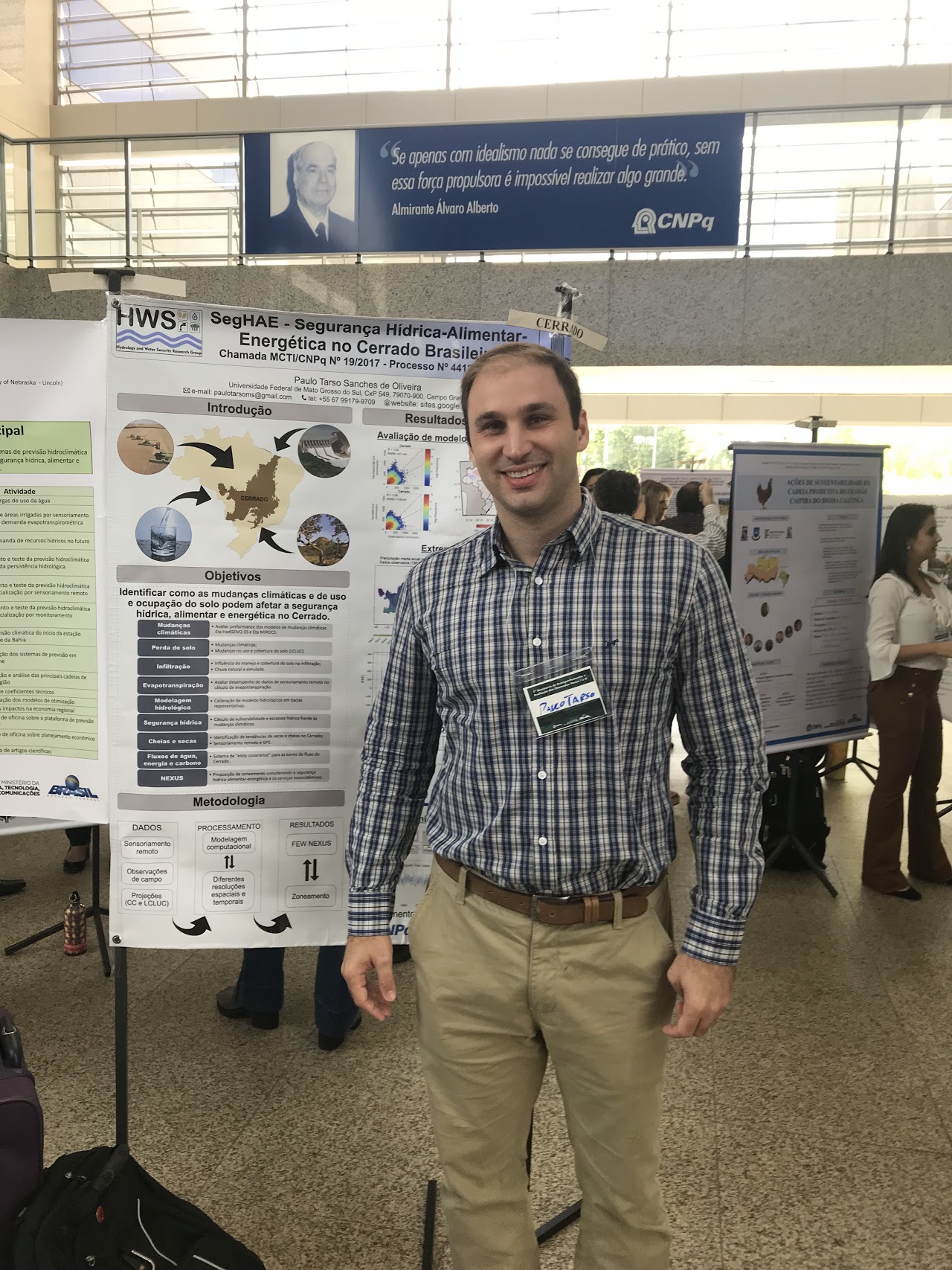 Paulo Tarso S. Oliveira 合作论文数Federal University of Mato Grosso do Sul3
 David Lawrence合作论文数Climate and Global Dynamics Laboratory, National Center for Atmospheric Research3
 Eileen P. Poeter合作论文数colorado school of mines3
 Richard O. Anyah合作论文数Department of Natural Resources and the Environment,University of Connecticut3
 Didier Gastmans合作论文数Laboratório de Estudos de Bacias, LEBAC3
 Jeffrey McDonnell合作论文数Global Institute for Water Security, University of Saskatchewan;School of Environment and Sustainability, University of Saskatchewan3
 Edson Wendland合作论文数Department of Hydraulics;Engineering School of São Carlos;University of São;Engineering School of São Carlos, University of São3
 Alessandra Fidelis合作论文数Department of Ecology, Technische Universität München3
 James P. Mcnamara合作论文数Department of Geosciences;Boise State University;Department of Geosciences, Boise State University3
 Paul Brooks合作论文数Department of Hydrology and Water Resources, University of Arizona3
 Grégoire Freschet合作论文数Station d'Ecologie Théorique et Expérimentale, Centre National de la Recherche Scientifique2
 Jose Gescilam S. M. Uchoa合作论文数2lucia gestalsouto合作论文数2




